|
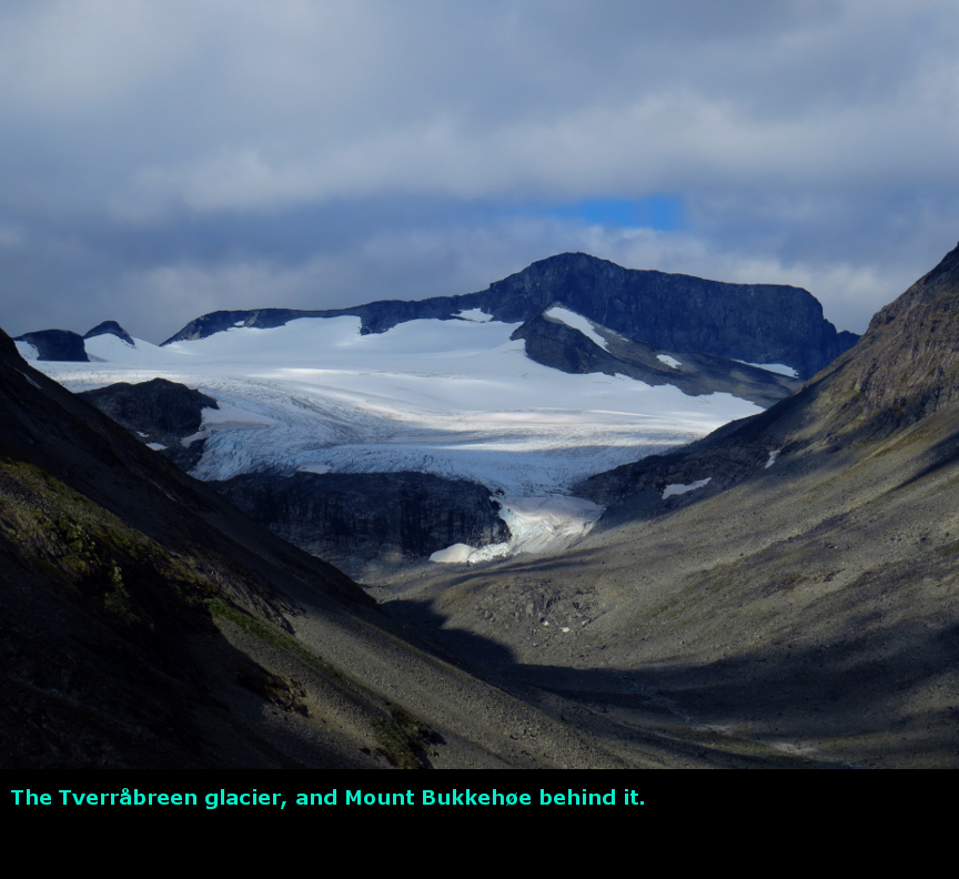
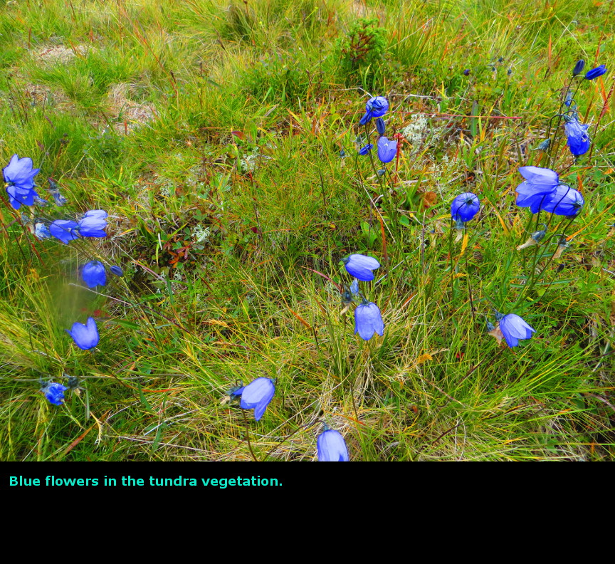
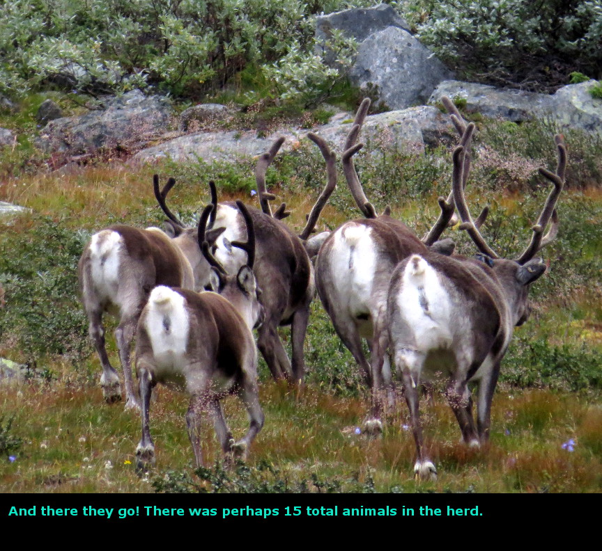
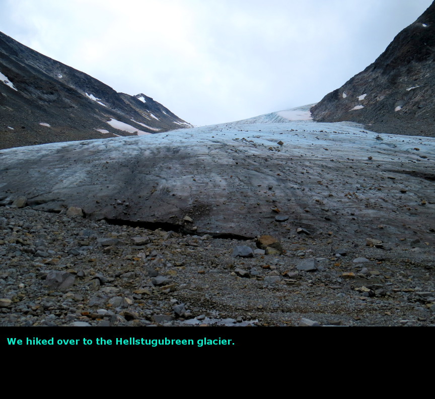
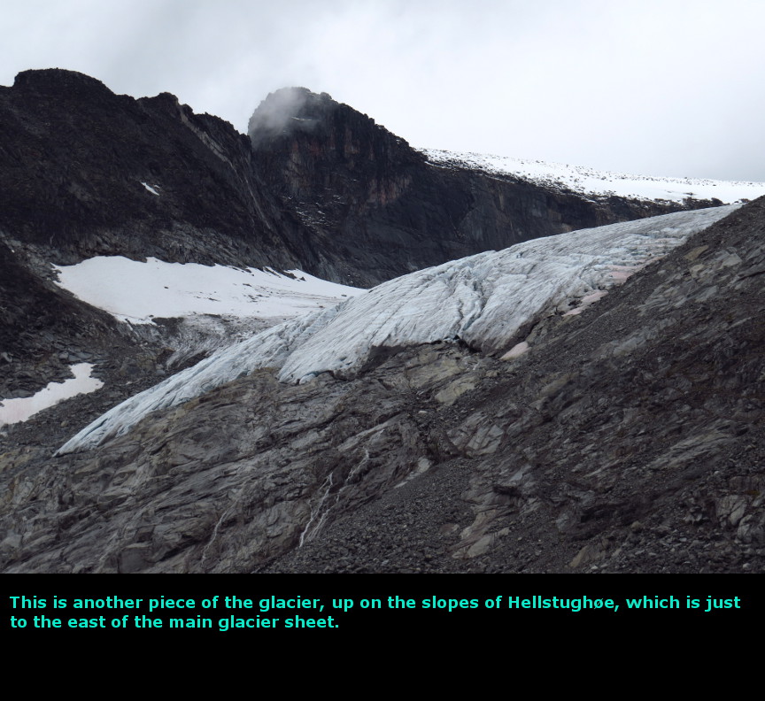
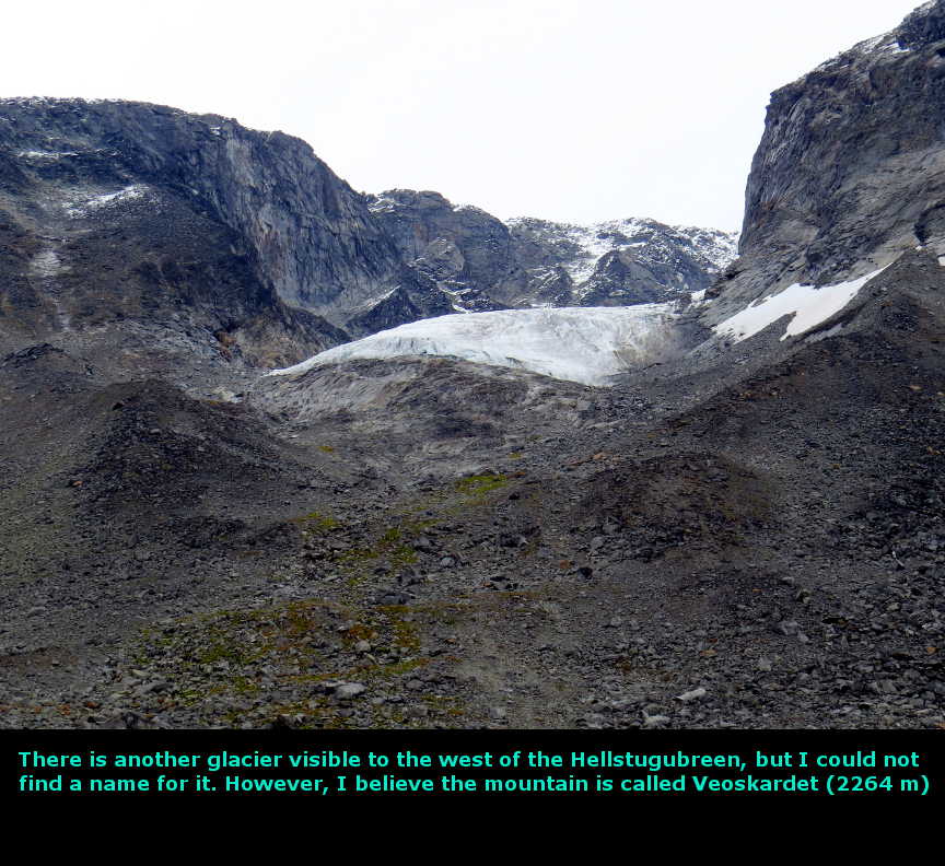
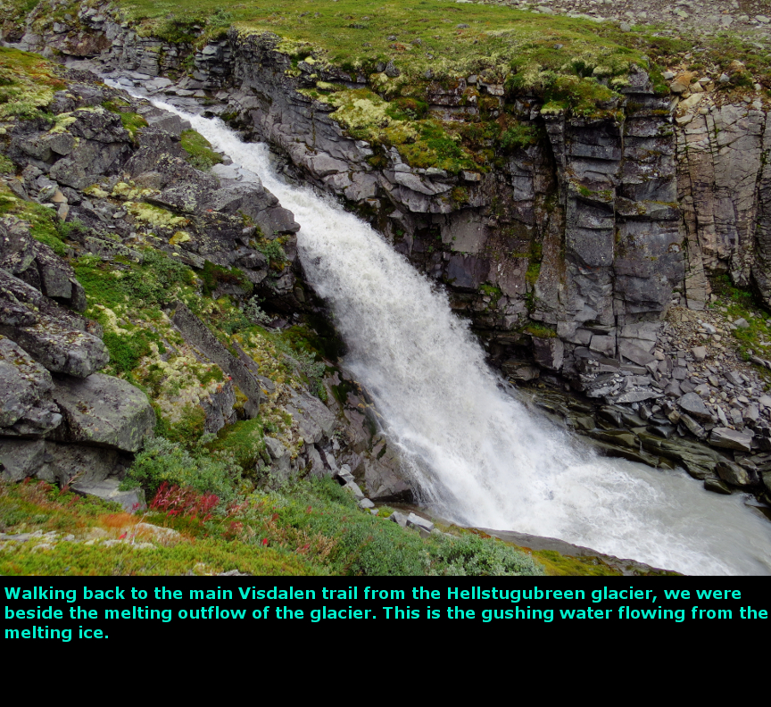
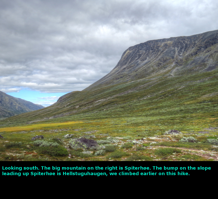
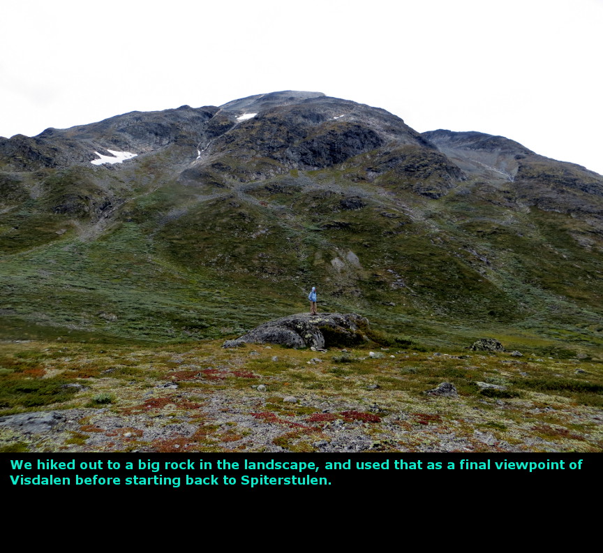
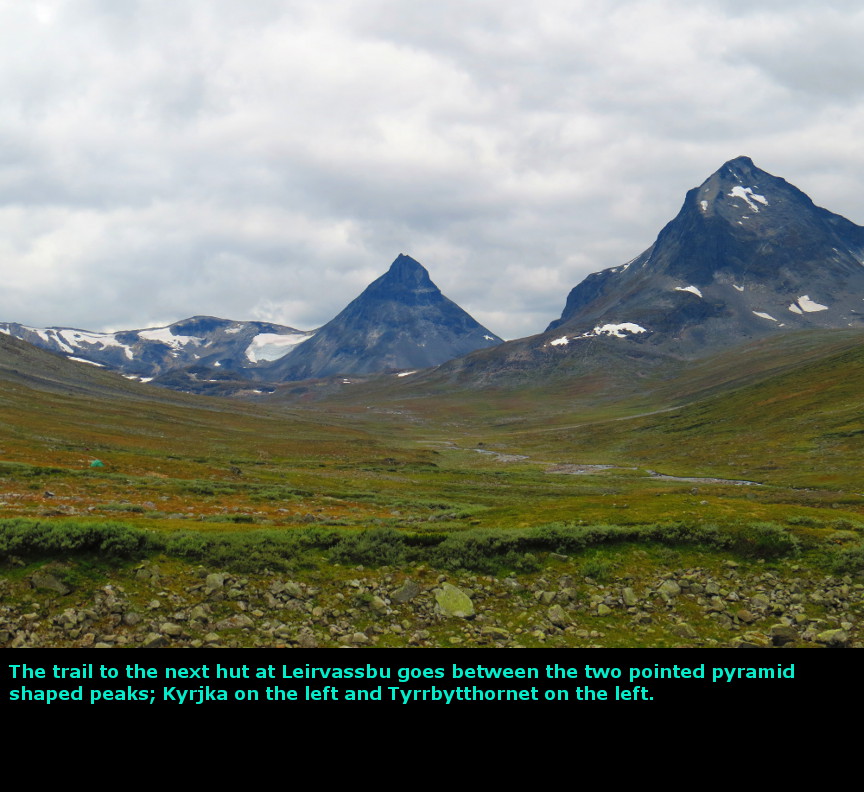
The highlight of this day was the reindeer herd that ran closely past us. Because I had expected that we would spend one day on the guided hike up to Galdhřpiggen, I hadn't done a lot of investigating of other activities around Jotunheim. Since we couldn't pass through the toll gate up to Juvasshytta, we had to find an alternate activity for this day. We knew that the Visdalen valley went into the heart of Jotunheim park, so we decided to drive up that road and see what might be there. This turned out to be an excellent choice, because Visdalen is a center for great hikes. At the end of the narrow winding road is the hut at Spiterstulen. A hut meant that it was several well constructed buildings, complete with food service, running water and dorm rooms. It also had an information desk, and we went there to ask about trails in the Visdalen area. It turns out there are many trails in this scenic area. The most popular hike is to march up Galdhřpiggen from here - apparently this route to the summit doesn't cross a glacier, so you don't need a guide. I believe there are some snow fields at the top. That hike sounded too aggressive, so we opted for a hike up the Visdalen valley and then a side trail up to the Hellstugubreen glacier. We started hiking along the main trail that goes up the Visdalen valley, but soon left that route to hike up to the Heillstuguhaugen, which is a low hill (1331 meters) that gives some nice views up and down the valley. There is sort of trail to and from this promontory - sometimes we could follow what was clearly a footpath, but othertimes we lost it in the heather and rocks, only to find it again further along the walk. We decided to stay as high as we could and traverse through the undergrowth until we reached the trail that climbed up from the Visdalen valley floor to the Hellstugubreen glacier. While we were walking, Melanie noticed in the distance some animals moving - she had spotted a couple of the reindeer that run wild in Jotunheim National Park. I got my camera out, and was trying to get a steady shot while at the maximum x50 zoom. I could hear someone coming up the trail beside us - but looking to our left, it wasn't another hiker, but a herd of about 20 more reindeer no more than 30 yards away. I think they were as surprised to see us as we were to see them. Naturally I tried to get as many closeup photos as I could. Seeing the wild reindeer so closely was a true delight. They moved quickly off through the landscape. Throughout the rest of the day we were able to sometimes spot the herd again, Melanie proved to be adept as a reindeer spotter. We trudged through the undergrowth, slipping a couple times on rocks while trying to cross streams. I landed flat on my back on a rock, but luckily I landed right on my pack full of rain gear and wasn't hurt at all. Eventually we joined the Hellstugubreen trail, and went all the way up that valley until we reached the glacier. At Hellstugubreen, you can walk right up to the toe of the glacier. There was a miniature ice cave there, so we peered inside. We couldn't see too far under the ice, and of course we didn't dare climb under it. We ate our lunch up here. We followed the trail down to the main route that runs the length of the Visdalen valley. As we headed down, we could see a couple of reindeer roaming around. They passed by us and loped on down the landscape. I wonder if there are any predators left that can disturb the reindeer, and if not, wouldn't their population grow to unsustainable levels? Do Norwegians hunt them? It was only mid-afternoon when we reached the Visdalen valley trail, so rather than return to the Spiterstulen hut, we went further north for another hour, just enjoying the view. This is a dramatic setting, with mountains and glaciers all around. There weren't many people around either, even though it was a dry day. The two previous days had been gloriously sunny, while this one was overcast, but no rain fell on us - three days in a row without rain in Norway! No wonder Jotunheim was my favorite part of this trip. We hiked back to our car and drove back to our cabin on the sheep farm. We had been using the wi-fi to monitor a volcano in Iceland, and every day we checked to see if the imminent eruption had actually occurred. We certainly didn't want our flight home to be cancelled. But once again the Icelandic volcanic remain quiescent. Today we drove 64 kilometers. Panorama Photos


MapsThe first map shows the drive we took up the Visdalen to reach the Spiterstulen hut where the hikes begin. 
This a contour map of all the mountains around the Visdalen at the heart of Jotunheim National park 
This is the trail map they gave us at Spiterstulen - it just shows the area near the hut, with a route shown up to Hellstuguhaugen. 
To display the photo images on this webpage, I am using a freely distributed java script called Lightbox v2.7.1 written by Lokesh Dhakar. You can download this program by clicking on this link. All the text and photographs on this webpage are my own creation, but the textured background is taken from a site, EOS development, that offers non-profit users free use of their graphics. Click the icon below to visit their site.
|
Click on any thumbnail to begin the slide show at that photograph Visdalen Photos


|