|
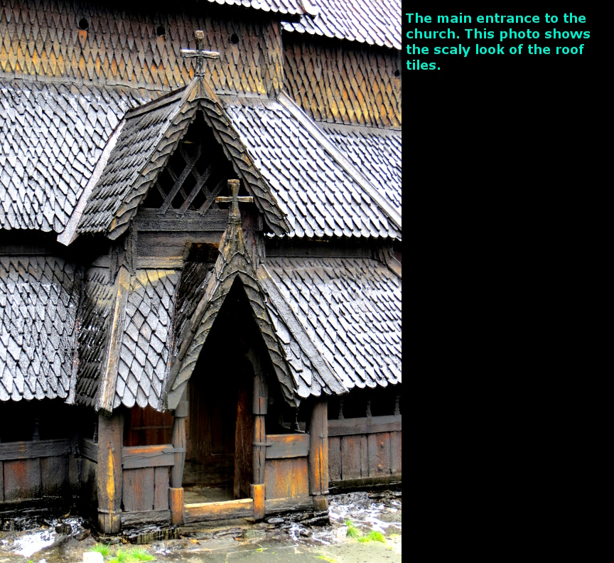
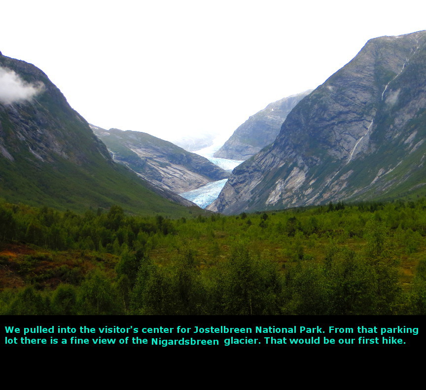
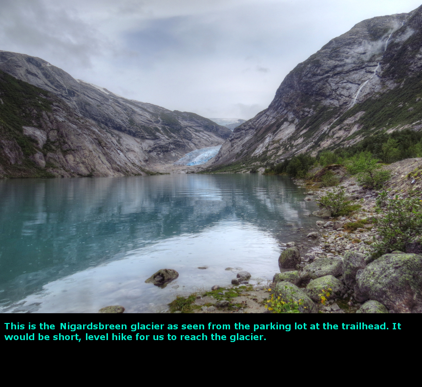
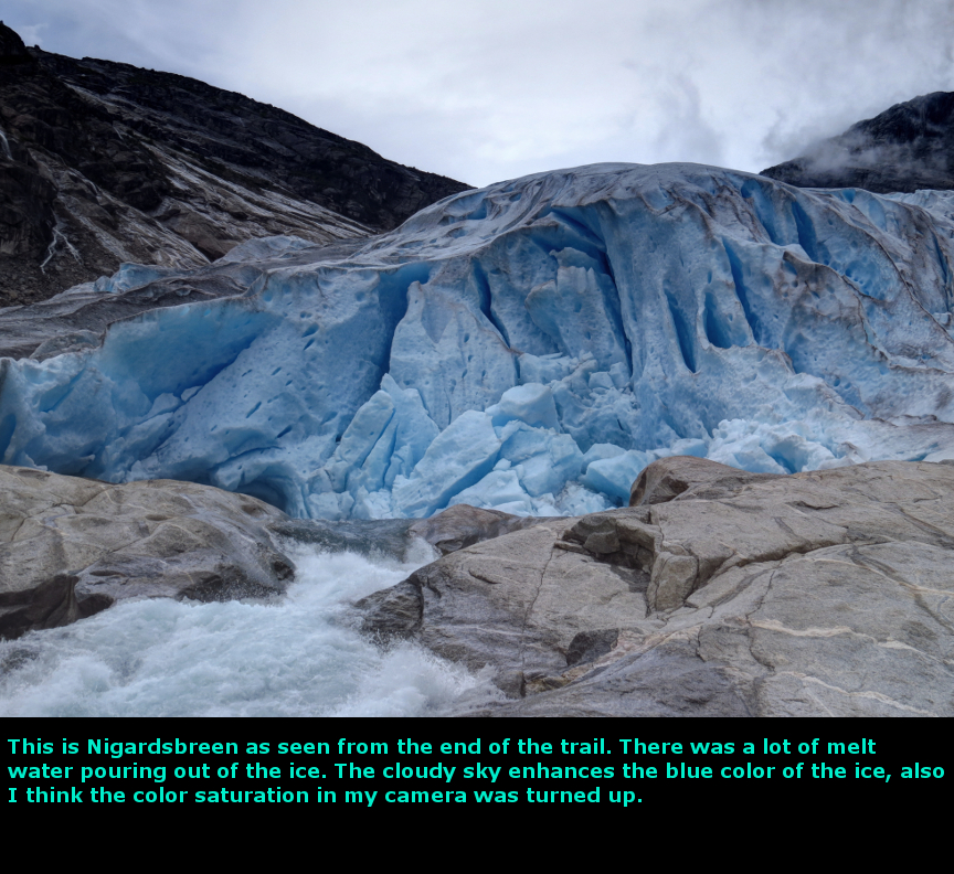
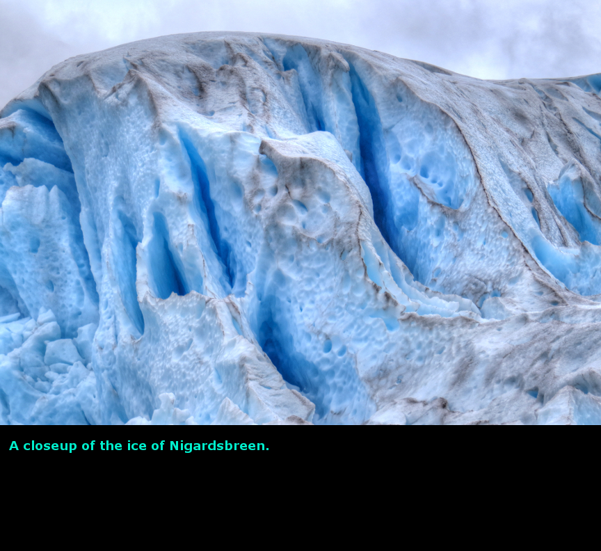
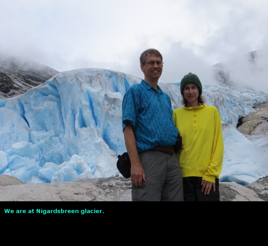
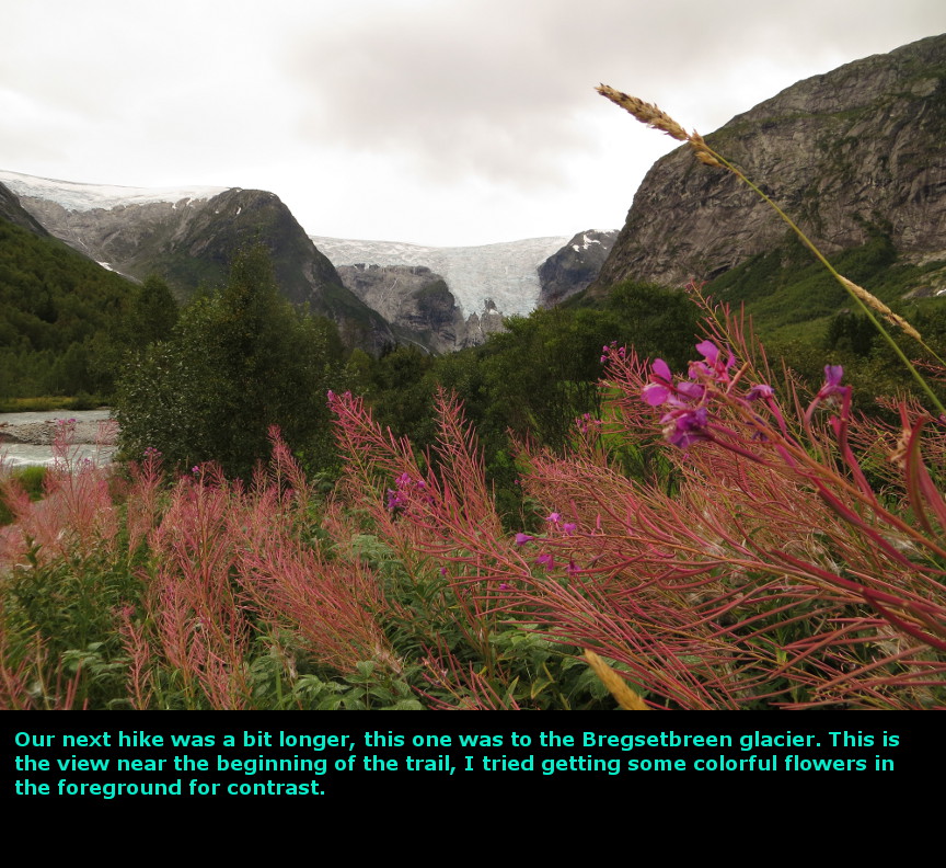
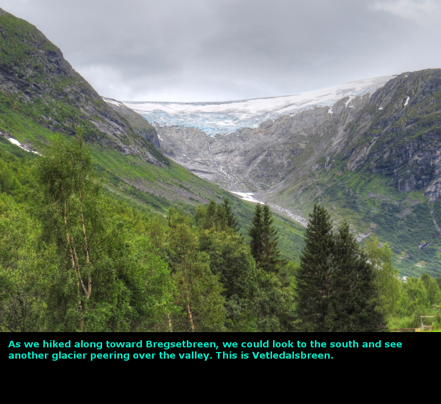
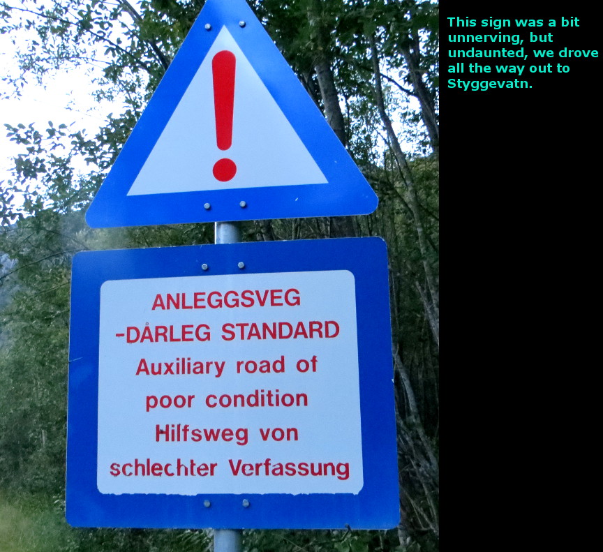
The highlight of this day was the drive to Styggevatn, although I also enjoy the hikes to Nigardsbreen and Bregsetbreen glaciers. Today we started our exploration of Jostedalsbreen National Park, which is named for the Jostedal glacier - which is the largest glacier on mainland Europe. Our day started with another fine breakfast buffet, and then we were off. We headed east on route E16 and soon entered Lćrdalstunnelen - which is the longest road tunnel in the world. It is 24.5 kilometers long. In order to keep bored drivers awake during the 20 minute journey, the Norwegians have a few interior points where there is electric blue lighting to illuminate the whole interior. There are even a couple places to turn around inside the tunnel. Hard to believe it only cost about $113 million in US dollars to build (it was built from the years 1995 - 2000). Huge fans suck in fresh air while the exhaust fumes are pulled into an air treatment plant. Before we drove to the Jostedalsbreen national park, we took a short detour to see the Borgund Stave church. It looked quite similar to the Fantoft church we had seen in Bergen. The church wasn't open yet, and wouldn't open until 10:00 AM, so we just took a few photos in the rain and continued onward. It rained lightly off and on all morning, but it stopped when we got to Jostedal. At the Fodnes-Mannheller ferry we drove right onto the boat as it was preparing to depart - less than a minute after we arrive, the boat had already moved away from the dock. Great timing! At the town of Jostedal, we stopped at the national park center to ask about trails for hiking to the glaciers. The lady at the desk told us about hikes to Nigardsbreen and Bergsetbreen, which we already knew about. But she also told us that there was a nice drive up to a lake at the north end of the valley that we might want to check out. We did the hike to Nigardsbreen first. It is an easy and popular hike, you get up close to the glacier. You can sign up for a hike onto the glacier, and it looked like a large quantity of people were doing exactly that. We ate some lunch while admiring Nigardsbreen, and then walked back. Our second hike was to Bregsetbreen, which is an equally impressive glacier. This hike is also short and mostly flat, so it is easily completed, yet I think we saw only six or seven other groups of hikers on this trail. It only took us 2 hours total time, and we were not rushing. We finished with Bregsetbreen by 5:30 P.M. We checked into the Jostedal Hotel and ate dinner in their restaurant. Dining options are quite limited in this town, but fortunately the Jostedal Hotel makes a good cheeseburger. After dinner we decided to check out the lake that had been mentioned by the lady at the park desk. We found the road to the lake. Styggevatn, but there was an ominous sign warning us that it was an auxiliary road in poor condition. We figured we would turn around if the road got to be too rough. But it wasn't a bad road at all - it was narrow, but lots of roads in Norway are narrow. It was also much longer than we expected - we kept driving because she told us there was a glacier view. Eventually we went up a steep set of switchbacks and found ourselves at the base of a huge stone dam. There was heavy trucks and men walking around in hard hats. We asked a guy in a truck if it was okay for tourists to walk up to the top of the dam, and he told us we certainly could. So we walked the last couple of switchbacks from the tourist parking lot and found ourselves at Styggevatn. It is an artifical lake formed by the melting of the Austdalsbreen glacier. We could see the glacier on the other side of the lake, though there were some low clouds that partially obscured the view. Also, it was getting later in the evening (we noticed that all the workers had left the dam, leaving us alone up there on the lake shore). It was fun to have taken this extra trip up here after dinner for a bonus viewpoint, and we were certainly rewarded. We drove back down the narrow road (much quicker going downhill!) and returned to Jostedal Hotel for a good nights sleep. Today we drove 244 kilometers. Panorama Photos

MapsHere is a map of our route. Leaving Flĺm, we drove through the 24 kilometers of Lćrdalstunnelen, and then on to the Borgund Stave Church. We doubled back, and cross the fjord on a ferry, and then drove up to the small town of Gjerde, which is one of the access points for Jostedalsbreen National Park. 
This shows the glaciers of Jostedalsbreen National Park. If we had more time, we would also have done the hike to Fĺbergstřlsbreen. 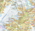
The trail map for the walk to Nigardsbreen glacier. 
Hiking map for Bregsetbreen glacier. The elevation plots shows that the trail is flat and not long. 
To display the photo images on this webpage, I am using a freely distributed java script called Lightbox v2.7.1 written by Lokesh Dhakar. You can download this program by clicking on this link. All the text and photographs on this webpage are my own creation, but the textured background is taken from a site, EOS development, that offers non-profit users free use of their graphics. Click the icon below to visit their site.
|
Click on any thumbnail to begin the slide show at that photograph Jostedalsbreen Photos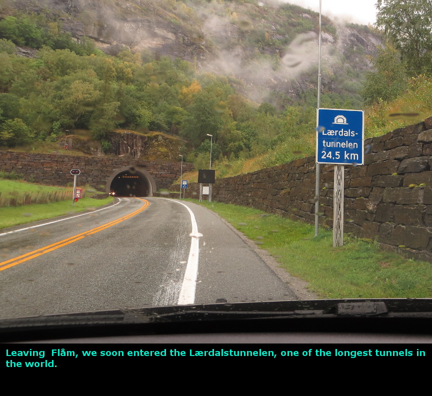


|