|
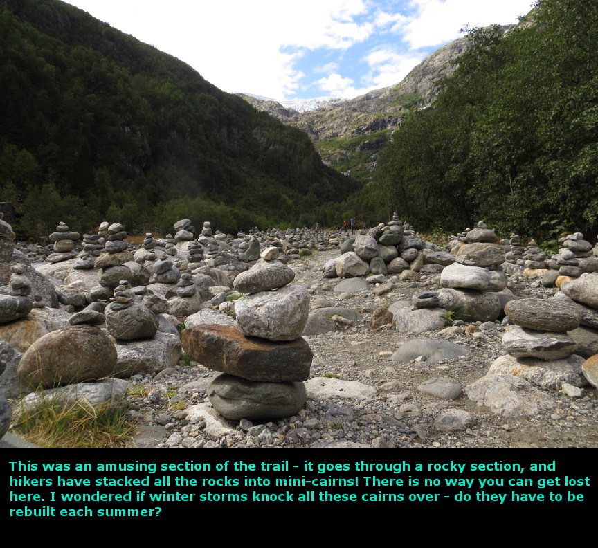
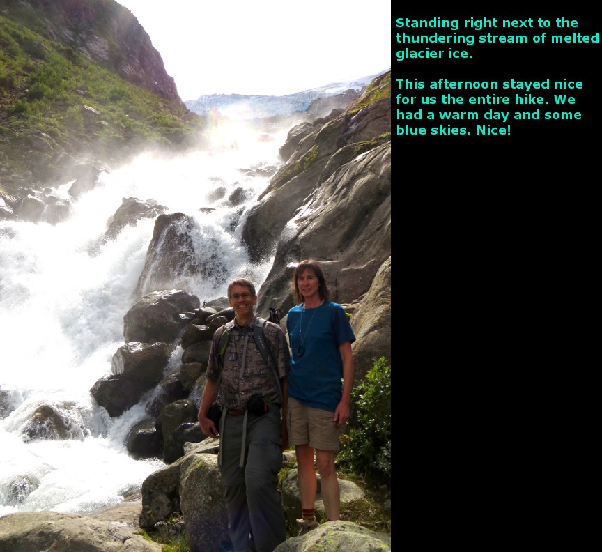
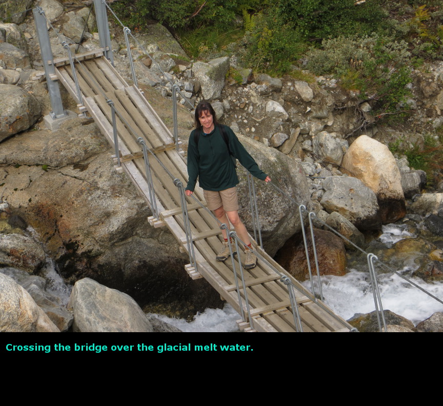
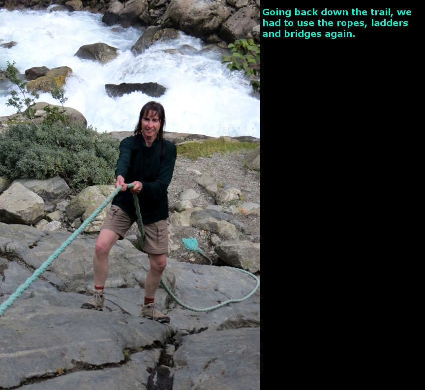
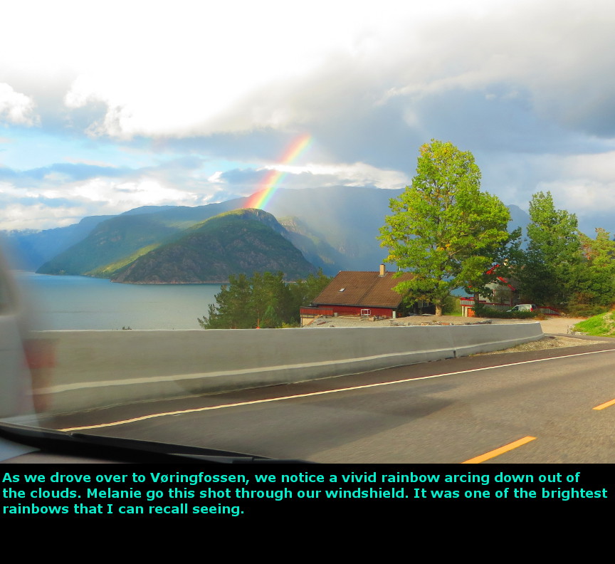
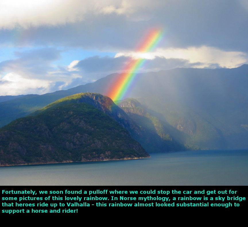
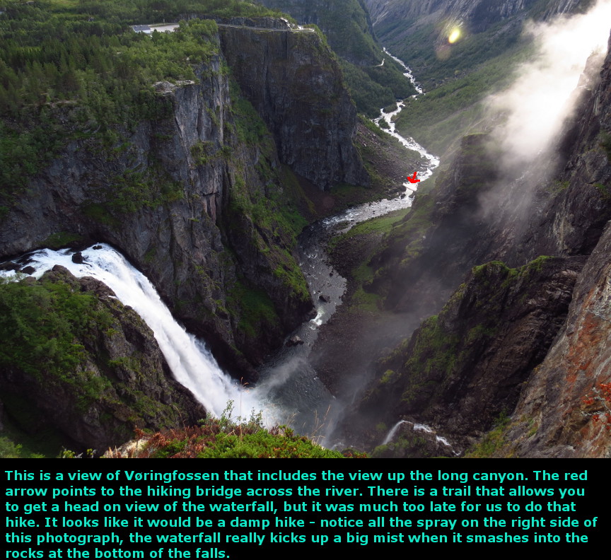
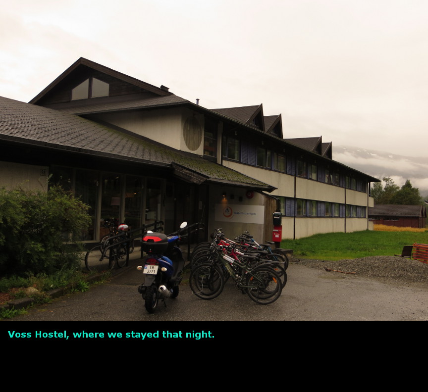
The highlight of this day was our hike Buerbreen Glacier. The Verkshotellet hotel serves a really nice breakfast buffet, but since it was a Sunday, it didn't start until 8:00 AM (breakfast begins at 7:00 AM during the week.) This delayed our start by an hour, which was disappointing because today we had to drive all the way back north, retracing the route we had taken to reach Jřrpeland the day before. Our strategy was to hike to Pulpit Rock early this morning if the weather had been too wet when we arrived the evening before. It turned out to be a good thing that we did the Pulpit Rock hike on the previous day, because it was quite wet this morning. It rained off and on all the way up to the first ferry crossing at Hjelmeland-Nesvik. We just missed the Hjelmeland-Nesvik ferry, so we had to wait for the boat to return. As we stood there, I ended up talking to a guy named Frank who was visiting from Germany. He told me how he had skipped the hike to Pulpit Rock because of the rainy weather yesterday and this morning. I felt bad for someone to come all the way to Norway and then miss such a major attraction. He was headed up to Odda, which was where we were also going. I told him about the Buer Glacier hike, which he had not known about. Hopefully, Frank did make it to that hike. Driving north, we saw a few waterfalls that we had missed on the way south. Specifically, we saw Fossefall, Espelandsfoss, Vidfoss and Tjřrnadalsfossen. Tjřrnadalsfossen required parking the car and walking about half a mile up a winding gravel road to reach a point where the falls could be seen through the trees. This area is called the Valley of Waterfalls, and there certainly were some impressed falls here. There are glaciers up in the high mountains around this area, and the melting ice drains down into beautiful Lake Sandvevatnet. Our hiking adventure for this day was the trip to Buerbreen glacier. A long narrow one lane road which starts just outside the Odda campground leads up to the Buerbreen parking lot, which was surprisingly big considering the narrow road that leads to it. The weather cooperated at this point - the rain disappeared and we enjoyed blue skies and sun, one of the nicest afternoons for us in Norway. The hike is not long, but it required much more boulder scrambling than I expected. In multiple places there were ropes anchored to the rocks to help hikers climb or descend the rocks. In some places these ropes weren't really necessary, but on a wet slippery day the ropes would have been a bigger assistance. Still, in some places the ropes did help. I tried to get some photos of us climbing using the ropes so it would look like a dramatic hike. The trail ends beneath the glacier. You can get pretty close to the ice, but a sign and a rope discourage hikers from getting too close, due to fears of falling ice as the glacier melts. We took some pictures and enjoyed the view for a bit before starting back down. We began our hike at 2:30 P.M. and returned to the car by 5:30 P.M., so it doesn't take to long to complete this hike. We drove north from Odda along the eastern shore of Sřrfjorden, which is a long skinny arm of Hardangerfjord, which happens to be the second longest fjord in Norway. It is surprising how far into the country these fjords reach - we were quite distance from the coastline at this point, but the fjord still connect out to the sea from here. I wondered how the tides had an effect so far inland. Unfortunately, route 13 is a narrow road here, barely a lane and half wide, and we got stuck behind a large truck that had a hard time squeezing around some of the tight corners. At several points, the huge trunk encountered oncoming traffic and there was a short delay while the vehicles inched and backed and turned until finally the truck could creep forward. I wondered why the truck driver didn't pull over at any point and let the long string of cars that were trailing him pass on by. It was early evening by the time we reached the turn off toward Voss. Our original plan was to drive out to see Vřringfossen, a famous waterfall - but it would require about an hour more drive in each direction. We debated whether it would be worth the trip, and ultimately we decided we would go see the waterfall, despite the fact that meant our arrival into Voss would be pretty late. This turned out to be the right decision. As we drove east toward the waterfall, it started to rain again. This resulted in one of the most brilliant rainbows I can recall seeing. The rainbow arced down so it looked like it was rising out of an island in the middle of the fjord; it looked like a fantasy painting. It was really nice. To reach Vřringfossen required us to drive through a number of tunnels. One of these tunnels was quite impressive - it was a full 360 degree tunnel that spiraled steeply upward with at least an 8% grade. We must have climbed a 1000 feet while spiraling up inside the mountain - it was quite an amazing feat of Norwegian engineering. The best viewpoint for Vřringfossen is from the Fossli hotel, which charges visitors NOK 30 to use their parking lot. But because it was so late in the evening, there was no attendant there to collect the fee. Vřringfossen is the 83rd tallest waterfall in Norway, but because of the large volume of water and the dramatic canyon that it plunges into, it is a famous attraction. We had the view entirely to ourselves that evening. There is short 1 km trail that you can do for a straight on view of the falls, but we simply did not have time for even a short hike. We drove back along the fjord, and this time we took the turn to Voss. We passed through another amazing tunnel system - underground, we came upon a roundabout, where three tunnels intersected. The underground roundabout was lit up with an electric blue light. When took the tunnel for Voss, and when we emerged from the tunnel we found ourselves on the 1.4 km Hardangerbrua suspension bridge, which spans the Hardanger fjord. The central span is the tenth longest suspension bridge in the world. When we reached the north side of the fjord, we immediately entered another tunnel, which led to another underground roundabout with three intersection tunnels. We took the Vallavik tunnel toward Voss - this tunnel continued underground for another 7.5 km before we finally emerged on the surface again. It was late when we reached the Voss Hostel, it was 9:30 P.M. We were much too tired to utilize the hostel's cooking facilities, we just ate some granola bars and went to bed. Maybe I had planned too much for this day, but we did see a lot of nice views, and in the morning we knew we would enjoy a huge breakfast at the hostel's buffet. Today we drove 371 kilometers. Panorama Photos

MapsHere is the route we drove from Jřrpeland all the way up to Voss, and the places we saw along the way. 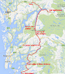
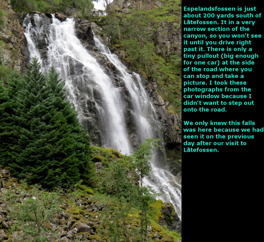
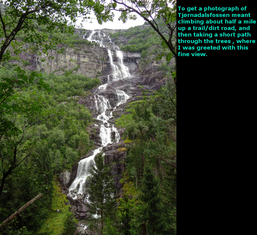
These are the waterfalls we saw in the Valley of Waterfalls 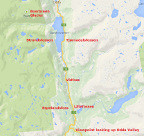
This is a contour map of the hike to Buerbreen Glacier 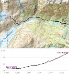
This is a contour map of the hike to see Vřringfossen 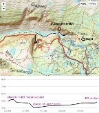
To display the photo images on this webpage, I am using a freely distributed java script called Lightbox v2.7.1 written by Lokesh Dhakar. You can download this program by clicking on this link. All the text and photographs on this webpage are my own creation, but the textured background is taken from a site, EOS development, that offers non-profit users free use of their graphics. Click the icon below to visit their site.
|
Click on any thumbnail to begin the slide show at that photograph Waterfall and Buerbreen Glacier Photos


|