|
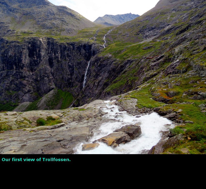
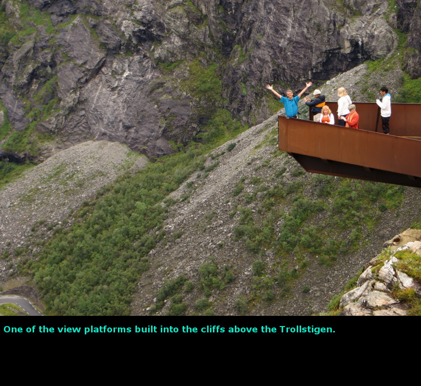
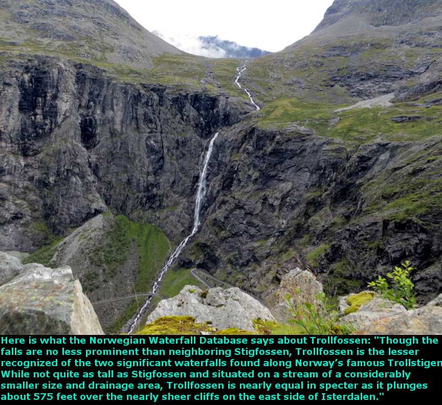
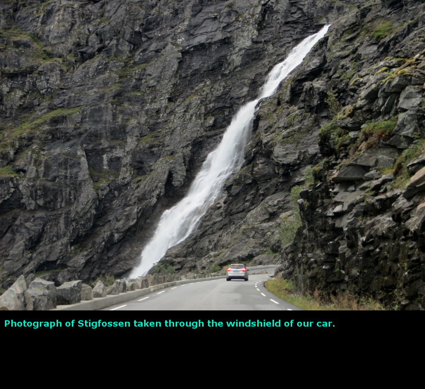
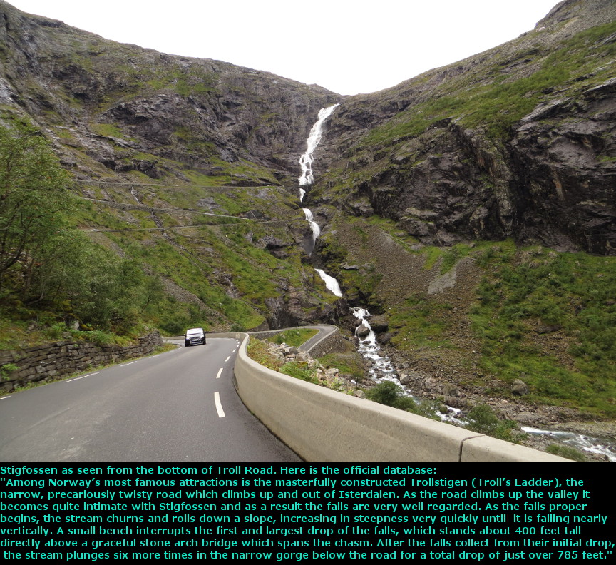
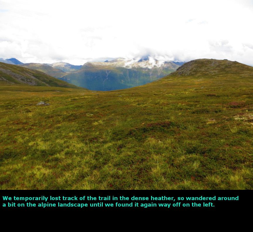
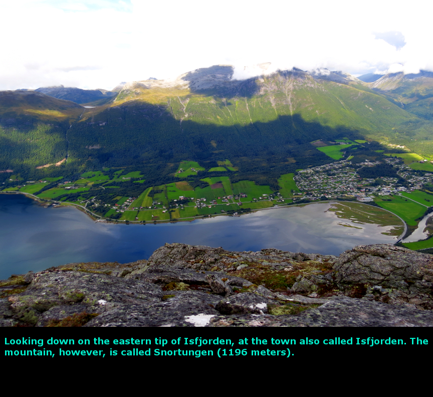
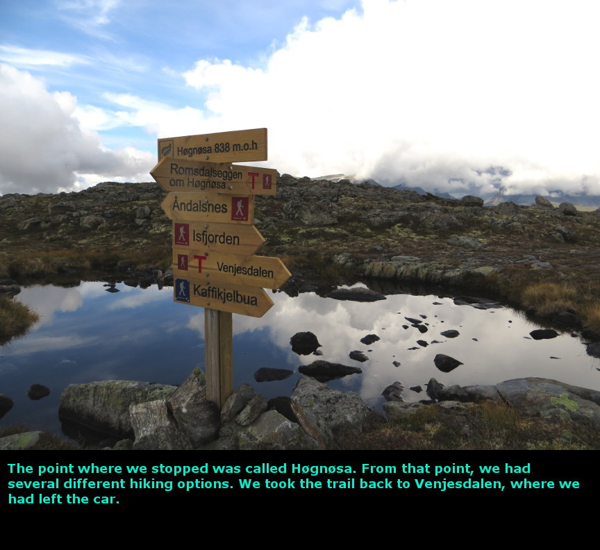
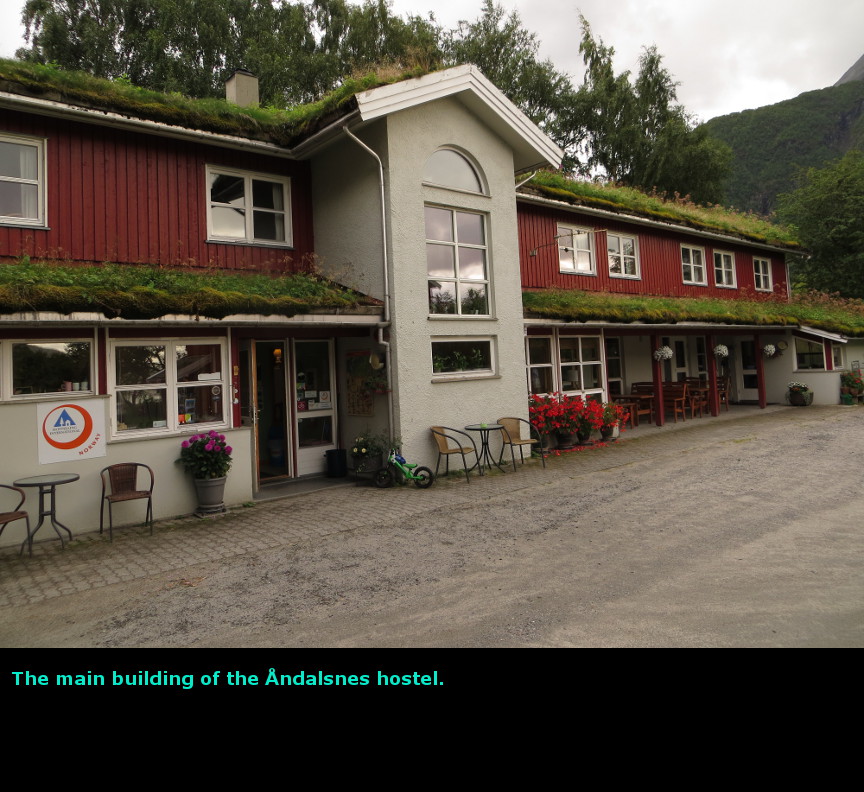
The highlight of this day was the Troll Road. Although they do not advertise it on their website, it turned out that Hotel Stranda provides a free breakfast buffet for their guests. So we enjoyed a hearty morning meal and packed up for an early start. Right outside the hotel was a helicopter that took off several times - it was too early for tourist activities, so we asked the front desk what the helicopter was doing. She told us that there was a mountain called Ċknes that had a large crack in its rock face - when the rock does fall off the mountain and into Sunnylvsfjorden, it will create an enormous tsunami that could wipe out the cities of Hellesylt and Stranda. The Norwegians have put in place a monitoring system which will hopefully provide as much as two weeks warning when the rock is ready to fall. The helicopter is used to transport scientists up to the mountainside for daily inspection. You can read more about this potential catastrophe here. We were first in line for the 9 A.M. Stranda-Liabygda ferry. It turned out to be a good thing we were early, because a large number of cars all showed up promptly at 9 to take the boat, but the boat didn't have room for all of them to board. For some reason, there was a large semi-trailer truck parked on the ferry that didn't disembark. Perhaps it was disabled? This large truck took up a lot of the vehicle space on the ferry so other cars couldn't get on board. We drove along scenic Norddalsfjorden, and then started climbing. Pretty soon we were up in the treeless Alpine environment. We were driving on route 63, but the road is commonly called Trollstigen, which means the troll road. The road itself is a tourist attraction - it has 11 tight hairpin turns that climb a steep 10% grade, while two large waterfalls thunder down dramatically beside it. At the top of the road, the Norwegians have constructed viewing platforms that allow you some fine views looking down on the road and waterfalls and the valley beyond. Because we were traveling west to east, we got to drive down instead of climbing up. We did see some RVs and buses on the road, carefully negotiating the sharp turns. You aren't supposed to stop on the narrow road as you drive down, but since there was no one behind us, we did pause in a couple spots and shoot some photos out the window. The Troll Road is pretty cool to witness. Our original plan for hiking Romsdalseggen Ridge called for us to start from Ċndalsnes and hike up to the nice view points. However, this route was pretty steep (I think there are chains anchored in the rocks at certain points to help hikers) and we had just slogged up the super steep Mt Slogen the day before. Melanie pointed out that we could start from the far end of the Romsdalseggen Ridge trail, which began at a point 350m higher than the trail head in Ċndalsnes. This seemed like a good idea, so we drove around to the parking lot at Venjesdalssetra and started hiking at noon. The Romsdalseggen Ridge trail must be popular with Norwegian hikers, because the first couple kilometers were a muddy mess. It was clear that a large number of hikers had passed through the trail and it was in bad shape. For some reason, the route runs right next to a stream, so water seeps onto the trail, which causes hikers to walk beside the official trail, which of course leads to more erosion and mud. It was a boggy mess. But once we had crested the initial slope, and got away from that stream, the hike was a lot better. The landscape is barren, devoid of trees. There are knee high plants and rocky cliffs, but no trees. The Romsdalseggen Ridge has two options - a steep option that goes up to the Mjĝlvafjellet mountain (this is described as "airy" for the scariest parts) and a flatter, though less scenic option called "The Family Route". We took the Family Route. The best scenery is when you get to the north end of trail, where you can look down on Isfjorden and the city of Ċndalsnes. There are also some nice views up the Grĝvdalen valley. Of course, ominous rain clouds were threatening us, but they did not begin raining until we had returned to the car just before 5:30 P.M. As we drove to the Ċndalsnes hostel, the rain started. We checked in and cooked some dinner. I wish we had been able to go further and higher on Romsdalseggen ridge, but the weather conditions had us a bit spooked from all the rain that we saw on this trip. Today we drove 94 kilometers. Panorama Photos


MapsThe route we took this driving this day. 
We hiked up to Hĝgnosa and back to Venjesdalen. 
To display the photo images on this webpage, I am using a freely distributed java script called Lightbox v2.7.1 written by Lokesh Dhakar. You can download this program by clicking on this link. All the text and photographs on this webpage are my own creation, but the textured background is taken from a site, EOS development, that offers non-profit users free use of their graphics. Click the icon below to visit their site.
|
Click on any thumbnail to begin the slide show at that photograph Trollroad Photos


|