|
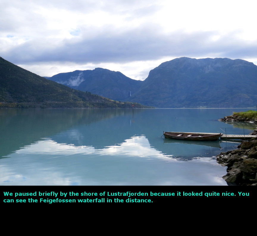
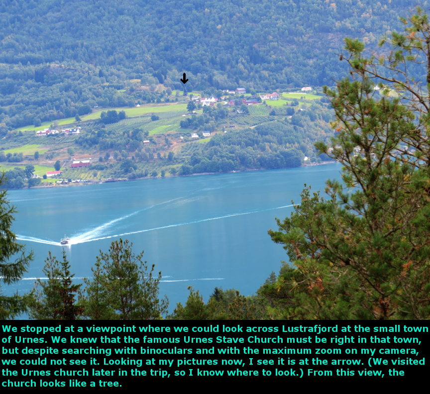
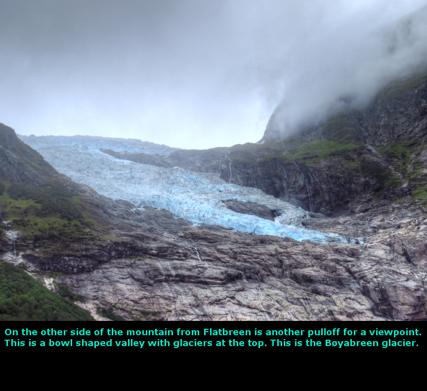
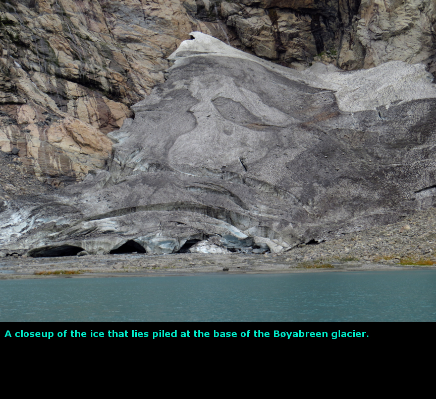
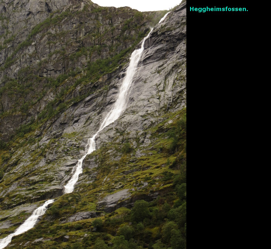
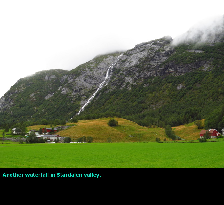
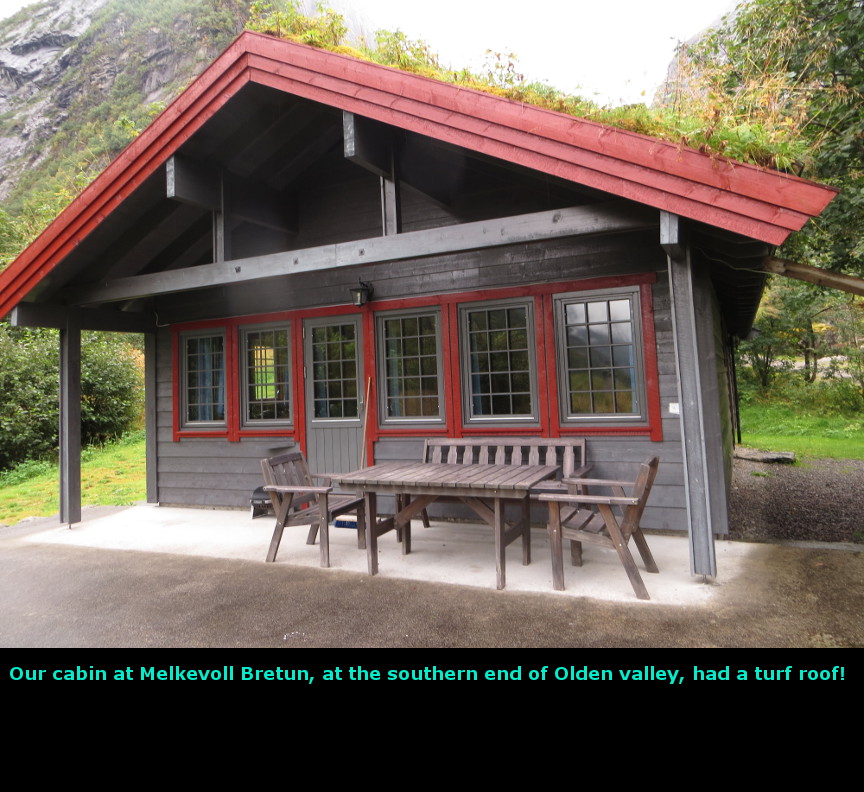
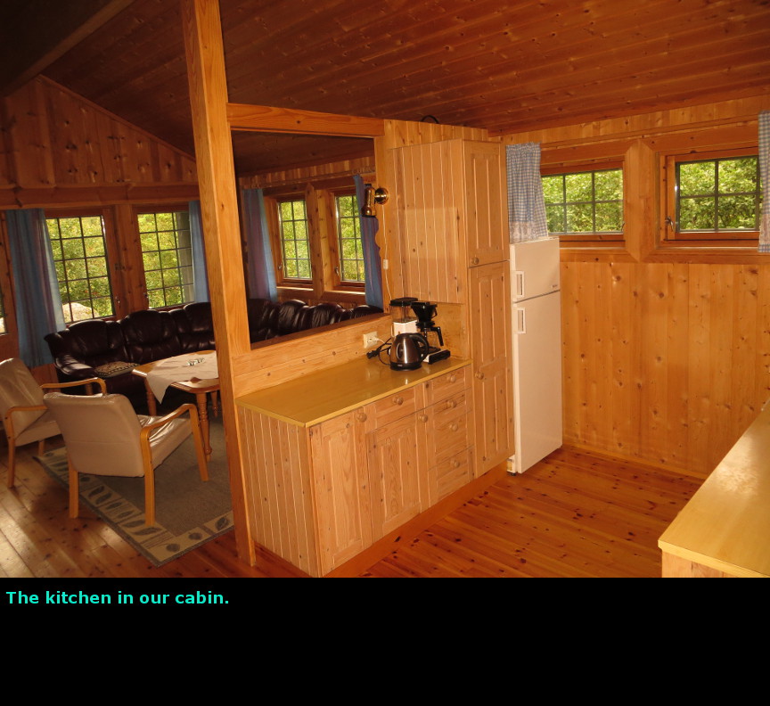
The highlight of this day was the viewpoint for Břyabreen glacier. The Hotel Jostedal website makes no mention of breakfast being included with the room, so we were pleasantly surprised to learn that a breakfast buffet was part of the standard amenities. Today was a big driving day. We had to go all the way around Jostedalsbreen National Park to reach our next stop in the Olden Valley at the north end of the park. Our progress was slowed because I kept stopping at viewpoints for pictures. For example, we went to a view point of Lustrafjorden, which is another arm of the immense Sognefjord. Looking across Lustrafjorden, we could see the Feigefossen waterfall. We could see the tiny town of Urnes across the water, and we knew that the famous Urnes Stave church was located there, but despite peering intently with binoculars and using the zoom on my camera, we could not spot the church. On the south side of Jostedalsbreen we took a narrow road to see the Supphellebreen glacier. This small glacier would have melted away long ago except that its ice is constantly renewed by the chunks of glacial ice that calve off of the Flatbreen glacier, which falls out of a hanging valley right above Supphellebreen. We stood around for a bit, hoping to see some ice fall, but nothing happened while we were there. A short distance later is a big pulloff for a tremendous view of the Břyabreen glacier. You can walk right up to the lake of melted ice water that has formed at the foot of this glacier. We had lunch here while admiring this view. On the other side of a tunnel, we pulled off again for another nice viewpoint of Jolstavatnet, a beautiful lake of melted ice water. I think this lake was formed by the outflow of the glaciers around Břyabreen. We drove north, going up the west side of Jostedalsbreen National Park on route E39, when we spotted the Heggheimsfossen waterfall. Melanie knew this meant we had missed the turnoff to Arnot and the Stardalen valley - so we had to turnaround a back track. It was raining pretty hard at this point, which made it difficult to appreciate the steep sides of the valley (called Votedalen) that we were driving through. We wanted to find Arnot, because there was a hike to the Haugabreen glacier that began near there. When we drove up to the narrow road that led to the trailhead, we happened to meet a couple of hikers who had just completed the hike to Haugabreen. They told us that the trail was difficult, scrambling over a lot of boulders before you get to a view of the glacier after an hour and a half of hiking. Since it was still raining off and on, we decided to skip the idea of climbing over slippery rocks, so we passed on the Haugabreen hike. Back on E39 again, we climbed up and over a steep mountain pass - coming down on the other side was a viewpoint of Nordfjorden (North Fjord) - which isn't quite as enormous as Sognfjorden (the name means Parish Fjord), but it is still impressive. It was still raining as we descended, but by the time we reached Olden Valley, the rain had ceased, though low lying clouds still lingered. Despite these clouds, Olden Valley still looked quite beautiful. Olden Valley is a long glacier carved valley. It has a long lake, Oldevatnet, that runs most of the length of the valley. Because this lake is fed by the many glaciers on both sides of the valley, it has the beautiful turquoise color that is so marvelous to see. Because there are glaciers up on the cliffs above the valley, there are numerous waterfalls that come splashing down out of the heights. There a lot of natural beauty here. A narrow road, which is just one lane wide in many places, is the only way up and down this valley. This lane is populated by many tourist buses, because on some days a cruise ship will come up Nordfjord and dock at Olden. The tourism industry drives busload after busload of people down this narrow valley to see the glaciers, especially Briksdal glacier, which is located at the southern end. We had reservations for two nights in a cabin at Melkevoll Bretun. We stayed in cabin #3, which turned out to be a stunning location. From the porch of the cabin, we could look north up the Olden Valley. Looking to the east, we had fine view of the Briksdal glacier. To the west, the mighty Volefossen waterfall poured down - we were close enough to hear the roar of this waterfall even inside the cabin. The cabin turned out to be pretty big, with a kitchen, dining room, sitting area and three bedrooms. Obviously, it was much more space than we needed, but it was nice to stay there. We cooked ourselves some dinner on the stove and then went to bed. Today we drove 265 kilometers. Panorama Photos


MapsThis map shows the route we took on this day as we drove all the way around Jostedalsbreen National Park, plus the landmarks that we saw along the way. 
This map is taken from a hiking map of the trails in the Olden Valley. 
To display the photo images on this webpage, I am using a freely distributed java script called Lightbox v2.7.1 written by Lokesh Dhakar. You can download this program by clicking on this link. All the text and photographs on this webpage are my own creation, but the textured background is taken from a site, EOS development, that offers non-profit users free use of their graphics. Click the icon below to visit their site.
|
Click on any thumbnail to begin the slide show at that photograph Jostedalbreen Photos


|