|
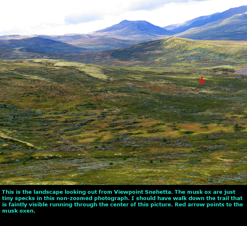
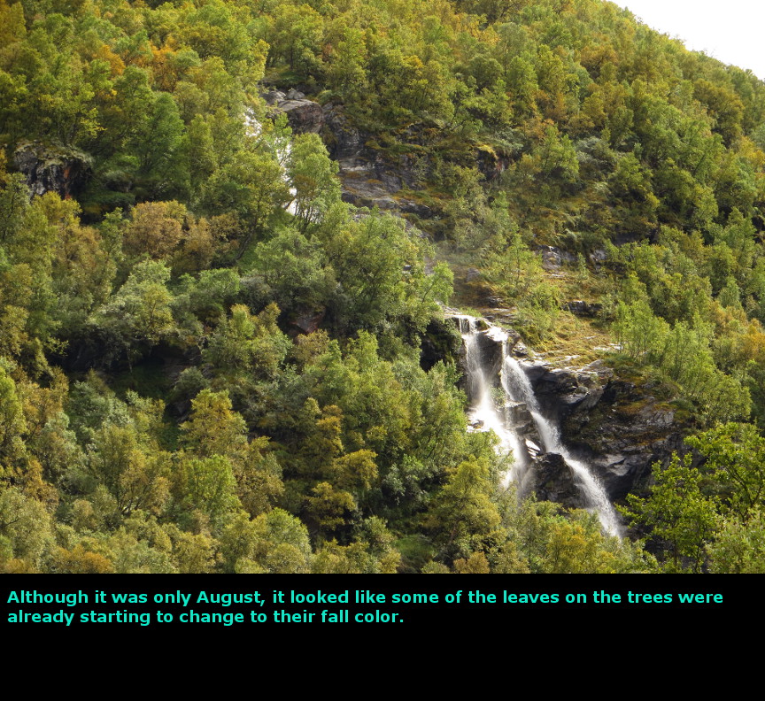
The highlight of this day was seeing the musk ox from Snřhetta Viewpoint. Using the iPad, we had been checking the weather forecast for every day. Finally, we got a prediction of a clear day without rain. But when we started south on Route 136, there were still a lot of clouds hanging low. We couldn't even see Romsdalhornet, the large mountain that looms on the other side of the valley from the Troll's Teeth. We did get some view of the Troll's Teeth themselves, because fortunately most of the clouds were lower than the jagged peaks. We continued south, stopping for pictures at all the waterfalls we could see. There was pullout and a short hike to Vermafoss - yet although we took the hike, we couldn't spot the waterfall. Perhaps the falls weren't flowing? It turned out that we had already seen Vermafoss further up the road, but didn't know the name of the waterfall when we were looking at it - we saw a lot of waterfalls in this valley. We tried to find the tourist information center in Dombĺs, so that we could ask about hiking trails in Dovrefjell National Park, but they appeared to be closed. We drove out to Dovrefjell, which is further out of town than we expected. Eventually we found the turnoff that led up to the Viewpoint Snřhetta. Snřhetta was long thought to be the tallest mountain in Norway, but modern measurements reveal that Snřhetta is 2,286 meters high, while Galdhřpiggen is 2,469 meters. Interestingly, you can hike to the top of both of those peaks, they are not technical climbs, though you will have to cross snowfields. At Viewpoint Snřhetta some other tourists pointed out to us a distant group of musk oxen. They were perhaps half a mile away - but I was still excited to see them. Musk ox had been wiped out in Norway until they were reintroduced in the country in 1932 (the animals were captured wild from Greenland). Now the musk ox population lives wild in the park. In hindsight, I wish I had walk closer to these animals to get a better look. The signs warn you to not get within 250 meters of the musk ox, I would have been happy to be within 500 meters. I used the 50x zoom on my camera, but my pictures are disappointing. But I am still glad we saw. For some reason, seeing wild animals and birds is an exciting experience. Maybe it is uplifting to know that there are still some pockets of natural wildlife running free on this planet. We drove further east - the road was straight across the open landscape. I am not sure what the speed limit was (80 kph?) on that stretch, but I briefly accelerated up to 100 kph (60 miles an hour!) just to feel what it was like to drive fast again. Driving 70 kilometer per hour everywhere does make for some slow going. We found a trail heading into Dovrefjell National Park, but decided not to take it. The weather looked threatening again (even though the forecast had predicted that this was to be a nice day), and we had a hike planned for tomorrow in Rondane. So we drove back to the Trolltun Guesthouse in Dombĺs. The rain came down in buckets after we checked in. Our perfect record of rain every single day in Norway was still intact. Today we drove 204 kilometers. Panorama Photos
MapsMap of our drive for the day 
To display the photo images on this webpage, I am using a freely distributed java script called Lightbox v2.7.1 written by Lokesh Dhakar. You can download this program by clicking on this link. All the text and photographs on this webpage are my own creation, but the textured background is taken from a site, EOS development, that offers non-profit users free use of their graphics. Click the icon below to visit their site.
|
Click on any thumbnail to begin the slide show at that photograph Dovrefjell Photos


|