|
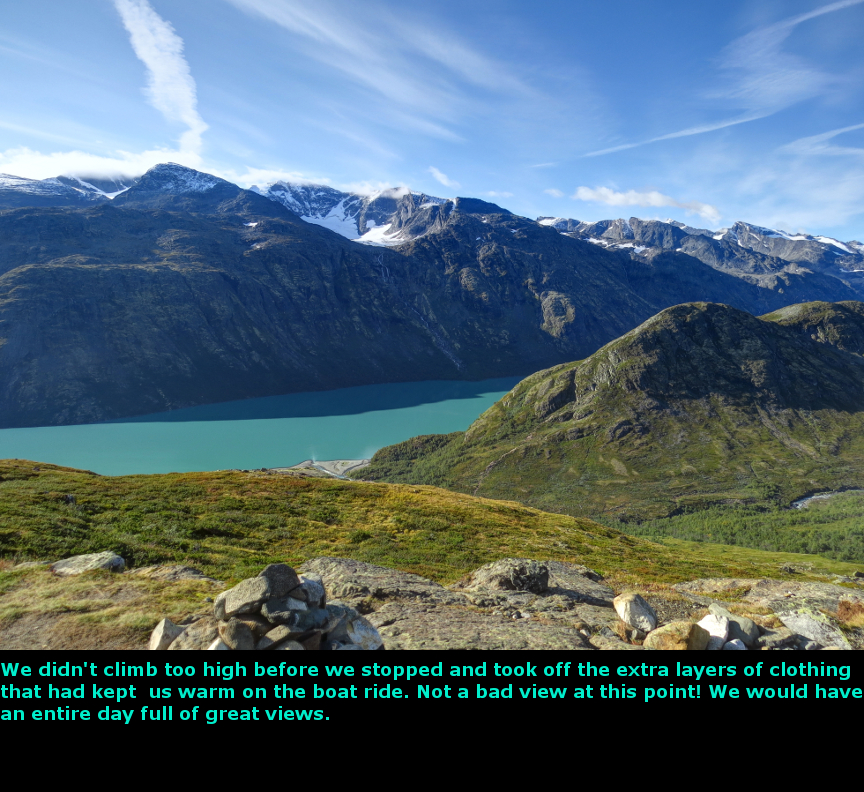
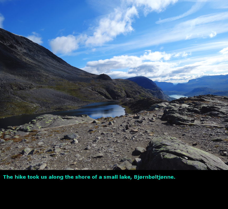
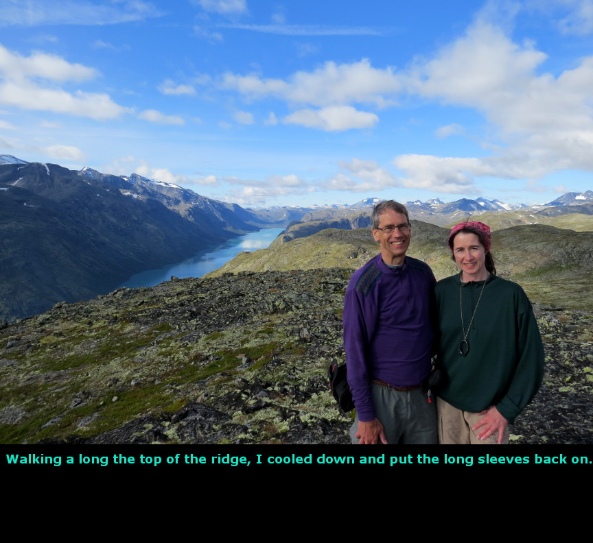
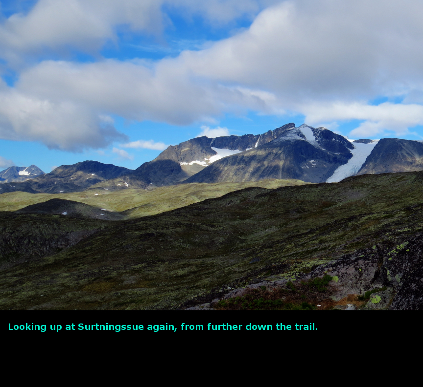
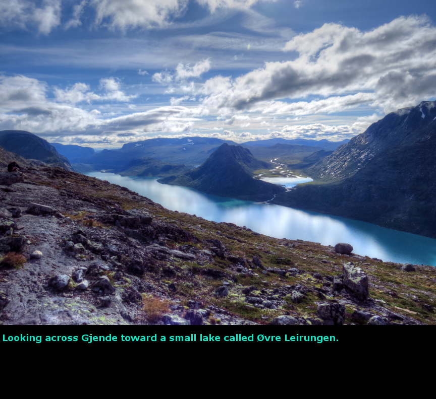
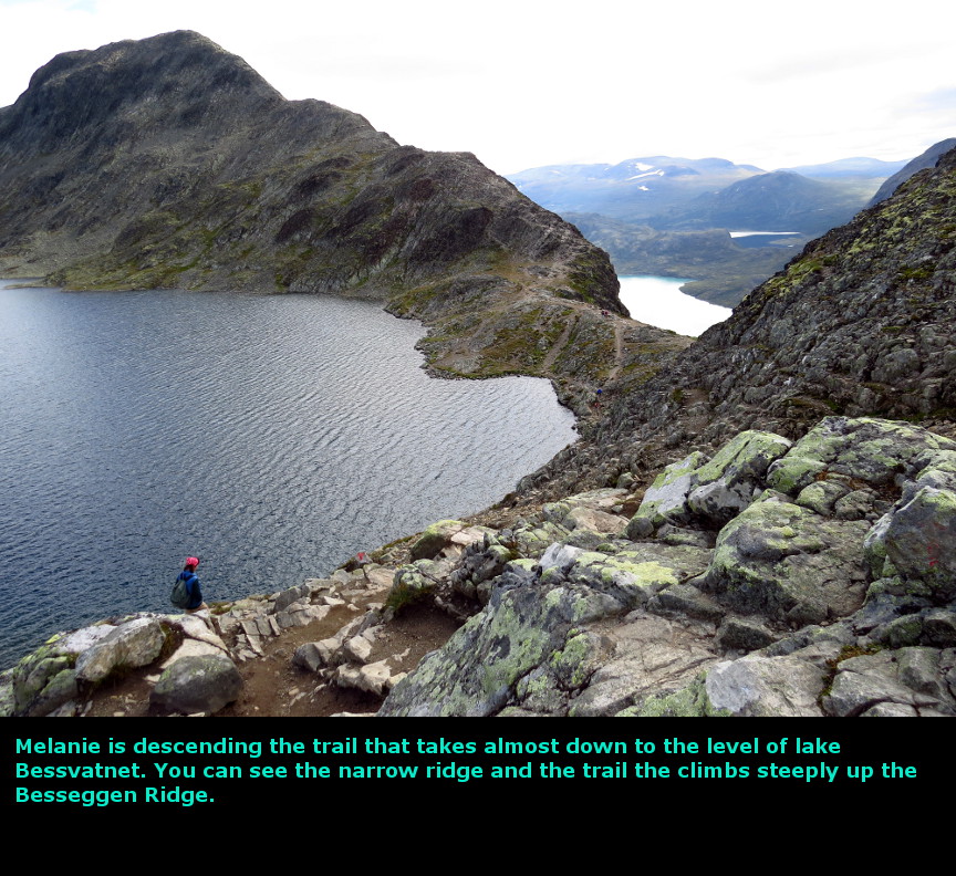
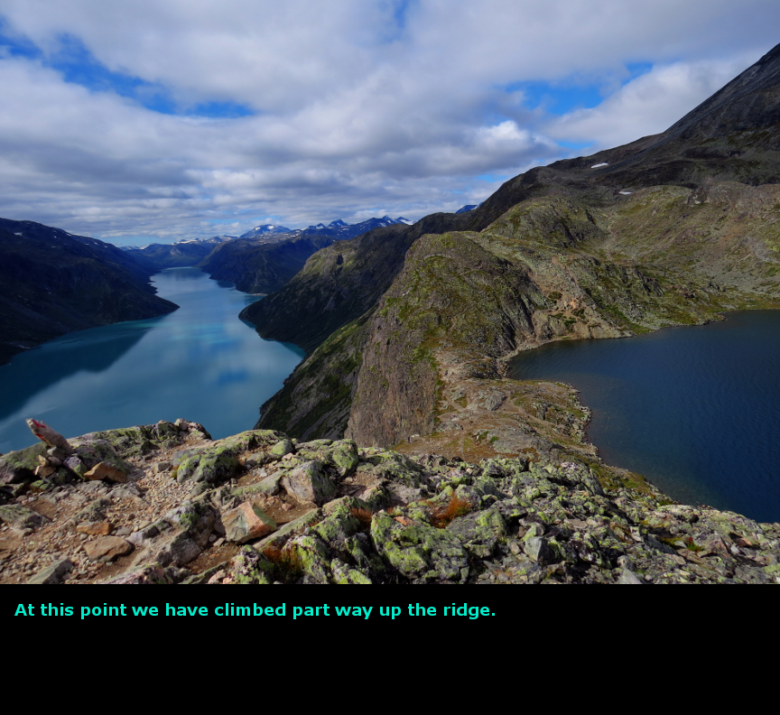
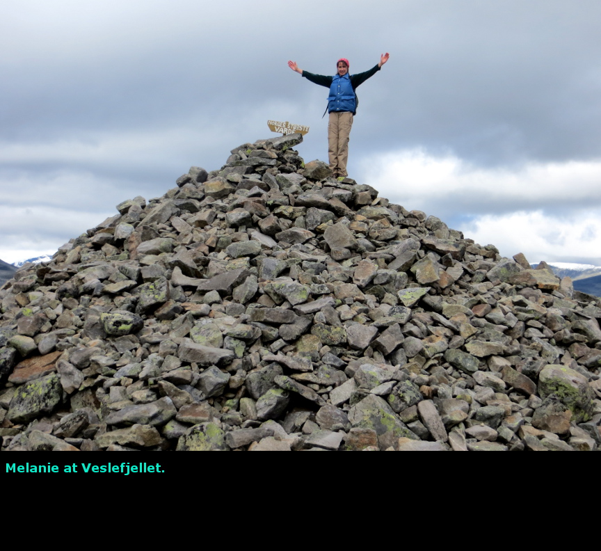
The highlight of this day was the highlight of our entire Norway vacation - the breathtaking hike over Besseggen Ridge. If I could have only one day of perfect weather on our Norway trip, then I would have picked this day. I was excited to see Besseggen Ridge, and fortunately perfect weather was exactly what we got. What a spectacular hike! The reason we stayed at Maurvangen campground was it proximity to Gjendesheim, it was just few kilometers from our cabin to the boat dock at Gjendesheim. We bought tickets for the first ferry to Memurubu, which left at 8 A.M. The ferry took us on a half hour ride across Lake Gjende, a long narrow lake in a steep-sided valley. The lake is filled with water from melted glacial ice, so it has a dramatic turquoise color that made me reach for my camera every couple of minutes for yet another beautiful picture. Lake Gjende is part of Jotunheim National Park. Jotunheim is Norwegian for "Home of the Giants"; the whole area is full of dramatic peaks with glaciers and waterfalls and forested cliffs. This is wonderfully scenic area. Every year, about 30,000 hikers do the Besseggen Ridge trail. The Norwegians have considered putting down stone slabs on parts of the trail to combat erosion caused by so many boots on the ground. The route is about 13 km long, and climbs as high at 1740 meters. It takes about 7 hours to complete, which sounds like a lot, but most people spend time admiring the jaw-dropping views. Also, there is a section where you have to climb up a narrow rock spine for a few hundred meters. With 30,000 hikers a year, I would think there would be an occasional fatality, because it looks like a long drop if you slip off those rocks, but I never heard or read anything about any one dying while hiking. Still, I was glad the rocks were completely dry while climbed up the ridge, I did not want to slip there! The ferry dropped us off at Memurubu at 8:30 A.M., and we hiked back to Gjendesheim at 3:15 P.M. Almost all the other hikers who got off the boat with us finished ahead of us - I simply could not resist take one picture and then another. After all the clouds and bad weather we had experienced in Norway, it was exhilirating to enjoy a day like this surrounded by magnificent scenery. At Memurubu there is nice looking "hut", so Besseggen Ridge can easily be included as part of a multiday hut-to-hut trekking adventure. From Memurubu, the trail immediately starts climbing. It had been cold at the start (I had to clean a layer of frost off the window of our car in the morning before we could drive to Gjendesheim.) but we quickly heated up on the climb and stopped to pull off the outer layers. The first part of the hike takes you up and over a big hill, with Lake Gjende to the south side. Because of the steep canyon walls and lack of trees, the lake is in view almost every step of the way. To the north is Mount Besshře (2258 meters) with the Besshřebreen glacier nestled at its peak. The most famous section of the trail is the saddle about midway along. You climb back down (though at the lowest point, you are still 400 meters above Lake Gjende) to reach the saddle, which splits Lake Gjende from Lake Bessvatnet. Unlike the milky-green color of Lake Gjende, Lake Bessvatnet is a deep dark blue; the lake is crystal clear. I don't know what water source feeds Lake Bessvatnet, but it clearly isn't glacial runoff. The contrast of color between to the two lakes is a nice effect. Lake Bessvatnet is much higher than Lake Gjende, when you are on the saddle you are nearly at the water level of Bessvatnet. We ate lunch here. From the saddle is the Besseggen Ridge itself - this is a spine of rock that divides Bessvatnet from Gjende. It is not very wide, but when you get up close you can find footholds and cairns. The best idea is to not look down, and just climb one section at time. Melanie told me later that the ridge climb was easier than she expected, but I thought it was enough of a challenge. I tried to remember to stop periodically for pictures while we climbed the ridge, because this is always the spot where the most classic of the scenic photos are taken. I was glad we were going up and not down, I think it would have been more difficult to climb down the ridge that to ascend, which is probably why the majority of the hiker travel west to east on this trail. There is a gigantic cairn at the high point of the trail (1722 meters) on Veslfjellet. After that point, the views are simply nice, rather than stunning. It is about 5 kilometers of hiking from there back down to the start. Just a fantastic day. This was our first day in Jotunheim, and we would soon enjoy some more. Today we drove 7 kilometers. Panorama Photos


MapsMaps of the Besseggen Ridge hike 

To display the photo images on this webpage, I am using a freely distributed java script called Lightbox v2.7.1 written by Lokesh Dhakar. You can download this program by clicking on this link. All the text and photographs on this webpage are my own creation, but the textured background is taken from a site, EOS development, that offers non-profit users free use of their graphics. Click the icon below to visit their site.
|
Click on any thumbnail to begin the slide show at that photograph Besseggen Ridge Photos


|