|
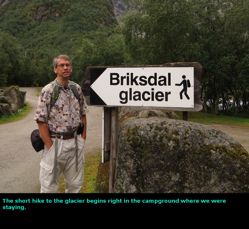
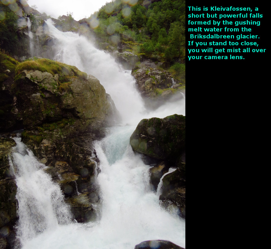
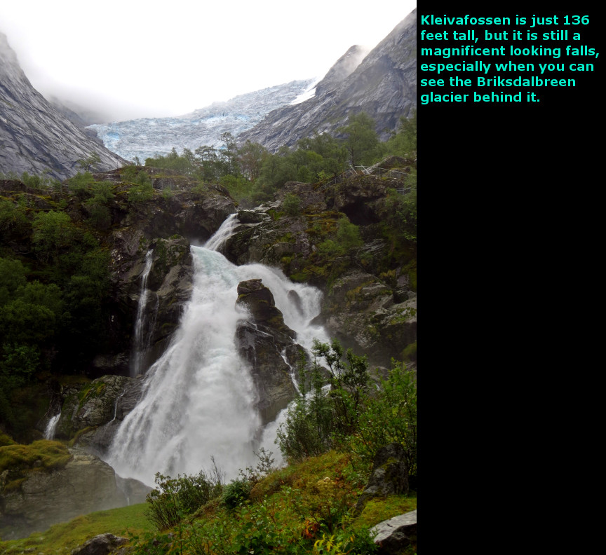
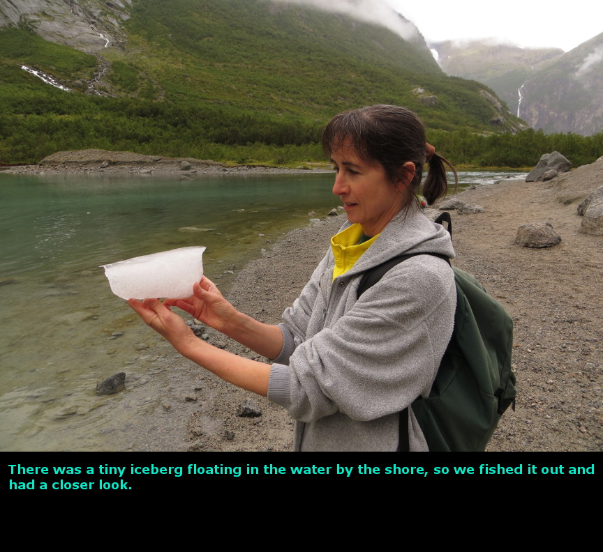
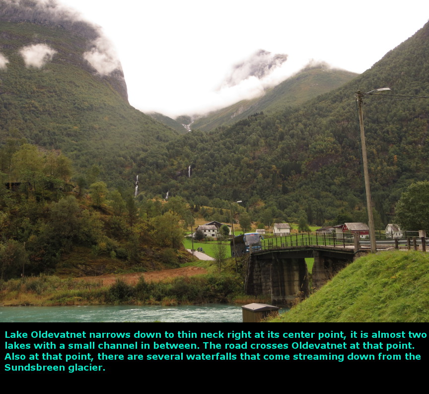
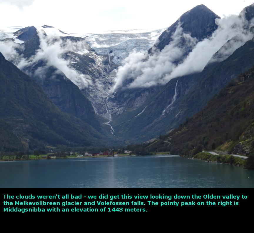
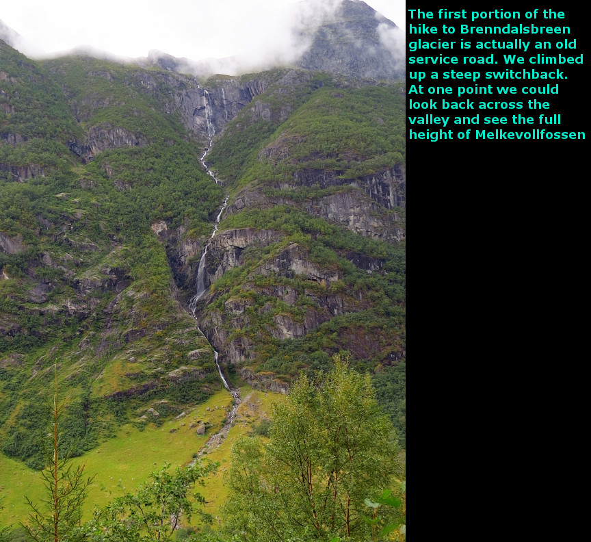
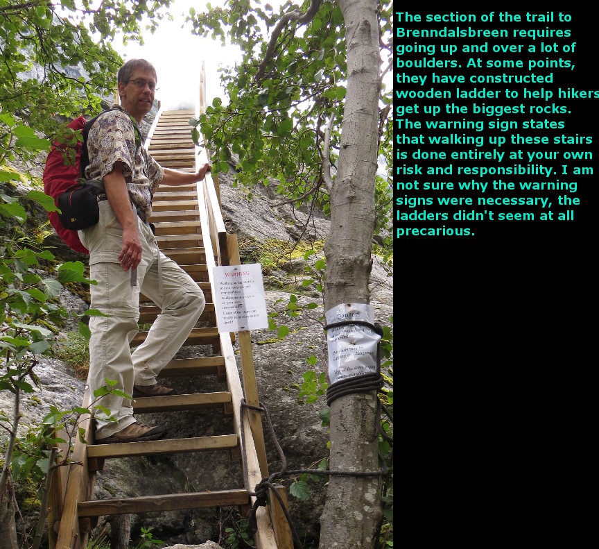
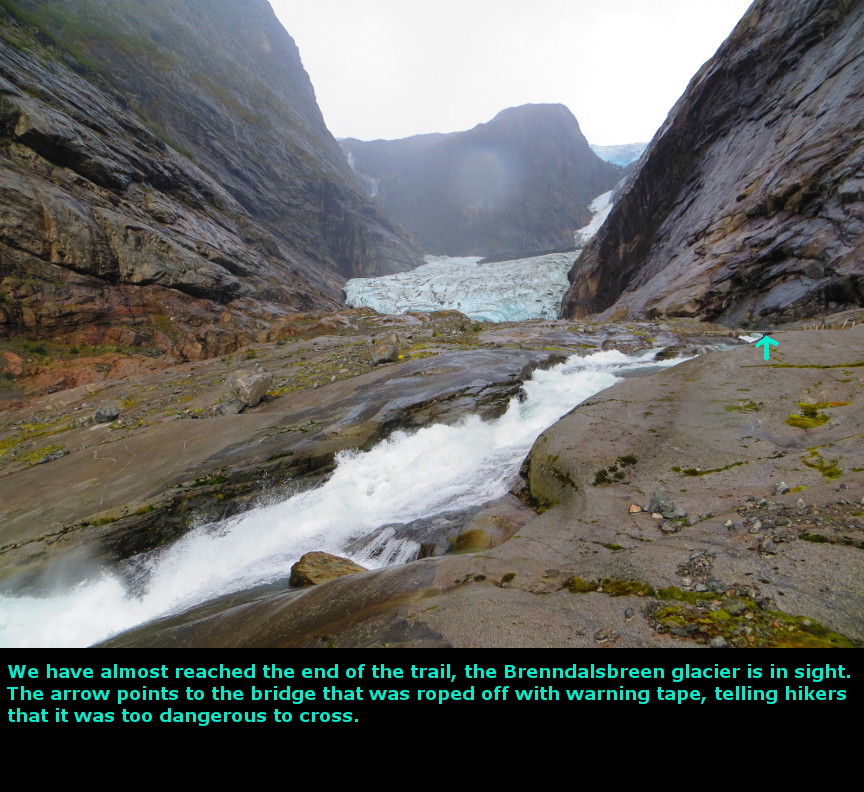
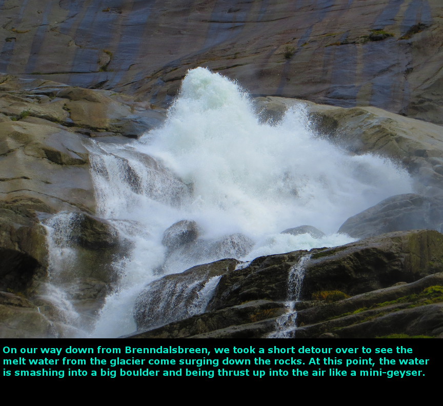
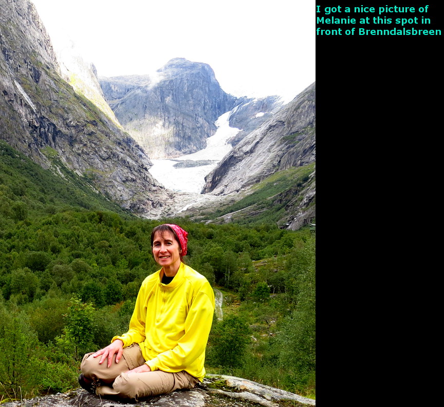
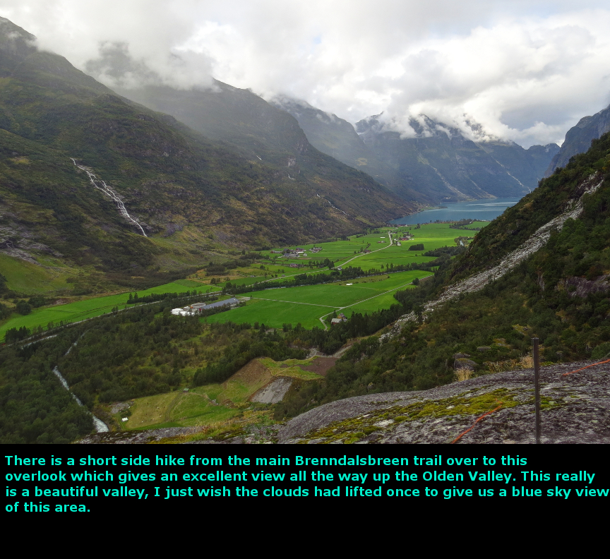
The highlight of this day was the hike to Briksdalbreen glacier. We got up early and made breakfast using the cabin's kitchen. We walked out the door and started up the trail to Briksdalbreen glacier. It wasn't raining, though there were a lot of clouds. There is a nice waterfall about halfway up the trail - this is the Kleivafossen falls. It is an energetic waterfall, throwing off a lot of spray from the rushing water. I had to step back a good distance to get a photograph without the lens getting soaked. We passed one couple heading downward, someone had gotten a start even earlier than us. But otherwise we saw no one else on the trail, and we had the views of Briksdalbreen all to ourselves. The pictures of us at the glacier were taken with the 10 second timer on my camera. There was a lake of melted ice in front of Briksdalbreen, and we watch tiny icebergs floating slowly in the water - one washed up on shore and we fished it out for closer look. Walking back down the trail, we started to pass large numbers of tourists - apparently the first cruise ship passengers were already arriving. Visitors who don't want to hike have the option of paying to ride in "troll cars" which will carry up to 7 passengers up the trail. Unfortunately, the "troll cars" don't stop to allow views of Kleivafossen, which is worthy of some admiration. After our Briksdalbreen hike, we considered taking the trail up to Brenndalsbreen glacier - but the clouds were so thick in the valley that I was afraid we climb up there only discover our views were completely obscured. So we decided to drive over to the Lodal Valley and see Kjenndal Glacier, hoping that the clouds would lift. It isn't that far to reach Lodal Valley, but the road is a single lane in most places so you have to drive slow. We were fortunate not to meet oncoming traffic except at points where a pullout permitted cars to pass. The Lodal Valley itself is a beautiful setting, but there were so many clouds and overcast skies that the view wasn't as dramatic as the photos on the tourism websites. When we made it all the way down the Lodal Valley, we were stopped by a road construction worker. He told us that the road to Kjenndal Glacier was being repaved and that we could not drive upon it. He suggested that we take an alternate road up to see Břdalsbreen glacier, so we started up that road. It was a bad road - very steep and poorly maintained - I started to get a bad feeling about the drive. An oncoming car forced us into an awkwark manuevering to try and let them pass us - but before they went by, I asked them if they had driven all the way up to Břdalsseter. They told me that did manage to drive all the way to the village, but they were unable to see the glacier. It was unclear to me if the glacier was too remote from the village to be seen, or if the thick clouds had blocked the view. Any way, we decided to turn around and return to Olden Valley. By the time we got back to Olden Valley, more of the clouds had lifted and we had some better views. Olden Valley really is a special scenic area, the waterfalls and steep canyon walls and the beautiful lake make it a nice place to visit. We stopped at many of the pullouts to try for pictures of waterfalls and of the lakes. We ate lunch on the lake shore. We decided to hike up to Brenndalsbreen glacier. It was 1:50 PM when we started this hike, and we finished at 5:40 PM. The first portion of the hike is up a steep old road, so there is a lot of climbing initially. When you get to the end of the road way, and go over a small hill, you are rewarded with a fine view up the valley toward Brenndalsbreen. This may actually have been the best point for shots of that glacier, though of course we took the entire trail all the way. The second part of the trail goes through dense forest along side a swift running stream (the melted glacier outflow). This part of the trail did not seem to be an official trail, I wonder if flooding had wiped out the established route and resulted in this alternate path forged by previous hikers. The final portion of the trail exits the trees and climbs up over rock to reach the glacier itself. There are perhaps a dozen ladders installed here to help hikers up the biggest rocks. I think we temporarily got lost on a few sections, because the cairns are not easy to spot; this resulted in a few boulder scrambles. But eventually we reached the base of Brenndalsbreen. To get the best views of Brenndalsbreen, you have to walk over a bridge over the rushing melt water. However, the bridge was wrapped in yellow tape and a sign stated that it was considered to dangerous to allow people to cross the bridge. I believe the authorities were worried about rock or ice falls. Twice during this hike we heard loud crashes from the direction of the glacier, though we were unable to spot anything actually falling. Still, I was tempted to risk crossing the bridge any way, just to get a quick view from straight on at Brenndalsbreen. The bridge itself certainly looked sturdy enough. But then it started to rain on us, which was discouraging. So we finished our photography and started back. The rain stopped and started several times, never falling very hard. On the return trip, we passed a family of four that was on its way up to the glacier. They were the only other hikers we saw on this trail. Yes, the hike is further than the hike to Briksdalbreen, but it isn't strenous, and it also isn't innundated with cruise ship passengers. On the hike back, we took a small detour into a pasture that led to some excellent views looking at the Olden Valley from a high vantage point. This was pretty nice. We hiked back down to the car and returned to our cabin for dinner. Melkevoll Bretun has a washing machine and a dryer, so we washed all our dirty clothes. We were already one week into our trip. Today we drove 91 kilometers. Panorama Photos


MapsThis map shows the trail to Briksdal glacier. 
This map shows the Brenndalsbreen Hiking trail. 
To display the photo images on this webpage, I am using a freely distributed java script called Lightbox v2.7.1 written by Lokesh Dhakar. You can download this program by clicking on this link. All the text and photographs on this webpage are my own creation, but the textured background is taken from a site, EOS development, that offers non-profit users free use of their graphics. Click the icon below to visit their site.
|
Click on any thumbnail to begin the slide show at that photograph Olden Valley Photos


|