|
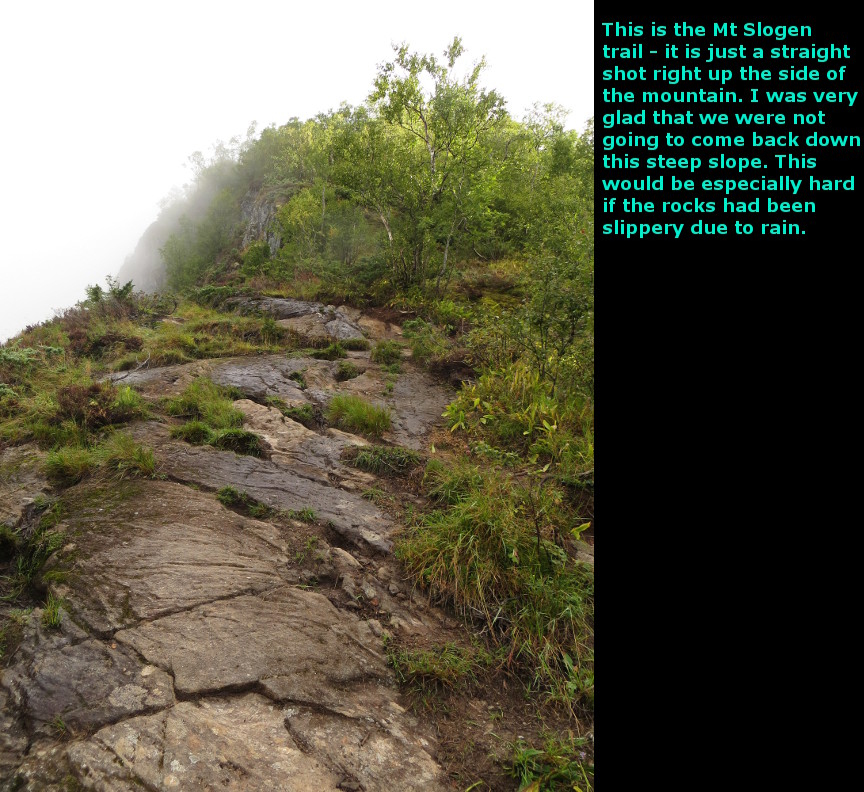
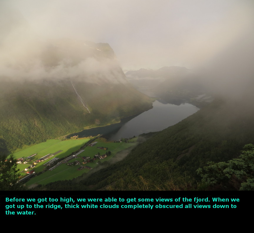
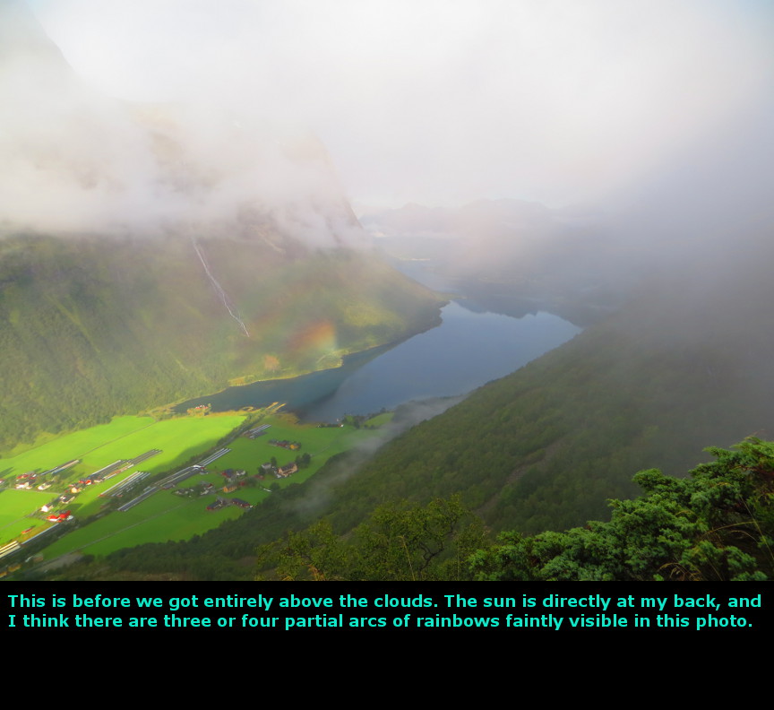
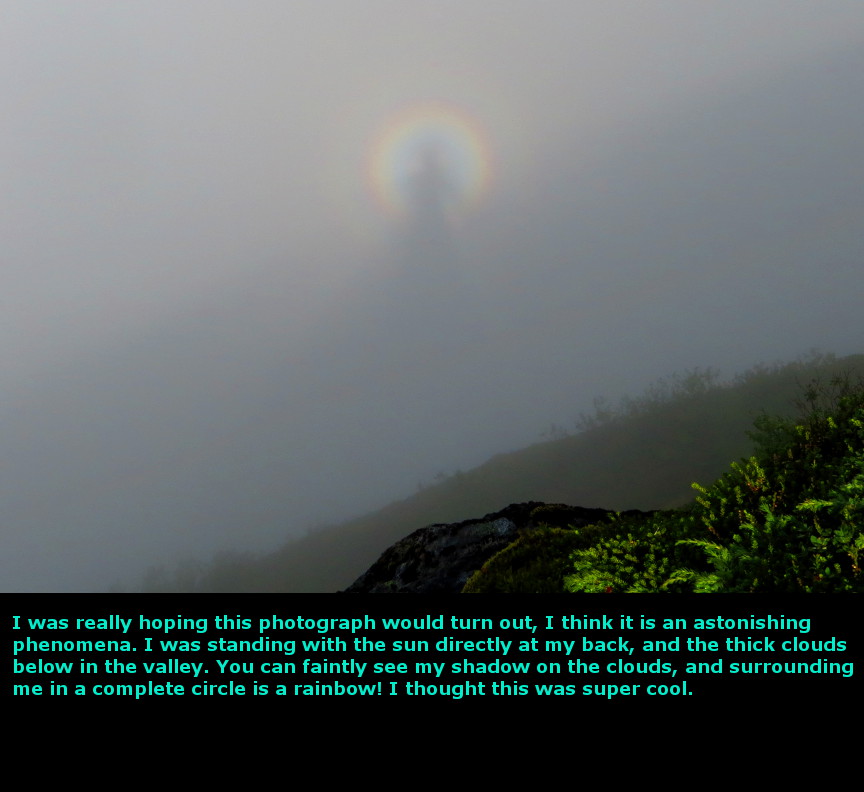
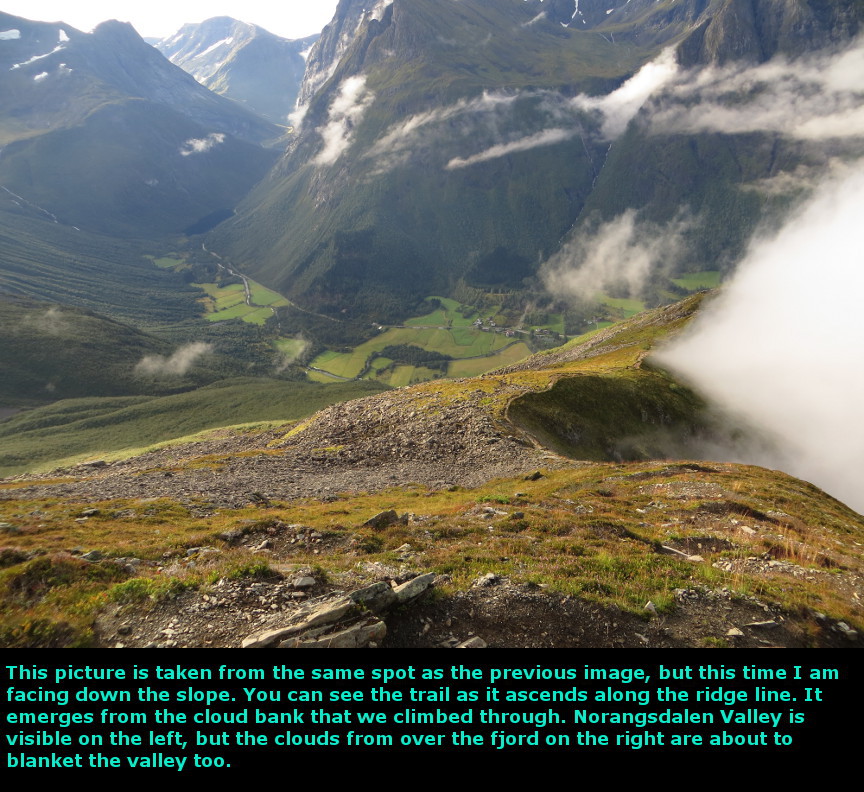
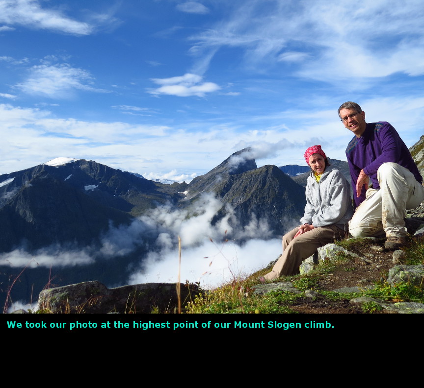
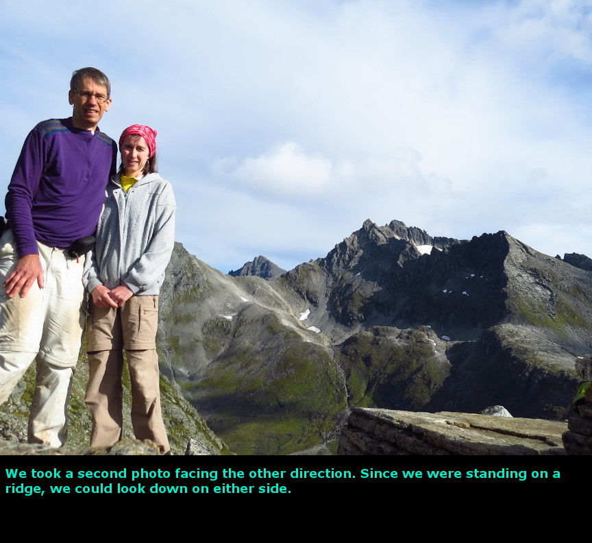
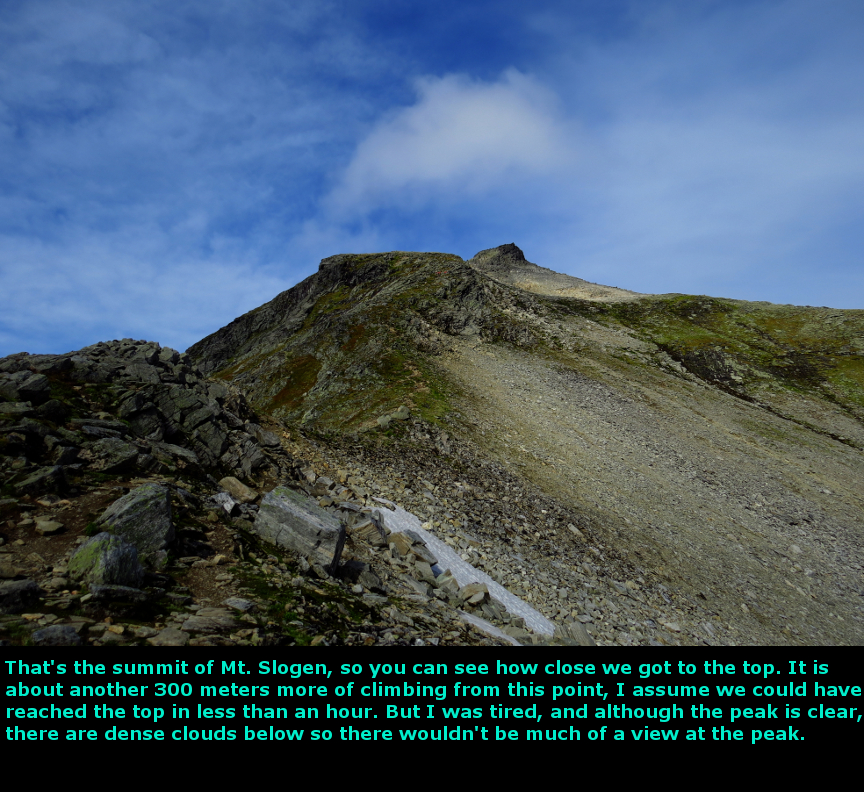
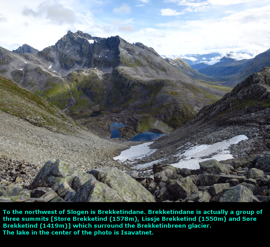
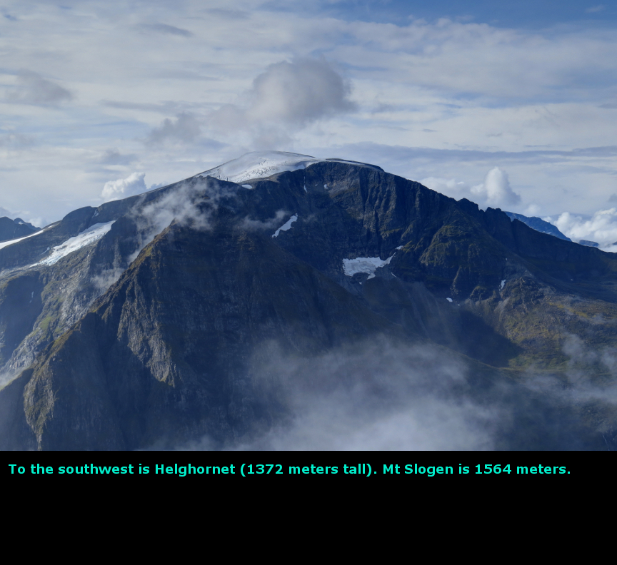
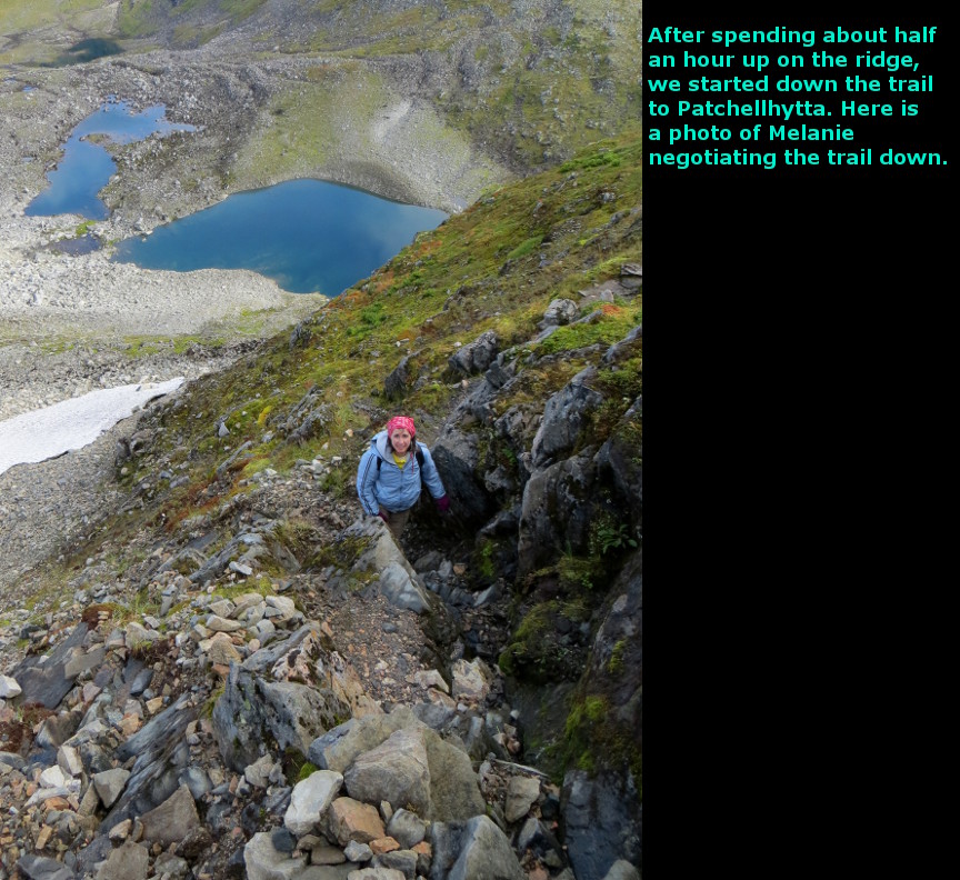
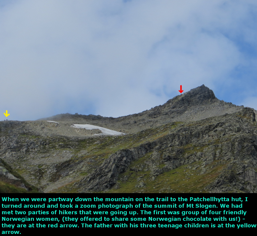
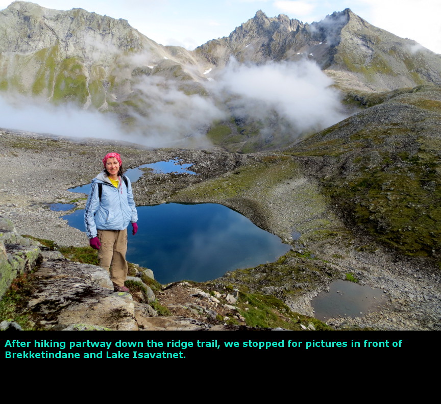
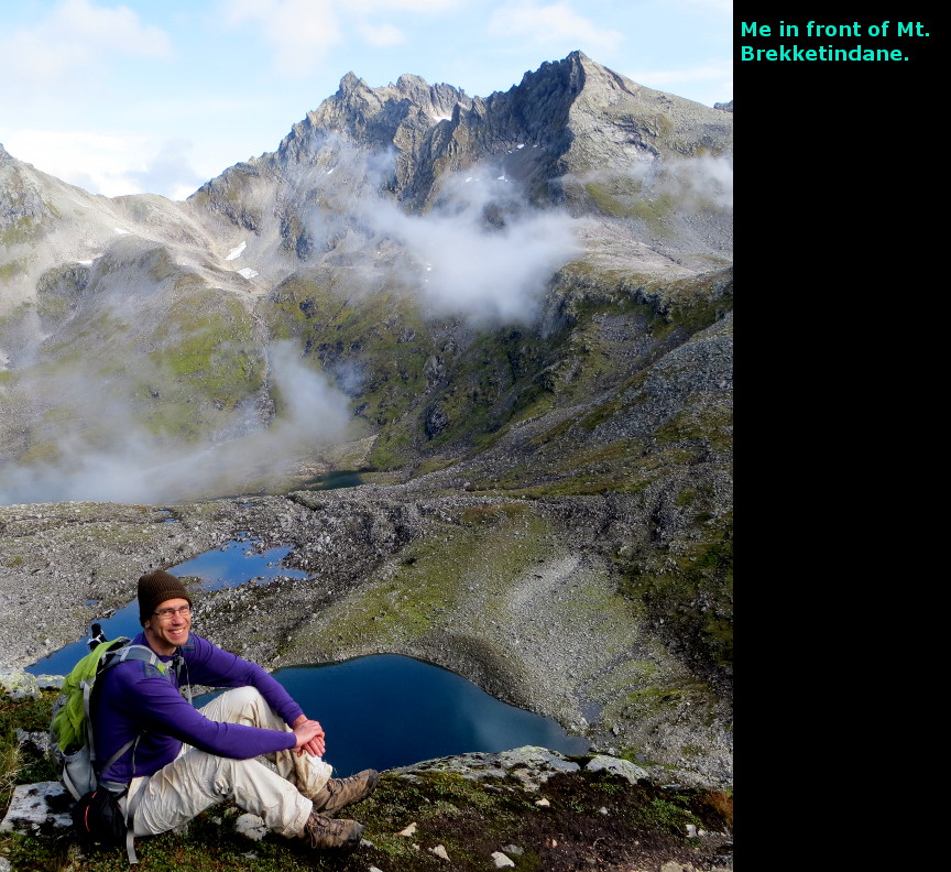
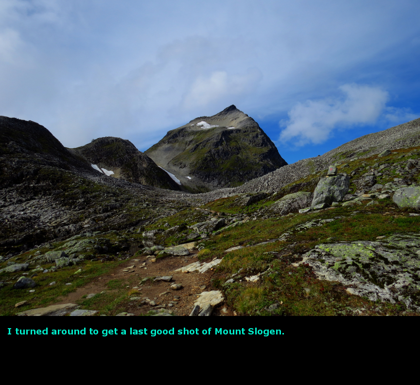
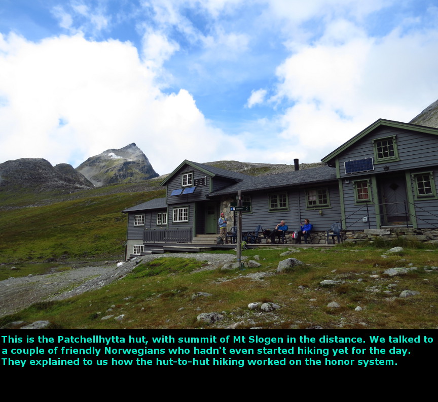
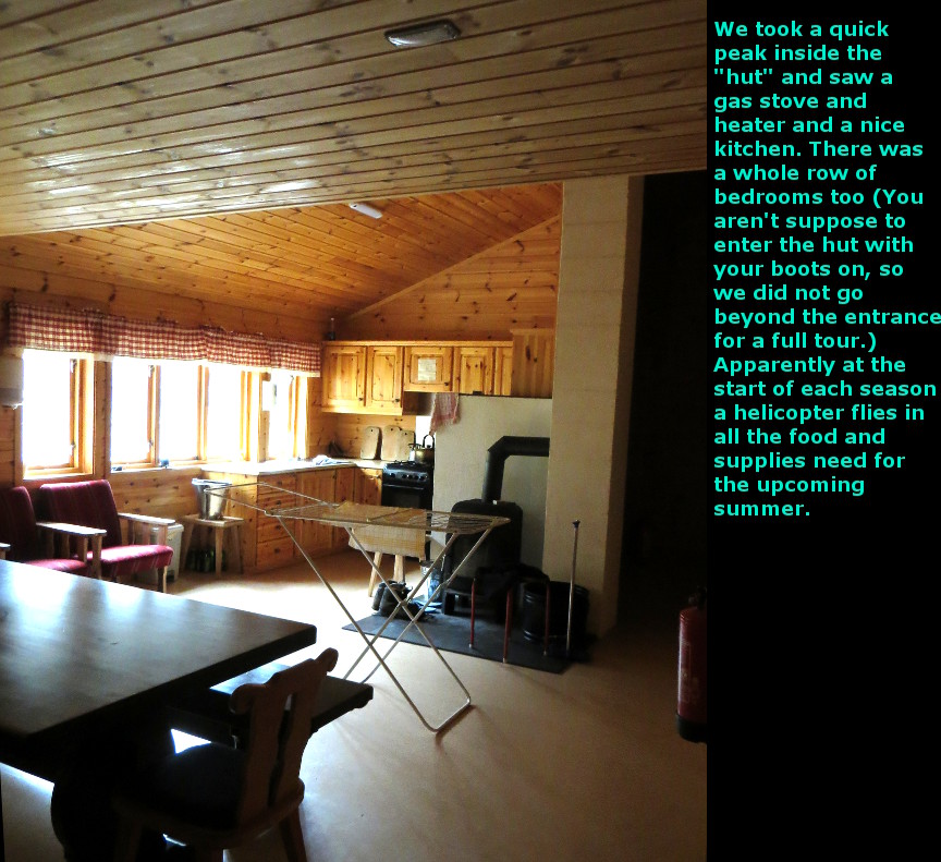
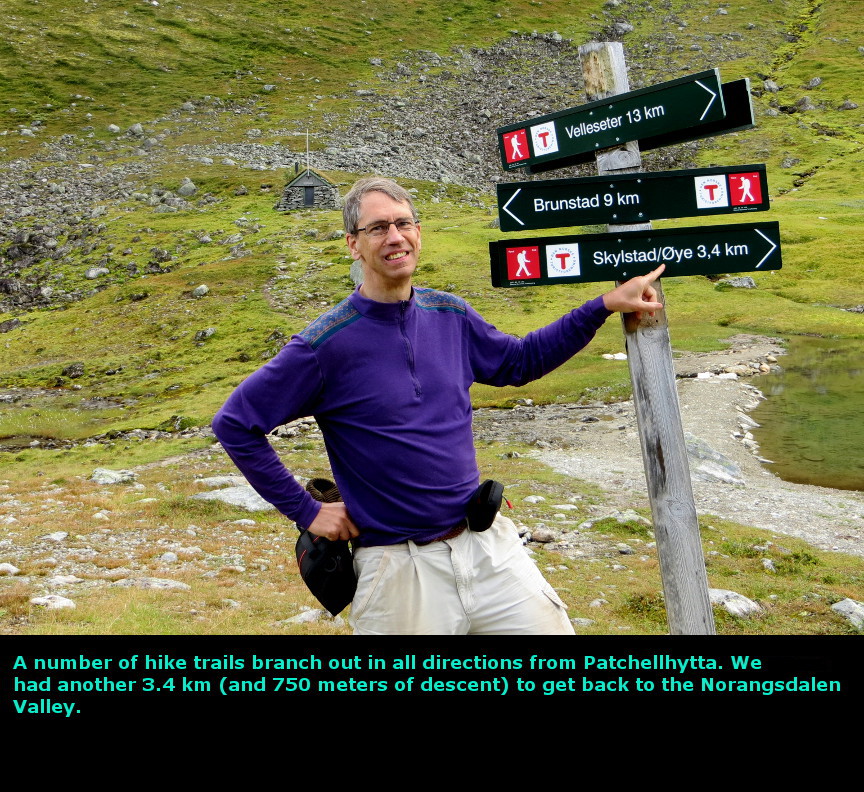
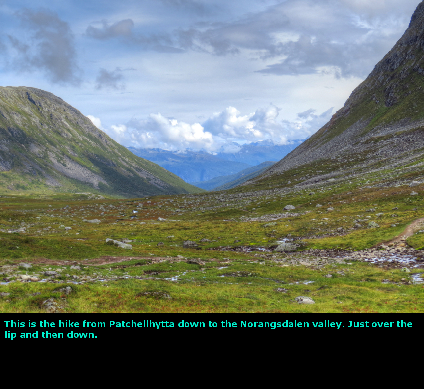
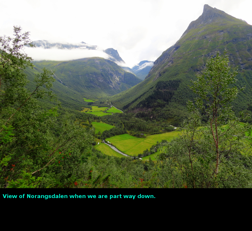
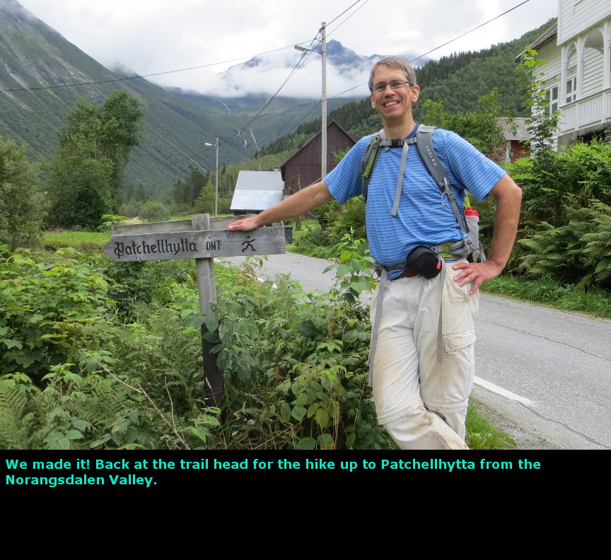
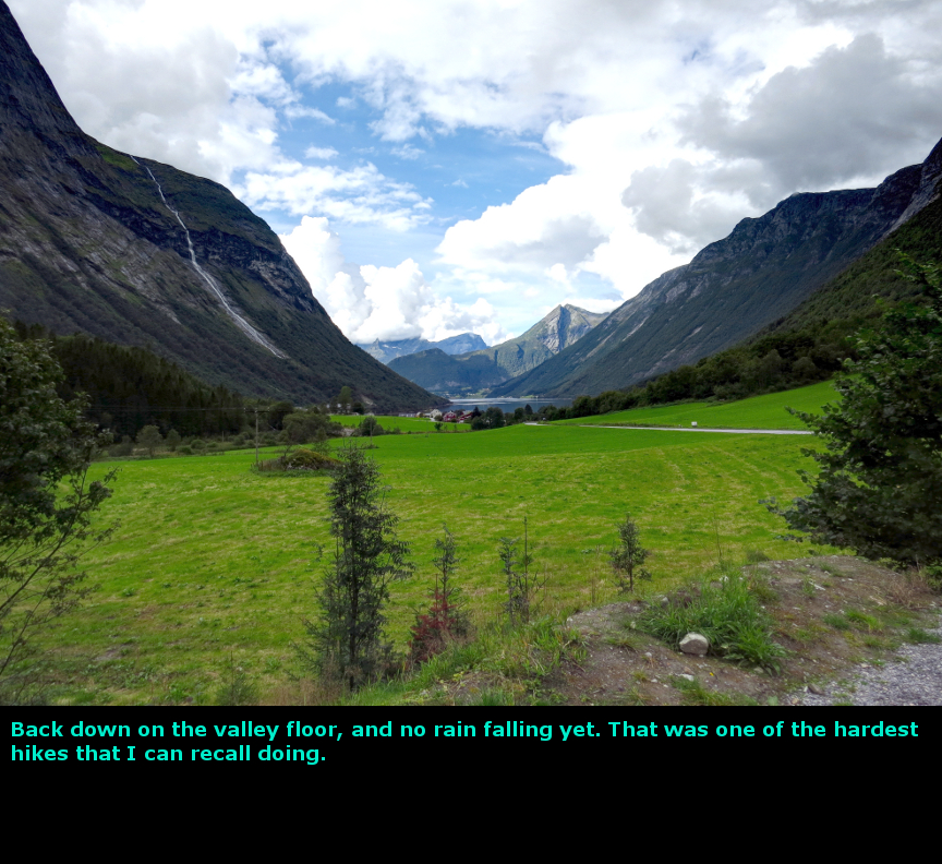
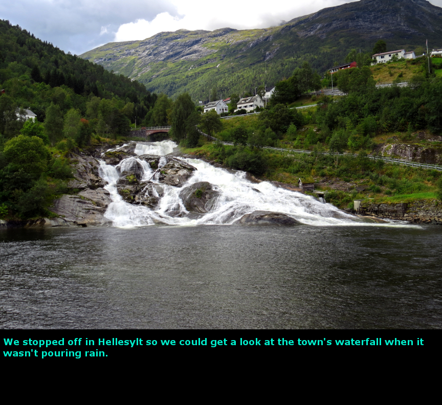
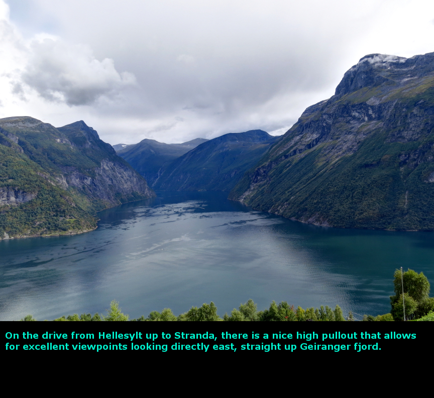
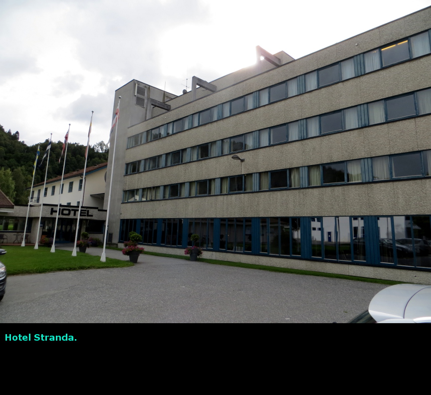
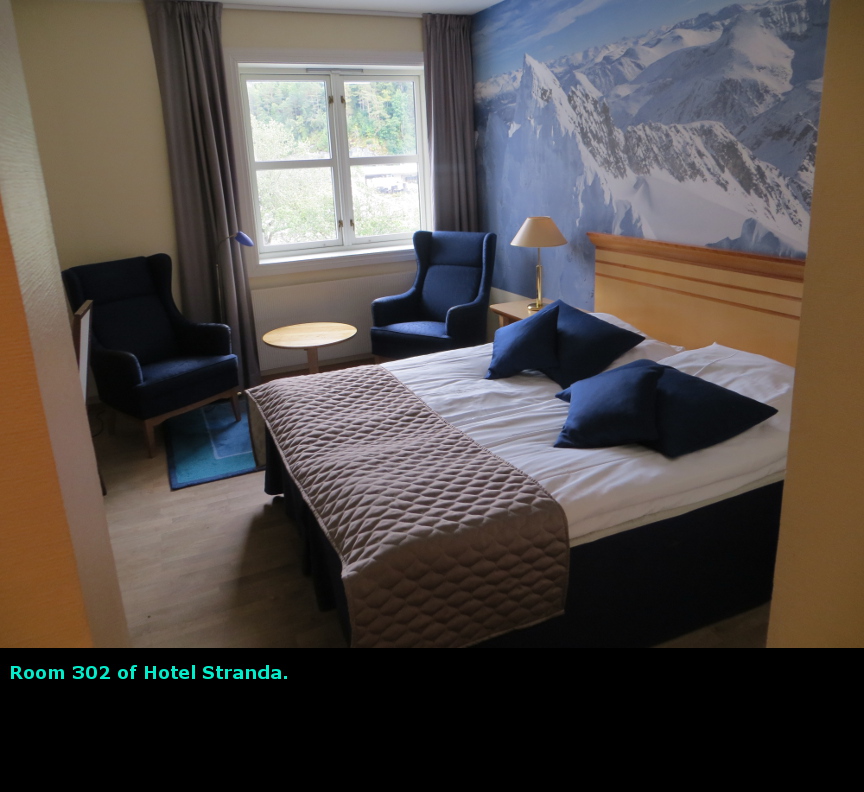
The highlight of this day was reaching the top of that direct route trail on Mount Slogen. We decided to get up early to attempt that hike up Mount Slogen. In hindsight, we probably should have gotten up even an hour earlier, but we did start up the trail at 7:15 AM. We left so early that we skipped the Hotel Union Řye free breakfast. I wonder what kind of elaborate spread they would have served at that fancy hotel. We tried to leave - but found that the front door was locked and we couldn't depart. We had to ring the bell for a sleeping staff member to come an open the door for us. It turned out the lock was just really tight; if we had tried to force it, we should have been open the door. I sort of wondered about the fire hazard of locking the doors at a hotel. Mount Slogen was the toughest hike we tried in Norway. In fact, it might be the toughest hike I have ever tried. It is rated as an expert level hike. The trailhead is basically at sea level, and the top of the mountain is at 1564 meters (5131 feet, nearly a mile of elevation gain.) We were attempting the direct route, which was a straight shot up the mountainside. One thing we learned is that Norwegian trail builders don't believe in switchbacks. Everywhere in Norway, the trails simply go right up the mountainside without any concern for erosion or the exhaustion of the hikers. No wonder we saw so many mighty Norwegian hikers. We didn't meet anyone on this section of the trail. The straight shot trail climbs 1200 meters before it intersects with the main trail that comes up from Patchellhytta hut. We paused to catch our breath multiple times on this ascent. Unfortunately, clouds were thick in the Norangsdalen valley this day, and they never burned off. We soon climbed into the cloud layer, and any hope of seeing the Norangsfjorden were dashed. We had checked the weather report, and it predicted rain would come in at about 3 PM. So we were eager to keep moving. At 10:00 A.M. we reached the intersection with the main trail. We were up on the ridge that climbs up the southern side of Mount Slogen. We were at about 1200 meters, so the peak was still about 1000 feet higher. I was very tired. The upward trail had been so steep there was very few places to sit down. Now we sat up on the ridge and looked out at the peaks all around us. Unfortunately, there were clouds in the valley still, but we could plenty of peaks and some ice above the clouds. Many photographs were taken. As we sat there, four women hikers came up the trail from the Patchellhytta hut. They told us that they had started hiking just an hour earlier, so we assumed that the hut must be pretty close. We talked to them for a bit (they seemed impressed that we had come up the tough trail rather going the Patchellhytta route), and one of them offered us some Norwegian chocolate. Then they went hiking onward, and we could see them quickly ascending toward the summit. We were so tired that we decided to not attempt to reach the summit, even though it was less than a kilometer away. The clouds were so thick that we would not have enjoyed a spectacular view, and we had already experienced so much rain in Norway that we were were worried about getting caught in another storm while trying to descend a steep trail. So we headed down the trail to Patchellhytta. We kept scanning the landscape to spot the hut, but could not find it. When we did finally see it, we assumed that what we were looking at was a farm instead, because it consisted of several buildings and because it was so distant. Surely those women hadn't hiked all the way up from the hut in just an hour? It took us an hour and a half to descend to Patchellhytta. We met some hikers there who were relaxing on the porch. They explained to us how the hut - to - hut system worked in Norway. Everything is on the honor system - there is a store with food, and you just take what you want. You write down what you took, and a few weeks later you get a bill from the Norwegian hiking association. The hut had a gas stove in it, and a large kitchen. There were rooms upstairs and downstairs, so there is plenty of capacity for hikers. Apparently at the start of each summer a helicopter carries in all the food and propane for the stove. The hut seemed pretty nice. I think if I ever return to Norway, I will try at least a few days of hut to hut hiking. It was all down hill from Patchellhytta back to the Norangsdalen valley floor. The clouds remained thick through out the day, and in fact they appeared even more menacing. The trail down from Patchellhytta was quite steep once we got into the trees (though not insanely steep like the trail we had hiked up) and I was glad that we were able to make the whole descent when the rocks and roots were not slippery. We finished our hike at 2:45 PM. Fifteen minutes after we reached our car, it began to rain lightly. We drove over to Stranda, stopping at Hellesylt to see the waterfall in the center of town (it had been raining too hard to see much of anything we drove off the ferry the previous day.) We also stopped at a nice viewpoint that gave views up the Geiranger fjord. We checked into Hotel Stranda, and then went out looking for dinner. We ended up at a place called the Siena Pizzeria & Grill. The guy working the counter only spoke Norwegian, and even when we pointed at different items on the menu, he always said "Cheeseburger." I think they may have been out of some of the other ingredients, or maybe he was just playing a prank on us, but we ended up with some hearty cheeseburgers. It started to rain again as we walked back to the hotel. Today we drove 54 kilometers. Panorama Photos


MapsThis map shows the route we hiked up Mt Slogen, to the Patchellhytta hut, then back down. 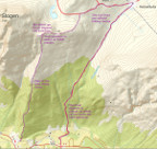
This map shows our short drive to get to Stranda, where we stayed this night. 
To display the photo images on this webpage, I am using a freely distributed java script called Lightbox v2.7.1 written by Lokesh Dhakar. You can download this program by clicking on this link. All the text and photographs on this webpage are my own creation, but the textured background is taken from a site, EOS development, that offers non-profit users free use of their graphics. Click the icon below to visit their site.
|
Click on any thumbnail to begin the slide show at that photograph Mt Slogen Photos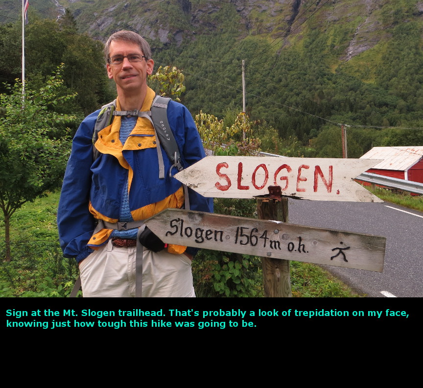


|