|
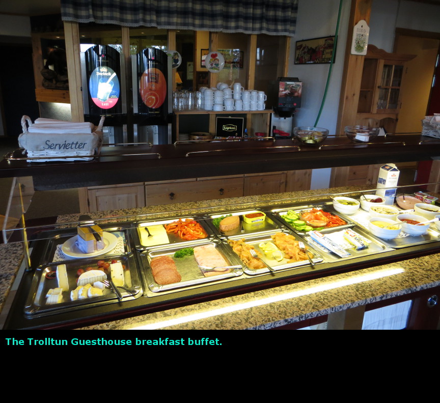
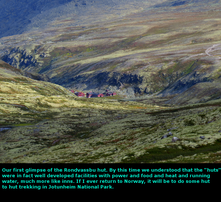
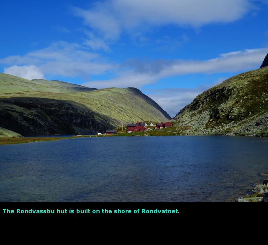
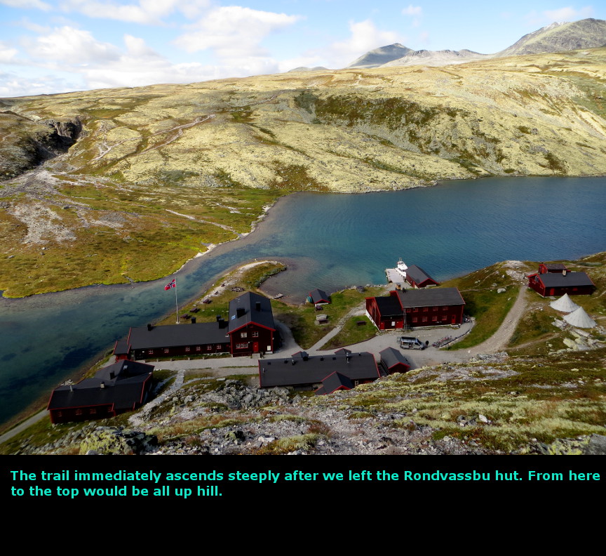
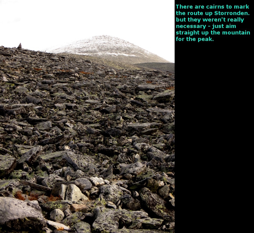
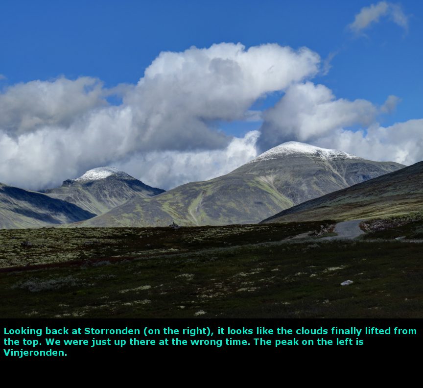
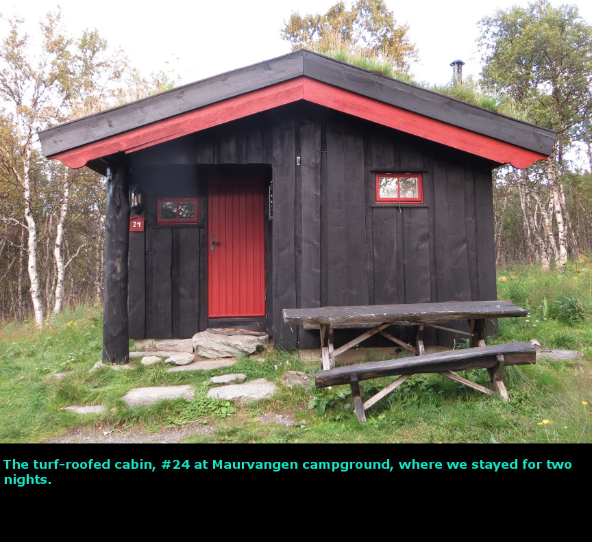
The highlight of this day was perhaps the unexpectedly nice view of the Otta valley from up high. Once again we saw a weather forecast for a sunny day. I'll give away the surprise ending: we got rained on. And a little bit of snow too. After enjoying a large buffet breakfast at the Trolltun Guesthouse, we drove south to the town of Otta, from there we took a narrow road that climbed steeply. We drove up above the treeline, and there we entered Rondane National Park. The landscape at this high elevation is tundra-like, with nothing but low scrubby plants covering a wind-swept land. Because the soil is so rocky and climate so tough, only lichen and hardy heathers can grown here. A range of tall mountains (there are over 10 peaks taller than 2000 meters in Rondane) stands around a narrow central lake called Rondvatnet. From the parking lot, it is about an hour and a half walk to Rondvatnet, which has a hut on the shore. We now understood what Norwegians meant by a "hut" and so we were not surprised to find that Rondvassbu (the name of the hut) was actually a large complex of manned buildings, offering food and dorm rooms for hikers. There is a road from the parking lot to Rondvassbu, but tourists are no longer permitted to drive directly to the hut. There was a huge number of bicycles available for renting if you wanted to ride to Rondvassbu, but the charge was NOK 100 for each way for each bike, so it would have cost us NOK 400, or over $60 US for a couple hours of bike rental. Just another example of crazy Norwegian prices. We started hiking from the parking lot at about 10 A.M. and reached the hut just a bit after 11. It is a 6 km flat walk between the parking lot and the Rondvassbu hut. Our goal was to climb up Mount Storronden, a 2138 meter peak. It is 5 km from the hut to the top of Storronden. Occasionally, we could see the top of Storrondon as we walked along the road to the hut, and it appeared to have snow at the top. But more disappointing was seeing the clouds gathered at the summit - if we did make it the top, we wouldn't see much. From Rondvassbu, the trail up Storronden climbs steeply. Since Norwegian trail builders don't believe in switch backs, the route leads directly up the mountain. Very soon all the lichen and heather plants are left behind and the hike climbs up over rocks and boulders. We followed cairns straight up, it isn't too hard to pick out the route, just head up the mountain. The clouds would come in, and then blow away. Then it started to rain on us. I confess this was one of the most discouraging parts of the our Norway vacation. I was heartily sick of all the rain, and the clouds that constantly blocked our views. We were eating lunch partway up the side of Mount Storronden when the rain turned to snow. I got pretty cold, because we had stopped moving. We weren't tired, but because of the cold and the fact that clouds had enveloped the summit, I didn't feel like going higher. We met a hiker coming down who told us he had reached the top, and that there was snow that was calf deep at the top. We decided to turn back, the payoff for the hike didn't seem worth effort (though there were a number of hearty Norwegian hikers going by who were determined to reach the top.) Of course, not long after we turned around, the sun came out to mock us for turning back, but I was tired of Norway's weather games by that time. This was the first time I was really cold on our Norway visit, I didn't want hypothermia. We got back to the car at 4 PM, and drove back down the narrow road. Just before the big descent to Otta, there was a nice pulloff that gave us some rather spectacular views of the green, fertile valley below us. The sun was out now, and Norway looked so blue and green and beautiful. That was the type of countryside we hoped to see in Norway! We drove to Maurvangen campground, where we had reserved a cabin for two days. It had a kitchen, so we cooked our dinner and checked the weather report for tomorrow: it predicted a sunny beautiful day. We needed good weather, because we were going to attempt to hike the world famous Besseggen Ridge. I was REALLY looking forward to that hike, every picture I had seen on line showed a staggeringly beautiful landscape, and I wanted to see it. Today we drove 165 kilometers. Panorama Photos


MapsThis map shows the short drive from Dombas (and Trolltun Guesthouse) down to Rondane National Park. 
This contour map shows the route up Mount Storronden. 
After leaving Rondane, we drove to Maurvagen Campground for the night. 
To display the photo images on this webpage, I am using a freely distributed java script called Lightbox v2.7.1 written by Lokesh Dhakar. You can download this program by clicking on this link. All the text and photographs on this webpage are my own creation, but the textured background is taken from a site, EOS development, that offers non-profit users free use of their graphics. Click the icon below to visit their site.
|
Click on any thumbnail to begin the slide show at that photograph Rondane Photos


|