|
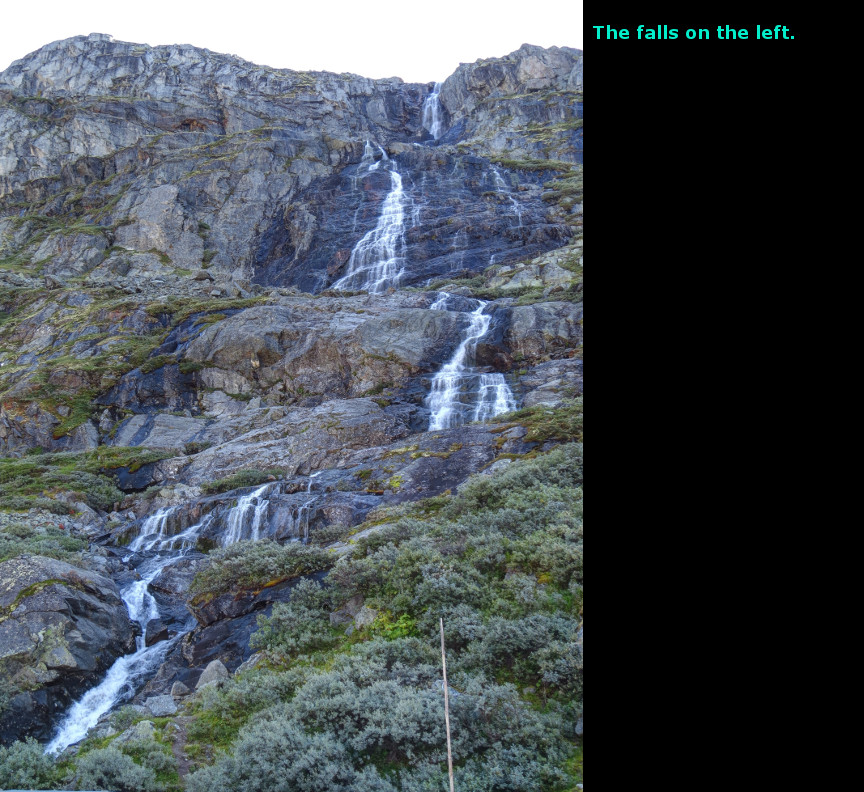
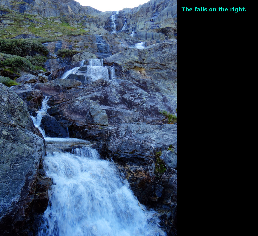
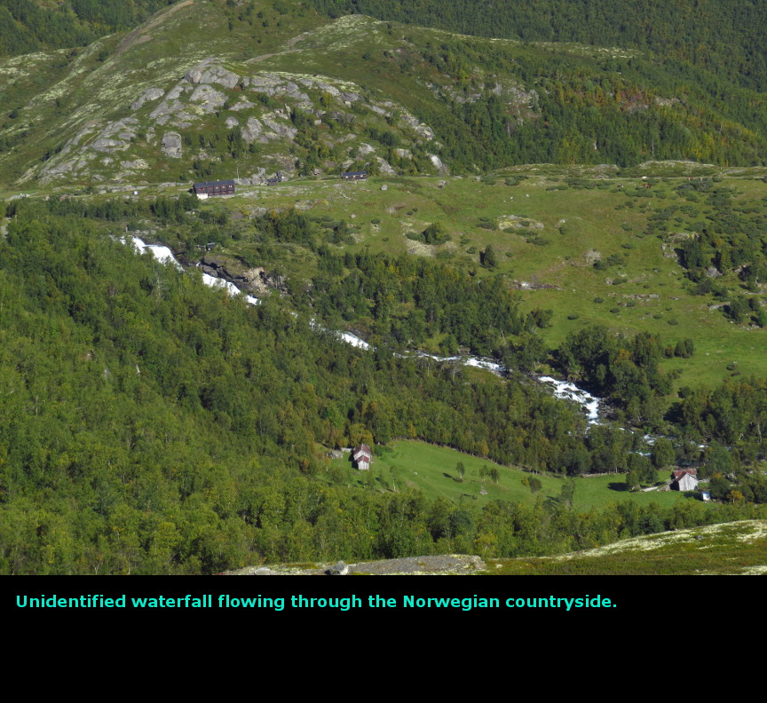
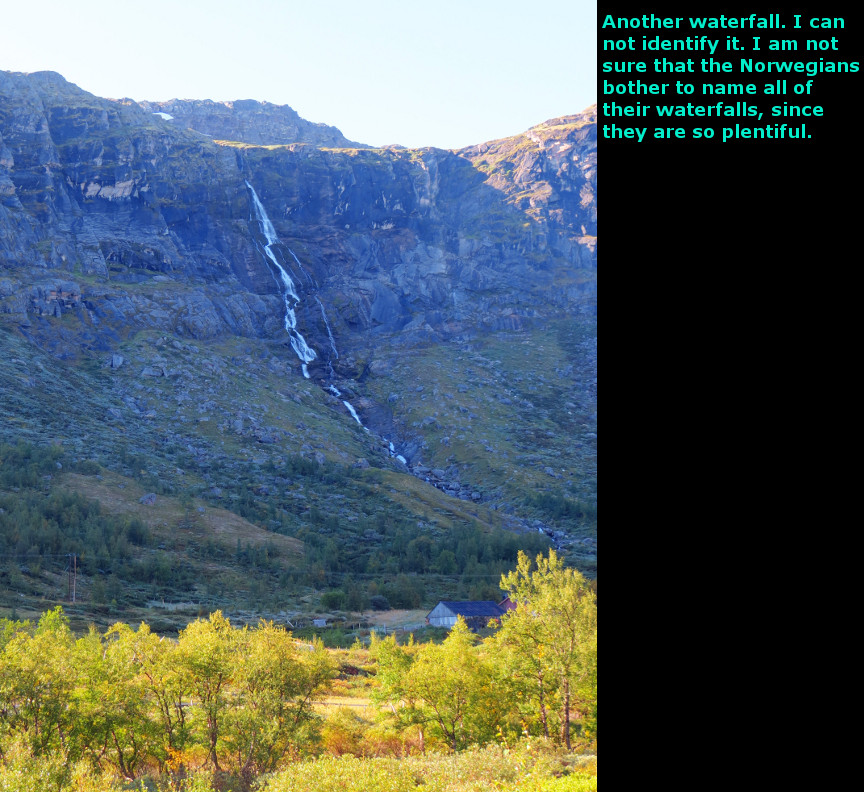
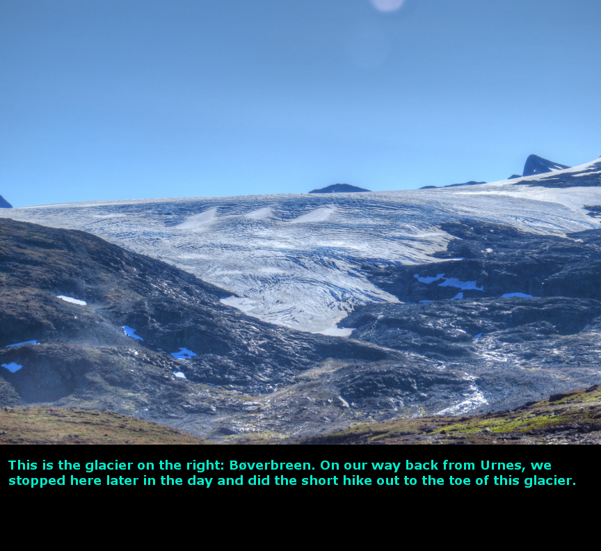
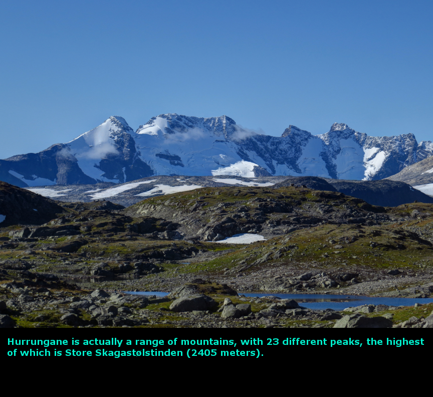
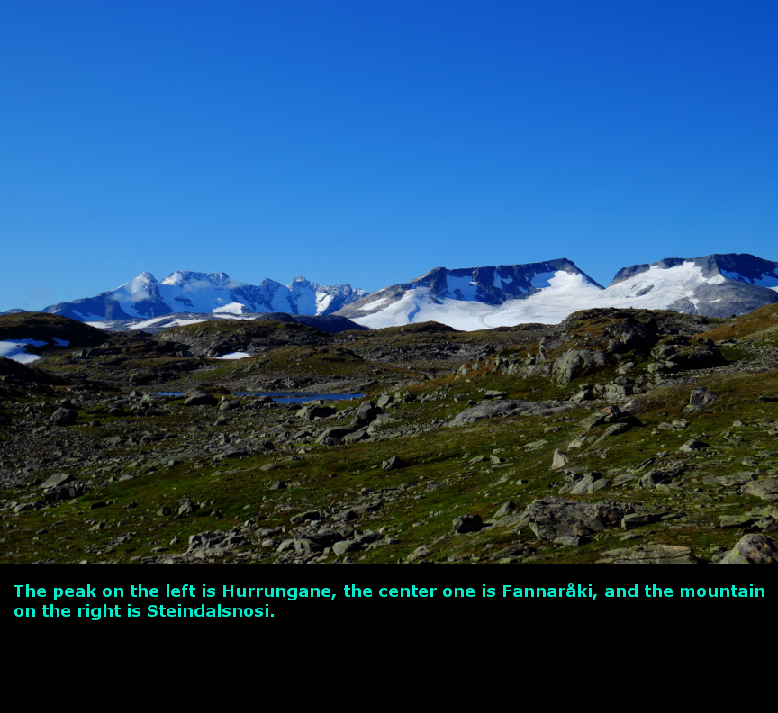
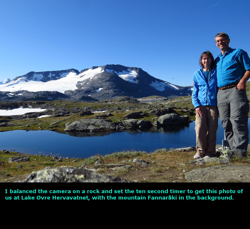
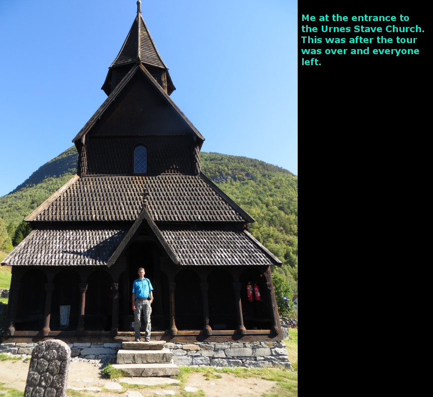
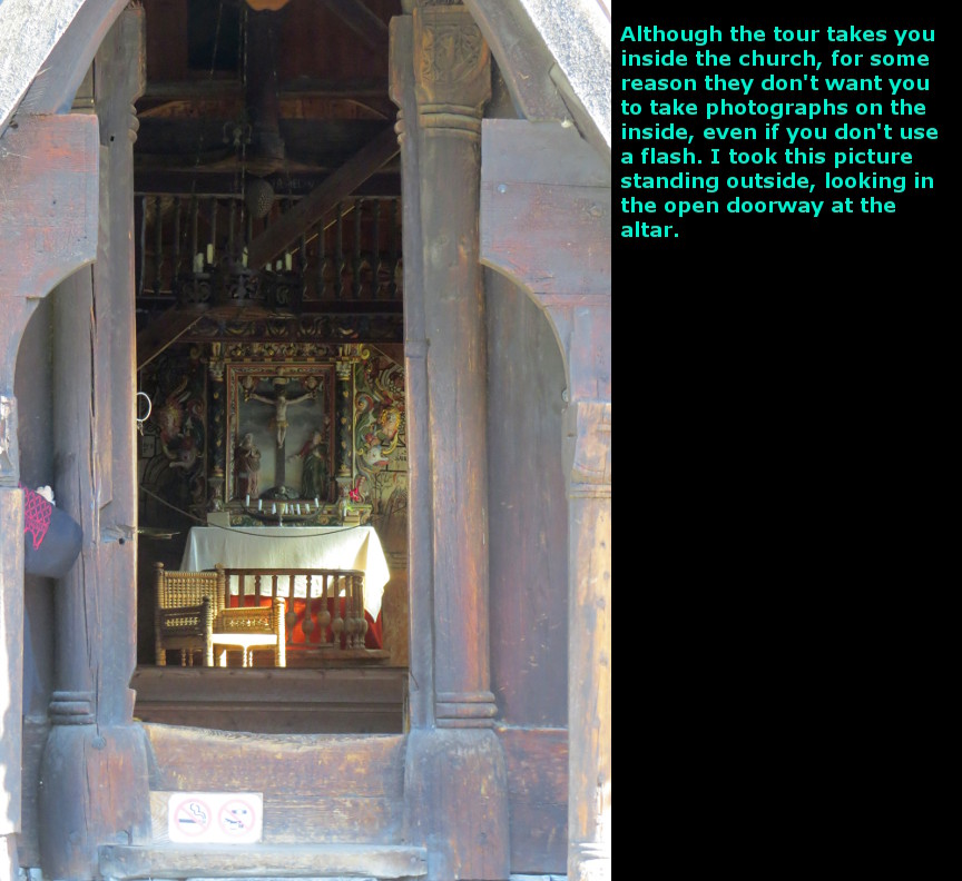
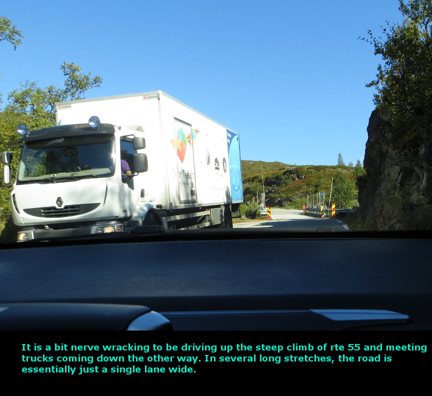
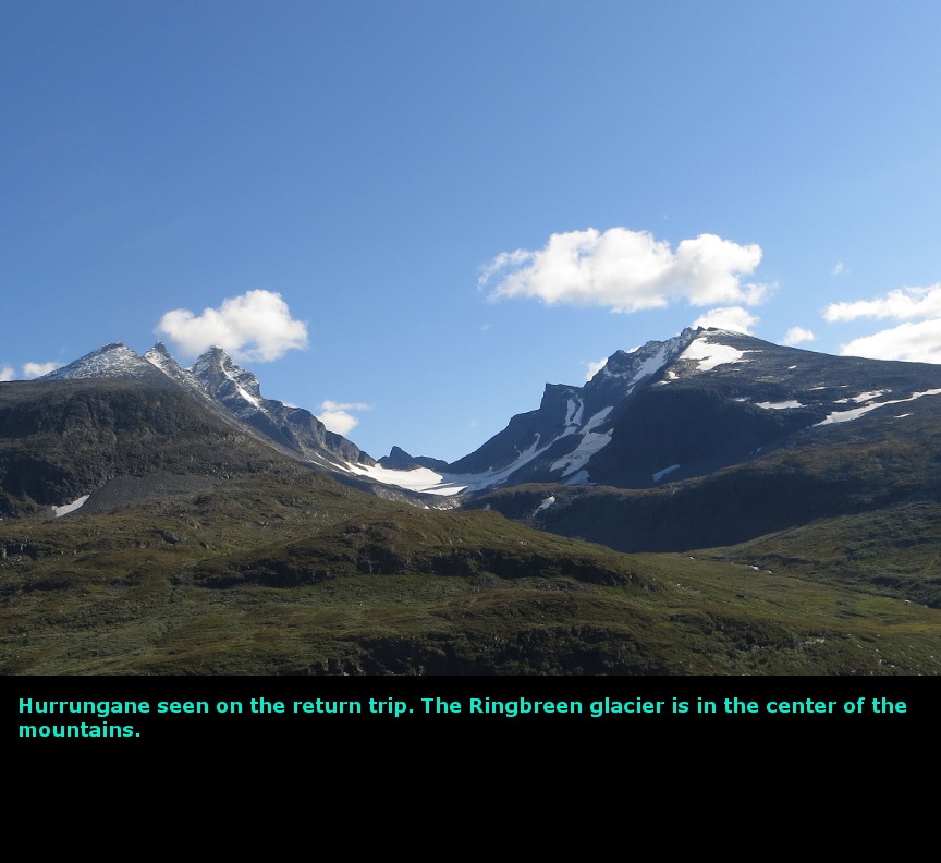
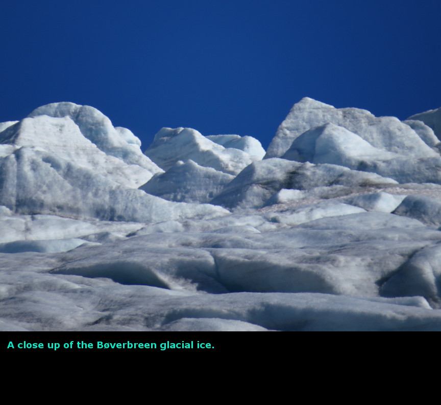
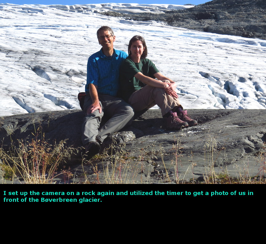
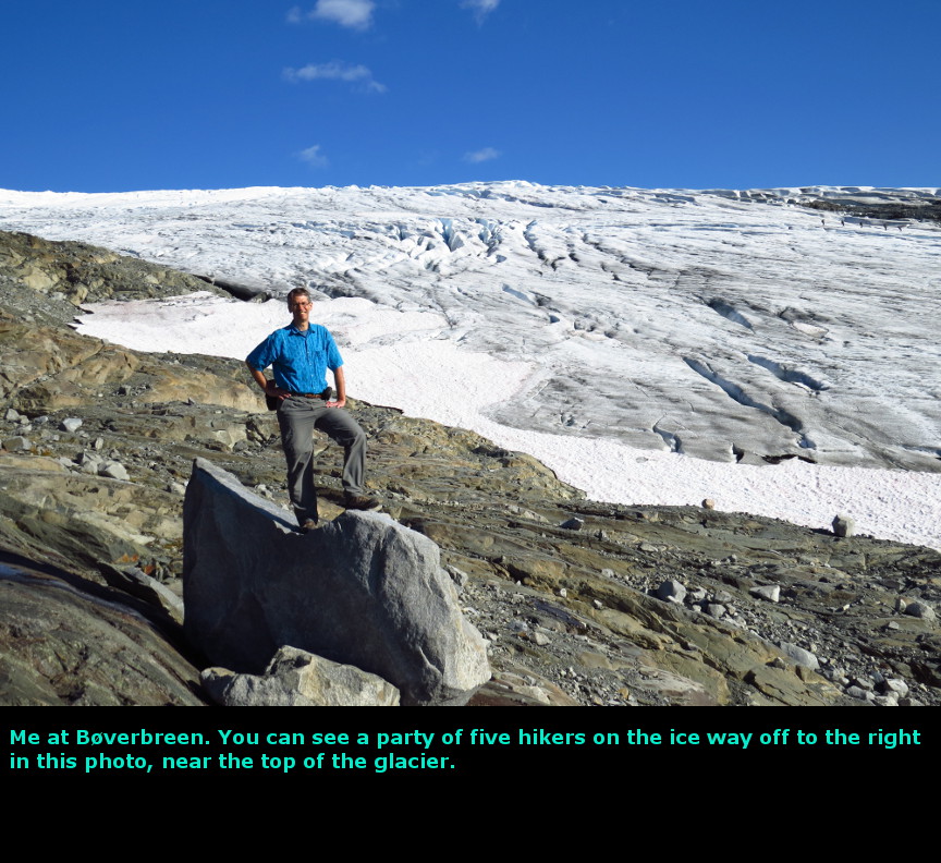
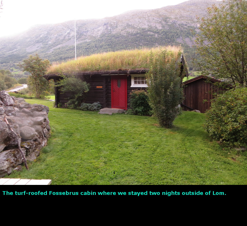
The highlight of this day was the unexpectedly scenic views along route 55. We left our cabin at Maurvangen early in the morning. We got such a good start that we were all the way up to Lom by 9 A.M. It looked like we were going to have another great day of weather. I knew that there was a guided hike to the summit of Galdhřpiggen that left every day from the Juvasshytta hut at 10 A.M. If we could reach the hut in time, we could join the guided walk across the glacier and reach the highest point in Norway, the peak of Galdhřpiggen at 2470 meters. We drove up the steep narrow road that led to Juvasshytta, but part way up we came upon a toll gate. The only way to pay the fee was to use a credit card that had an encoded chip with a 4 digit P.I.N. number. Of course, we have the old style magnetic strip credit cards which require us to sign for each transaction, so there was no way for us to pass through the gate. There wasn't any slot for paying with cash. So we missed out on the Galdhřpiggen trek. We drove south along Route 55, which skirts the western side of Jotunheim National Park. Our goal was to drive down to the Urnes Stave Church, I didn't realize when I picked this route that was designated a scenic route by Norway. Once the road reaches the heights, there is majestic view after spectacular view. There are many viewpoints along this stretch of road, and I think I pulled off at most of them and snapped a few photographs. The weather was terrific - sun and blue skies! We had dramatic mountains and glaciers and beautiful lakes - all of the factors that give Norway the reputation of being one of the most beautiful countries in the world. Because of all the stops, it took us quite some time to drive Route 55, but it was quite an enjoyable trip. I think it was even more fun because it was unexpected, I had not known this road had such scenery, so discovering all these nice views was a real bonus. From the high alpine scenery, route 55 does a quick descent all the way down to sea level at Lustrafjorden. The road here is a twisty turning affair, with many hairpin turns and a steep grade. In many places, it is only a single lane wide. At one point, as we headed down, we came face to face with a garbage truck coming uphill. There were no pulloffs. The truck driver was very aggressive, she pulled right up toward me. I put our rental car into reverse and tried to go backwards up the narrow steep grade. Every yard that I went backwards, the garbage truck lurched forward. It was unnerving. Fortunately, I didn't back into the rocks or guardrail that lined the road, and successfully reached a pullout, and the garbage truck went racing by. Whew. The road to Urnes goes along the eastern shore of Lustrafjord. This was another narrow single lane road, but there is only a light amount of traffic. It is about 30 km to go all the way down to Urnes, and the few times we met a vehicle coming in the other direction we always happened to be right near a pullout. So there were no issues driving there. The highlight of Urnes is the stave church. This building is a UNESCO world heritage site. It is still the original structure, it hasn't burnt down and been restored. When we arrived, our timing was ideal, because they had just begun an English speaking tour of the church. The church at Urnes was apparently one of the first stave church with the distinctive carving. At least, it is the oldest surviving structure built in this way. The church is actually pretty small, but the population of Urnes was never that large. For some reason, tourists are not permitted to take photographs of the interior. We drove back up the narrow roads and steep grade of route 55. When we reached Krossbu, we stopped for the short hike (about a mile each way) out to the Břverbreen tongue of the Smřrtstabreen glacier. This was nice, easily accessible glacier. We started up the trail to the Leirbreen glacier, which begins from the same trailhead, but after going part way, we decided that the glacier might be further than we expected and it was getting late. We got back to the car at 6:30 P.M. We drove back down the road toward Lom. Our stay for that night and the next night was at the Strind-Gard sheep farm. The farmer has a few cabins that he rents out to supplement his income. The cabin that we stayed in turned out to be quite nice. We cooked some dinner and turned in for the night. Our second week in Norway was now complete. Today we drove 306 kilometers. Panorama Photos


MapsMaps of the Besseggen Ridge hike The first map shows the route we took from the campground up to Lom early in the morning 
The second map shows how we followed Route 55, and then took the narrow road down to Urnes 
A contour map of the hike to Břverbreen 
To display the photo images on this webpage, I am using a freely distributed java script called Lightbox v2.7.1 written by Lokesh Dhakar. You can download this program by clicking on this link. All the text and photographs on this webpage are my own creation, but the textured background is taken from a site, EOS development, that offers non-profit users free use of their graphics. Click the icon below to visit their site.
|
Click on any thumbnail to begin the slide show at that photograph Rte 55 Photos


|