|
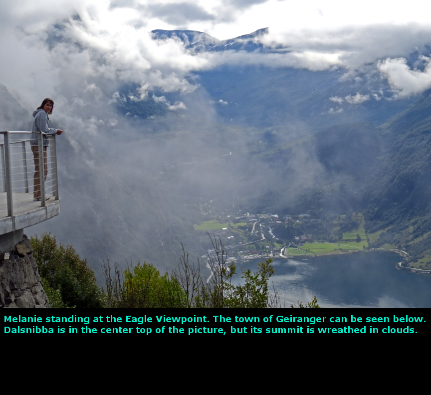
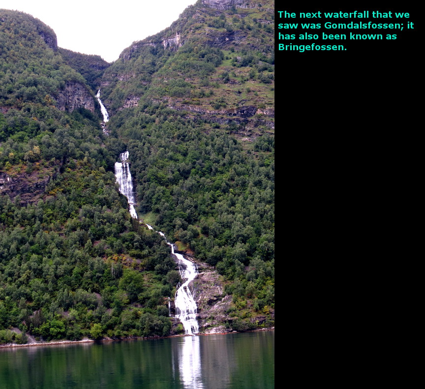
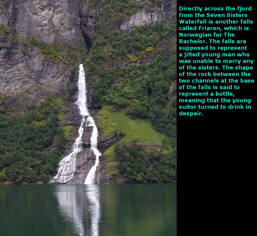
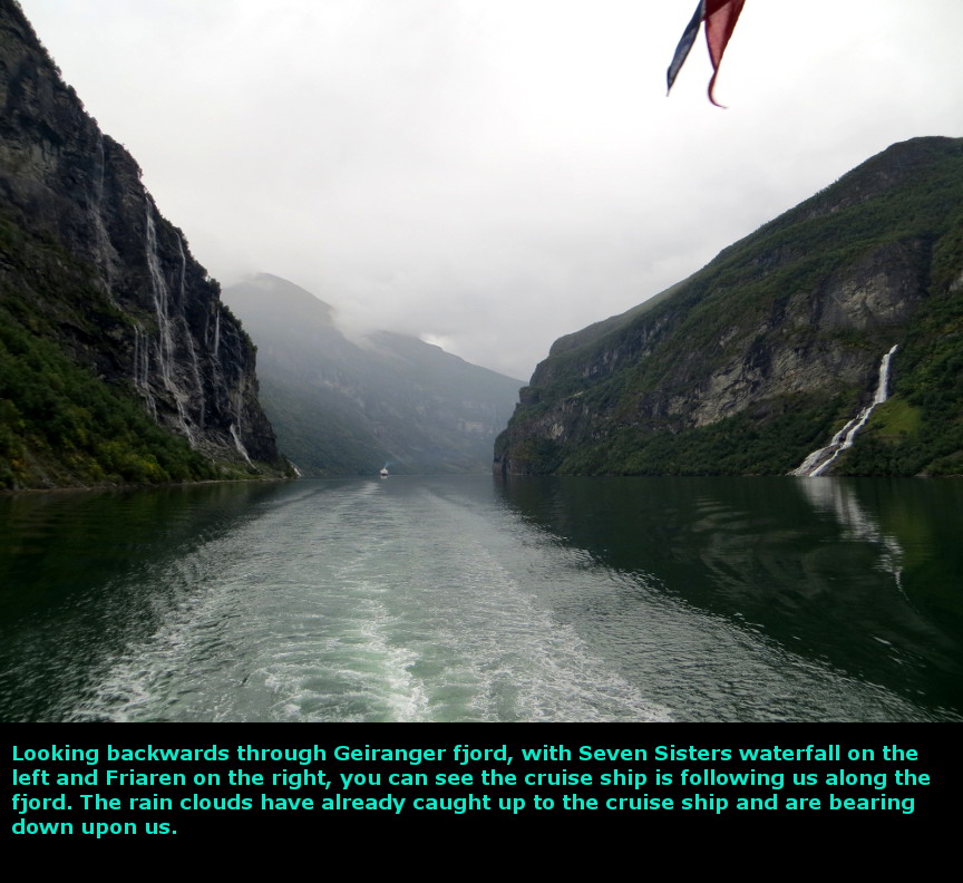
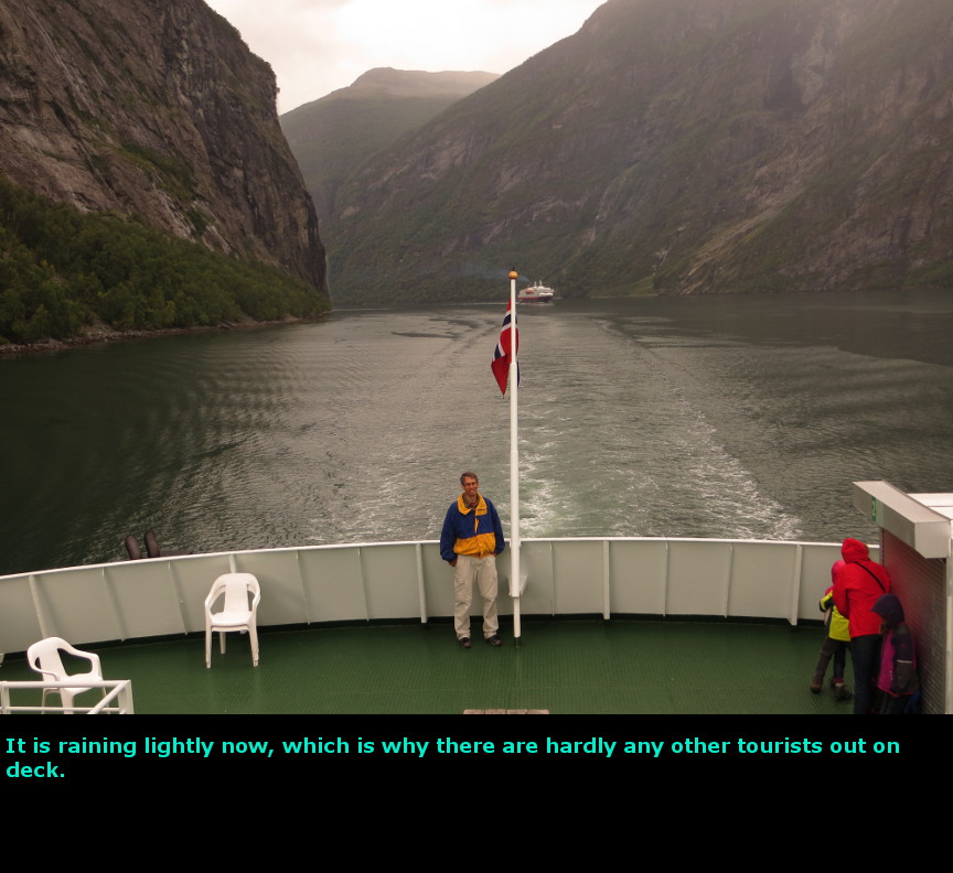
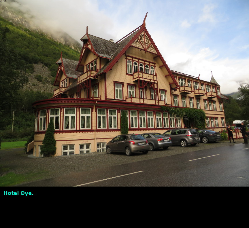
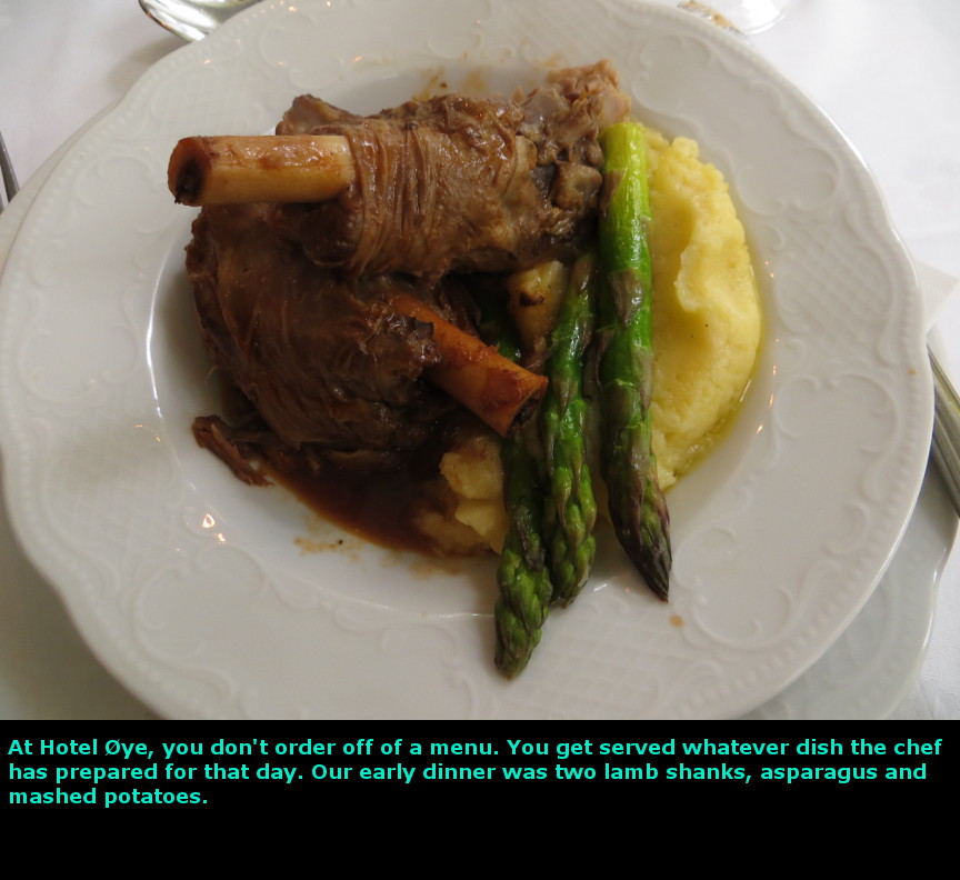
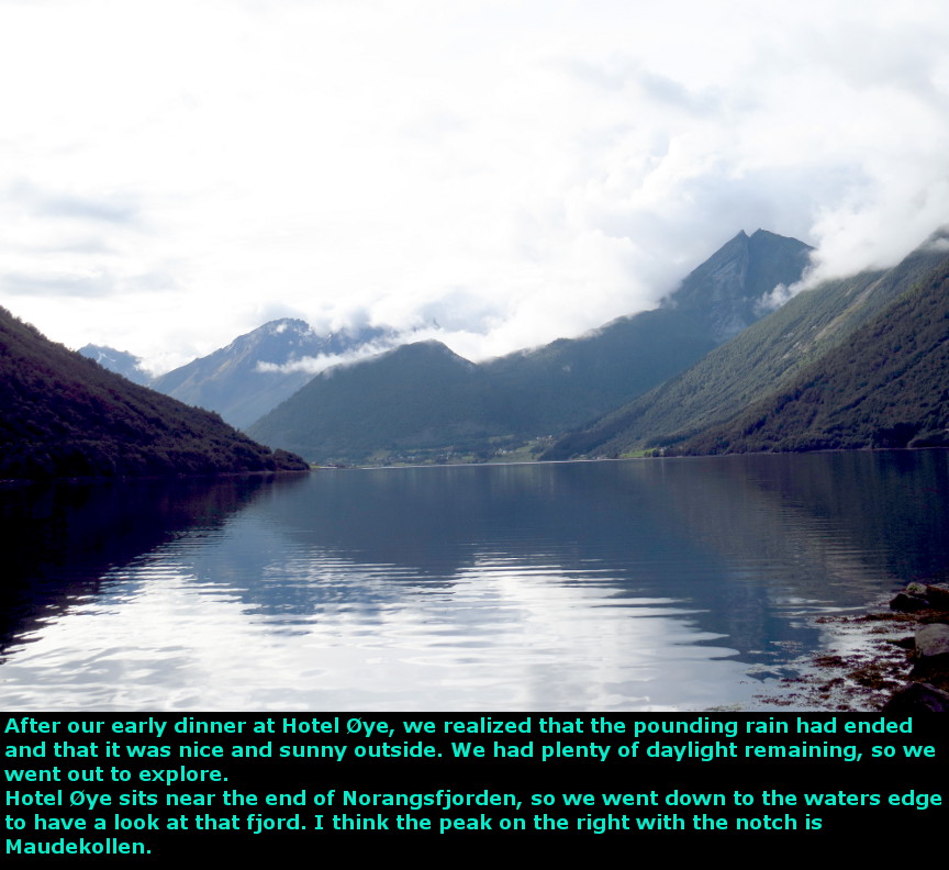
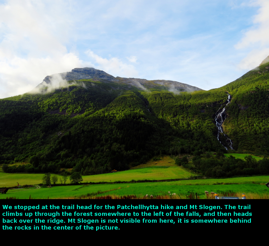
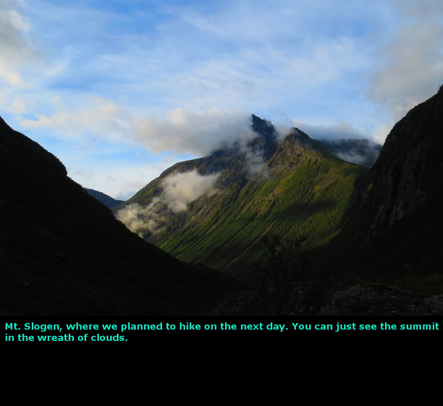
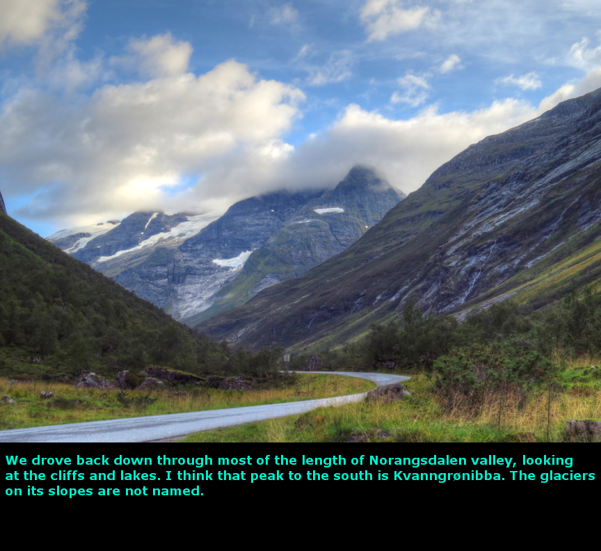
The highlight of this day was the hike to Briksdalbreen glacier. Another early start. We drove up Olden Valley without encountering a single tourist bus. When we got to Olden, we saw that there were no cruise ships docked. Driving along the shore of Nordsfjorden we had some fine views. The early morning water was still and reflected the Norwegian scenery. From our planning, I expected to see two waterfalls (Řvstefoss and Videfossen) along this route before we made the turn into the tunnels that led to the Dalsnibba viewpoint, but some how we missed both of them. Going through a series of tunnels along route 15, we climbed steadily, until finally we were high in the mountains, well above the treeline. We could see glaciers around us. The road up to Dalsnibba is a private road, so there is a toll to drive up it. It is a steep road with some tight switchbacks, so it is a little bit of an adventure to reach the top. However, there are tourist buses that navigate the Dalsnibba road, so it isn't too challenging for a little rental car like ours. Dalsnibba is at 1500 meters in elevation, and we had started at sea level on the shore of Nordfjord. And after Dalsnibba, we were going to return back to sea level at Geiranger - that's Norway, plenty of up and downhill. Unfortunately, there were still a lot of clouds below us, and they obscured some of the view. We walked around a little bit, and enough of the clouds shifted to permit us to see Geiranger and part of its famous fjord. We also could see the winding switchbacks of the Eagle Road. The road down to Geiranger was a steep and twisting drive. Partway down there is another viewpoint, this one is called Flydalsjuvet. Since it is much lower, it was beneath the clouds, so it gave us a nice view of Geiranger. We drove through the tiny town of Geiranger, which is really nothing more than a port for cruise ships, and went up the switchbacks of the Eagle Road. At the top of the last switchback is another famous viewpoint. This spot gives classic views of Geiranger and its fjord. We also had some nice sunny weather here, so we enjoyed this point a lot. We ate our lunch here. Back down in Geiranger, we tried to decide if we should catch the 2 PM ferry to Hellesylt, or should we do the hike to Storseterfossen. Melanie pointed to the clouds building up on Dalsnibba, and they did look threatening, so we decided to skip the waterfall hike and ride the next ferry. We had about an hour to kill, so we went into one of the tourist shops and I found a Norway Tshirt that I liked - I now had my souvenier for the trip. A big cruise ship came up the Geiranger fjord, but it didn't approach the dock. Instead, a small boat went out to meet it and unload all its passengers. No doubt most of them were headed up to Dalsnibba viewpoint. Geiranger fjord is so beautiful it has been awarded UNESCO World Heritage Site status. After we drove our car onto the ferry, we went to the top deck where we could enjoy the famous scenery. The ferry pulled out and we sailed between the steep cliffs. Waterfalls splash down off of these cliffs to provide a memorable view. The most famous of these falls is the Seven Sisters falls, and the Friaren Falls which is opposite on the southern cliff. After we got by the waterfalls, the rain clouds caught up to us. At first it was raining lightly, but the intensity of the rain increased until it was a downpour when we docked at Hellesylt. I had the windshield wipers going full speed when we drove off the ferry boat. Melanie's decision to skip the hike to Storseterfossen certainly was correct - if we had gone to the falls, we would have been caught in the cloudburst, and when we took the 3:30 PM Geiranger ferry, our entire trip would have been in a rainstorm. From Hellesylt we drove on to Řye through the Norangsdalen Valley. Norangsdalen is famous for its steep cliffs and narrow valley floor, but we couldn't see anything in the rainstorm. We arrived at Řye relatively early and checked into the Hotel Union Řye. This was going to be our most luxurious accommodations while in Norway, a change from all the budget hostels and cabins we had reserved for the rest of the trip. However, Hotel Union Řye told us that they could not find our reservation, despite the fact that we had a confirmation number. Indeed, two weeks before our trip, I had sent an email to each of our Norwegian lodgings and reconfirmed that we were listed on their books, and Hotel Union Řye replied that they did indeed have us on record. But now our reservation was missing. The lady at the desk offered us a little room on the top floor, it didn't have a bathroom (which was down the hall) and only had bunk beds - clearly, this was a servant's room in the previous incarnation of the Hotel's existence. However, she said we could have that little room for free, so we decided to take it. There were no other places of lodging anywhere close to Řye, we would have had to drive back to Hellesylt to find a room. Not only is there no other place to stay in Řye, there is no other place to eat. If you eat in Hotel Union Řye's restaurant, you get whatever the chef has cooked for the day. There is no menu to order off of. The front desk told us that lunch was being served until 4 P.M., and it consisted of lamb shanks, mashed potatoes and asparagus spears (NOK 290 each), or we could be seated for dinner of halibut (NOK 590 each). Since dinner is served at only a specific hour, we opted to eat their lamb shanks as an early dinner for us. Because we had such an early dinner, and since the rain had stopped, we decided to explore Norangsdalen in the evening light. The first place we stopped was at Lake Lyngstřylvatnet. This lake was created when a large avalanche fell from Mount Keipen in 1908. The rock fall blocked the stream, which resulted in a flooded valley. In a few days, the waters had risen high enough to form Lyngstřylvatnet. There was a nearby farm that survived the avalanche, but soon found itself underwater. As we walked along the shore, we could clearly see the stone foundations of the old farm buildings beneath the water. Norangsdalen is one of the narrowest valleys in Norway, with steep towering cliffs. Naturally, this results in a lot of avalanches. There are several old farmhouses at Urasćtra that were constructed partially underground in attempt to gain protection from the falling rock. We gazed up at Mount Slogen from the trailhead, thinking about our big hike the next morning - when four guys came tramping down the trail. They had just finished with their hike. They looked really wet, they must have been out on the trail while we were driving in that tremendous downpour. But their spirits didn't seem dampened, they told us that they had made it all the way up to the top of Mount Slogen. They told us the best route was to go up the steep straight trail (from the other trailhead) and then take the return trip via the Patchellhytta hut. Taking their advice, we decided to try that route on the next day. Today we drove 185 kilometers. Panorama Photos


MapsThis map shows the route we took from Jostedalsbreen through Geiranger Fjord and ultimately to Řye. 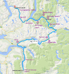
This map shows the short drive we took north of Geiranger to go up to the Eagle Viewpoint. 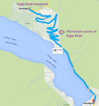
This map shows the route from Hellesylt at the end of Geiranger Fjord and up the Norangsdalen valley to Řye. 
To display the photo images on this webpage, I am using a freely distributed java script called Lightbox v2.7.1 written by Lokesh Dhakar. You can download this program by clicking on this link. All the text and photographs on this webpage are my own creation, but the textured background is taken from a site, EOS development, that offers non-profit users free use of their graphics. Click the icon below to visit their site.
|
Click on any thumbnail to begin the slide show at that photograph Geiranger Photos


|