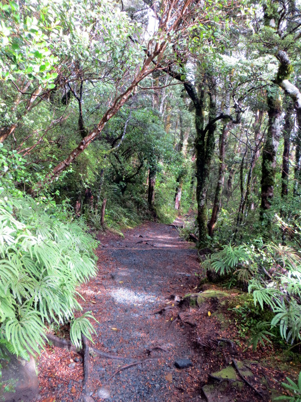
The map below shows our route from the Whakapapa Village to the Mangatepopo Hut, this is the first stage of the Northern Circuit. The Northern Circuit is typically hiked in four days, but we combined days three and four into one long hike. The first day is the easiest day. We did a side jaunt to see the Taranki Falls - an out and back that added a few Km to our total distance. There is hardly any elevation gain this day, the only difficulty is sometimes the trail is not in prime condition and it can get really muddy.

If I were going to do this trip again, I would skip this first day hike and not spend a night in the Mangatepopo Hut. Instead, on my first day I would join the throngs of people doing the Tongariro Crossing - but when I got to the point where the trail splits, I would turn to the right and continue to Outere hut, spending the night there. Then, on my second day, I would do the long hike back to Whakapapa Village. This plan allows you to do the trek in just two days and still see the entire Northern Circuit.
The Tongariro Crossing Shuttle picked us up promptly at 8 A.M. After hearing the dire forecast last night about the possibility of the park closing the Tongariro Crossing due to high winds, I had on all of my rain gear. While we waited for the shuttle, the rain actually was not too bad, just a heavy mist.
When we got to the Tongariro Vistor Center in Whakapapa Village, we asked the rangers about updated conditions. They told us that the wind advisory was cancelled, the Crossing was open today! They also told us that the water at the huts must be purified before drinking - boil or filter the collected rainwater before drinking it. This was disappointing for me to hear, none of the literature I had read anywhere made any such comment; purifying the drinking water is nowhere on the NZ Department of Conservation guide to the Tongariro Northern Circuit. So we bought some iodine tablets from the visitor center. The hut wardens later told us that they just drank the rainwater without any worries of purification, so decide for yourself if it is necessary.
Because we knew we had a short day ahead of us, we hung around the Visitor Center, reading some exhibits and hoping the rain would stop. Luck was with us, and 9 A.M. we set forth on our three day trek.
We took a side trip up the Wairere Stream to see Taranki Falls. The return trip on day 3 also passes by these falls, but I wasn't sure how much time we might have for sightseeing on the last day since our day 3 plan required us to cover 23 Km and we might be running for the 4:30 shuttle. So we went to Taranki Falls today, which turned out to be a great decision - the weather cleared and we had excellent viewing conditions.
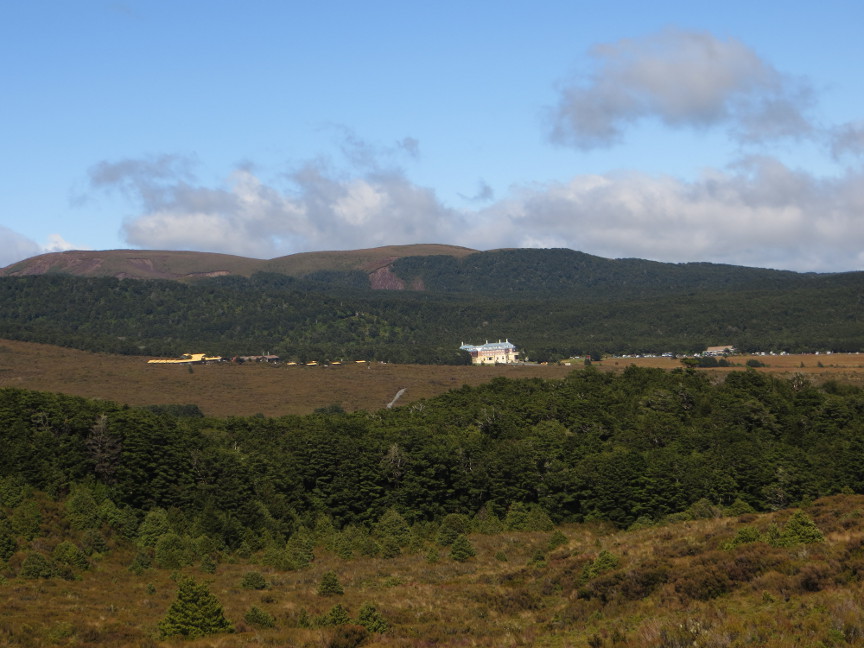
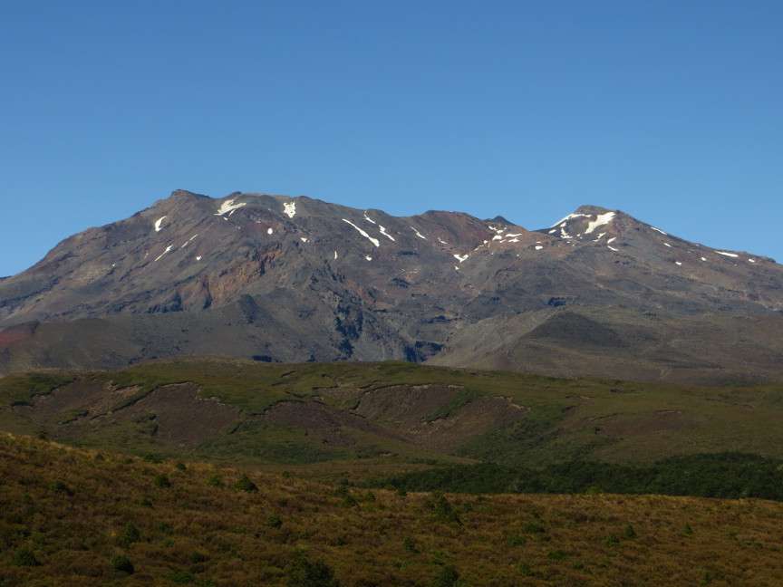
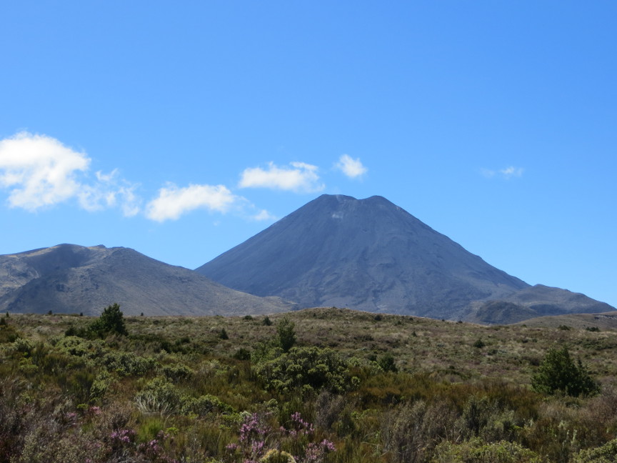
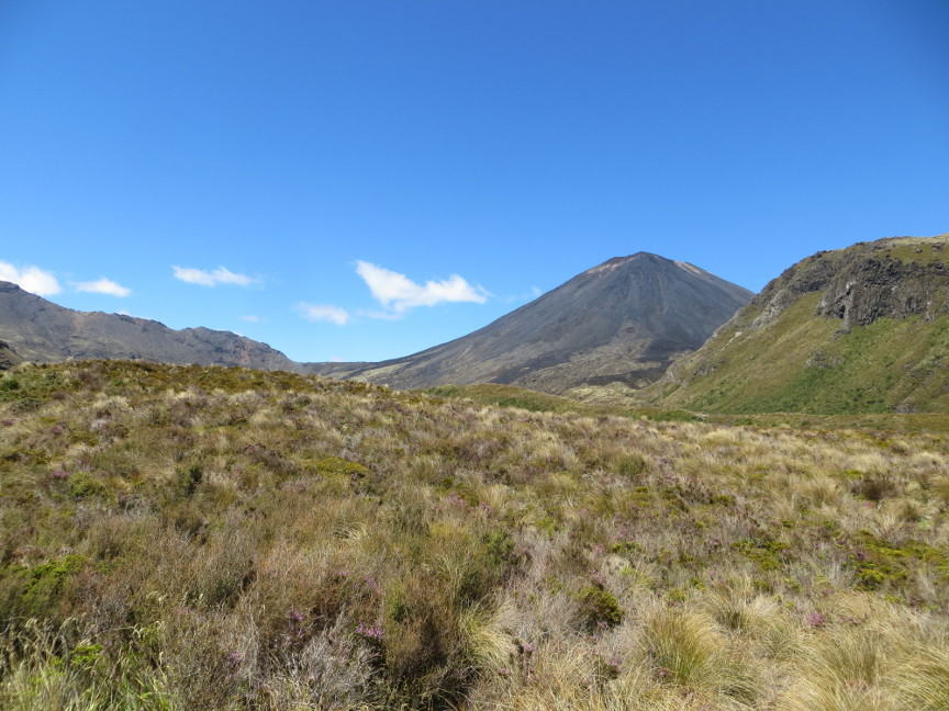
We hiked back along the Wairere Stream under the trees, until we reached the fork that took us to the Mangatepopo Track. The trail went straight across the desolate landscape, crossing several streams. The path was badly eroded in some places, but fortunately the day had turned sunny and dry, so we weren't forced to wade through too many mud puddles. The clouds had all vanished and we had clear blue skies, allowing us to see the famous mountains Mount Ruapehu and Mount Ngauruhoe. The landscape is covered with dense scrubby brush growing in the volcanic soil.
We arrived at Mangatepopo Hut at 2 PM. Only one person was there before us. But later in the afternoon it filled up entirely, with some hikers coming in quite late. Tomorrow was the big day: the Tongariro Crossing. I hoped for good weather.