|
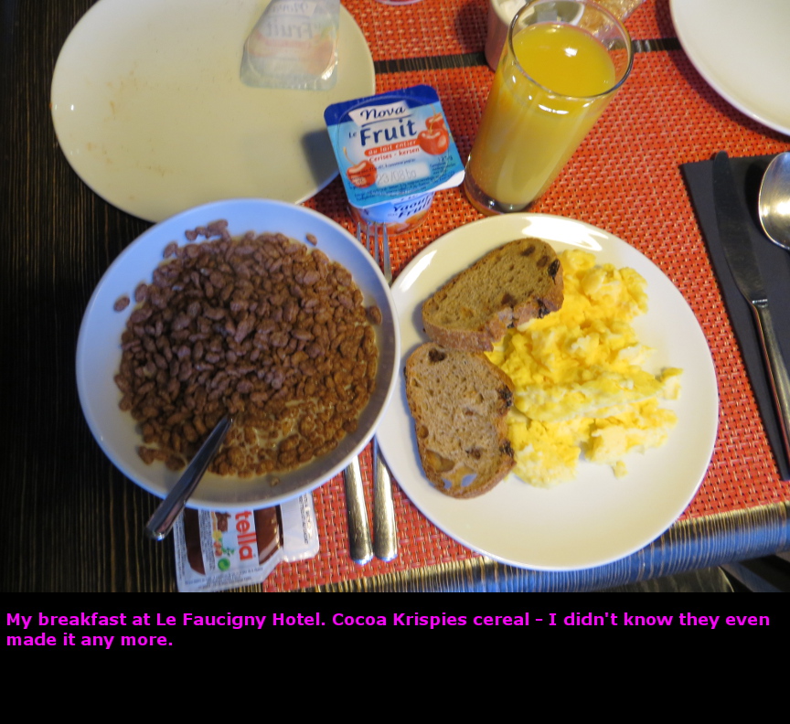
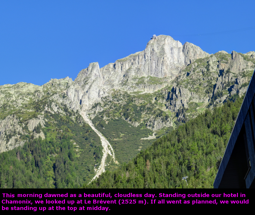
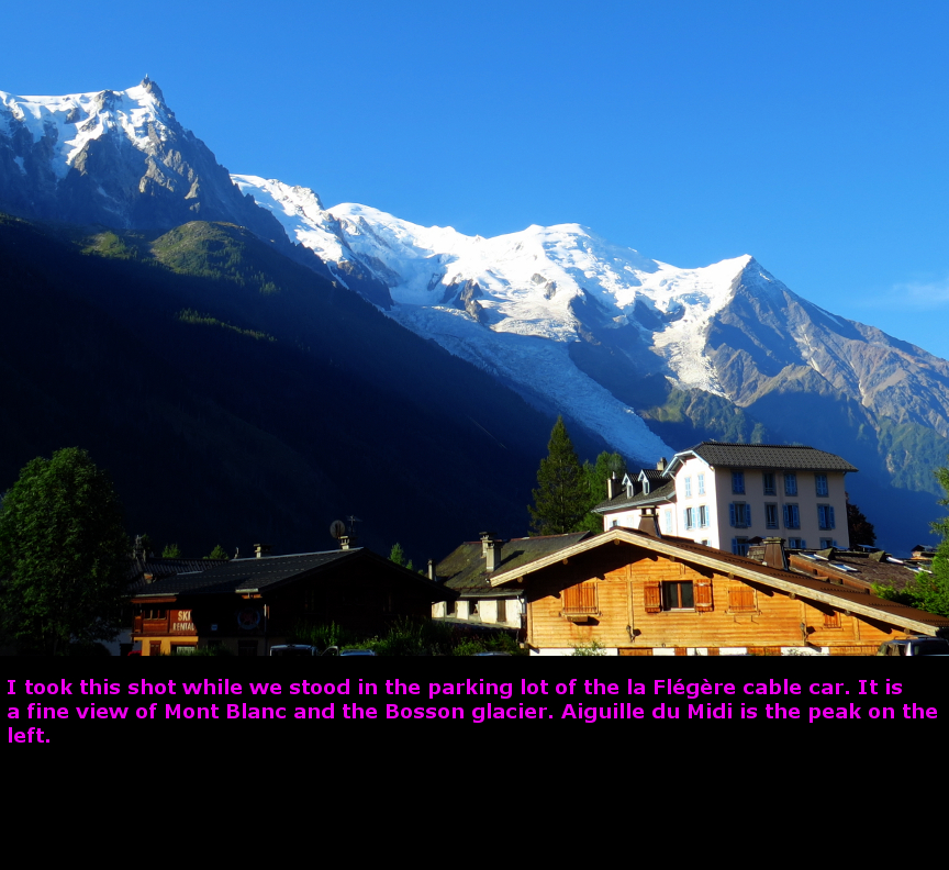
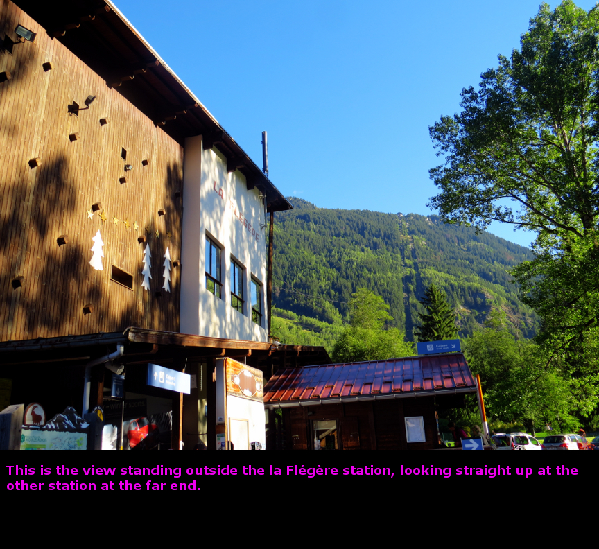
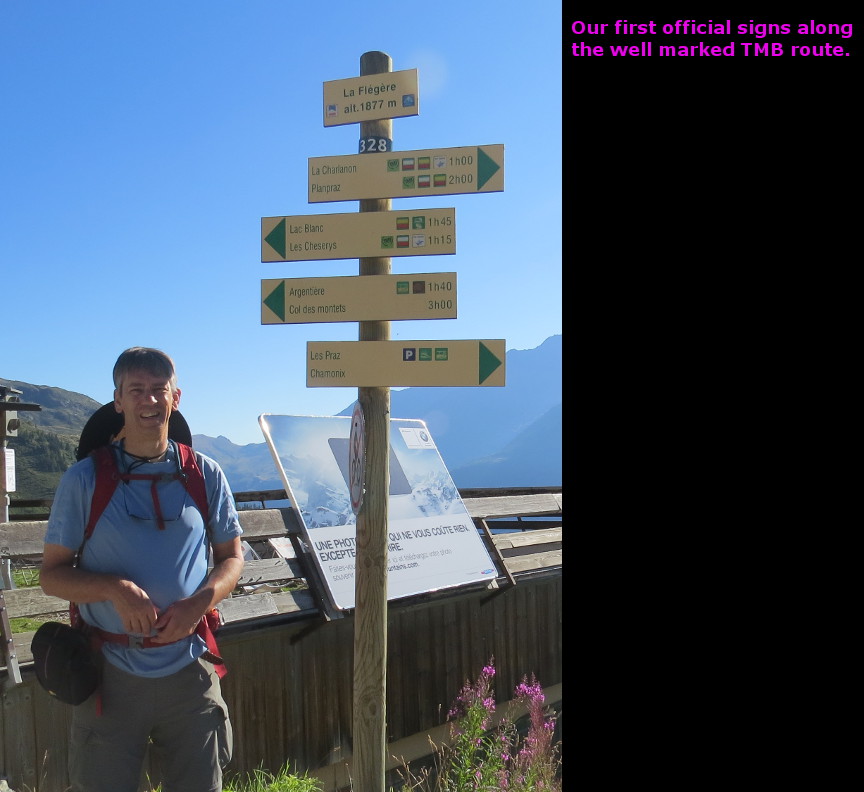
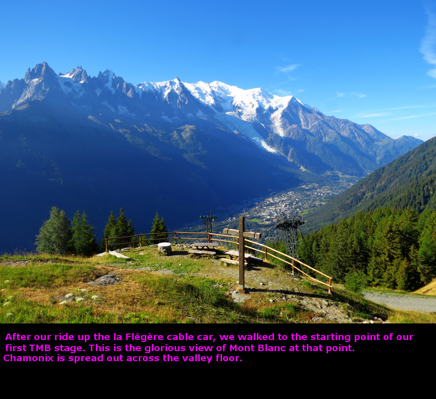
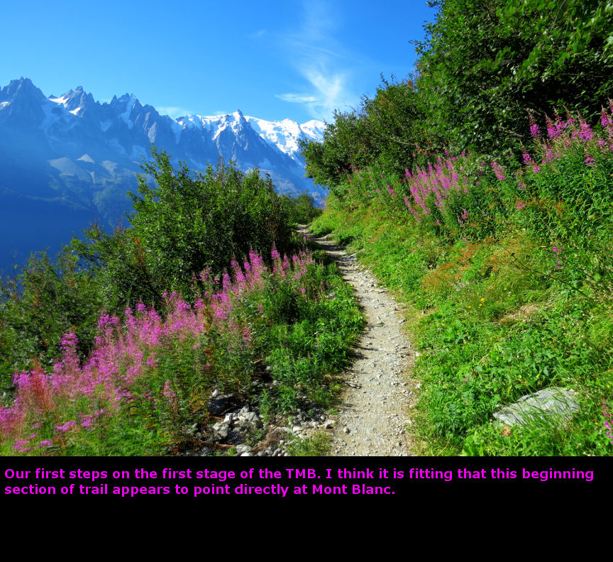
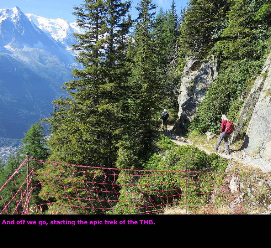
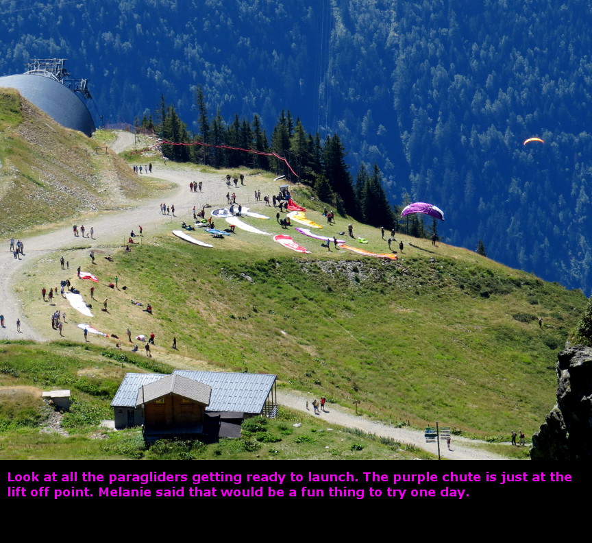
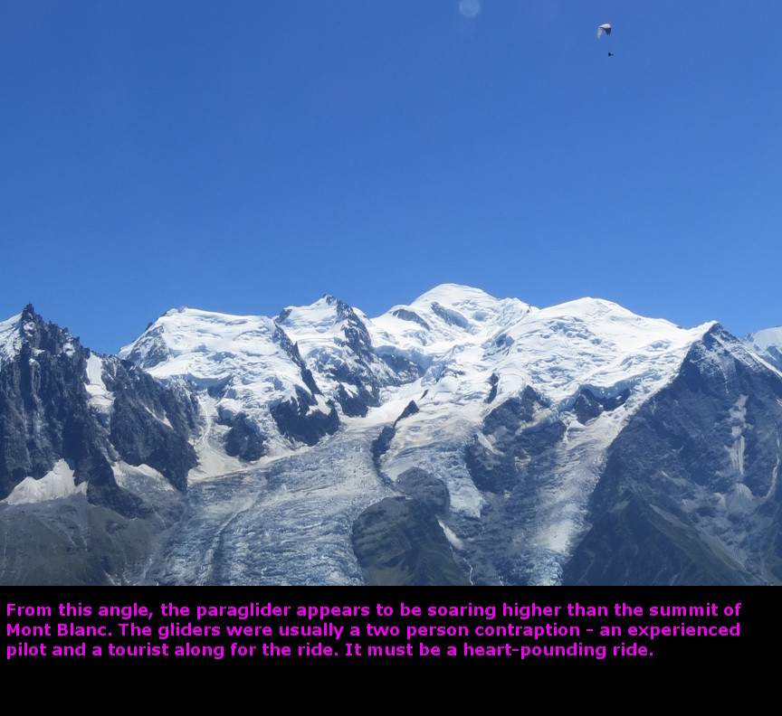
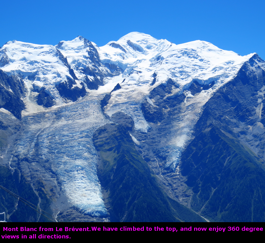
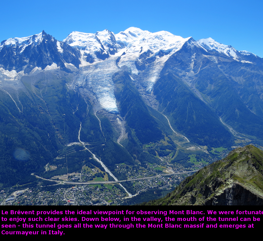
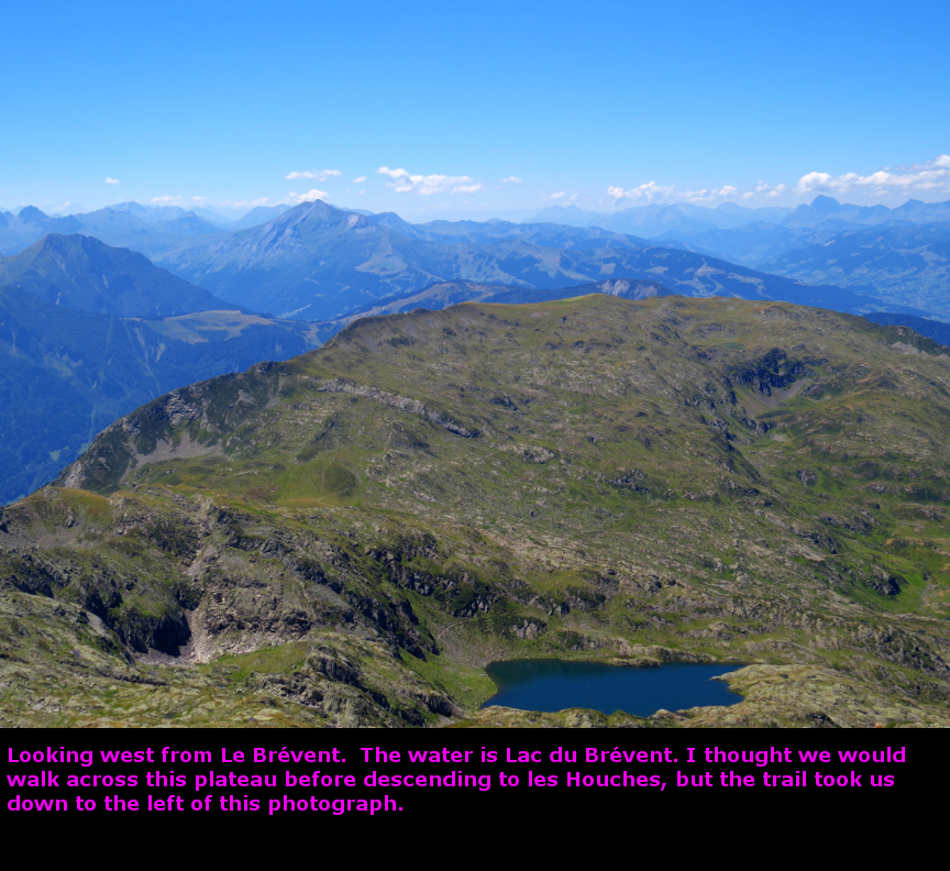
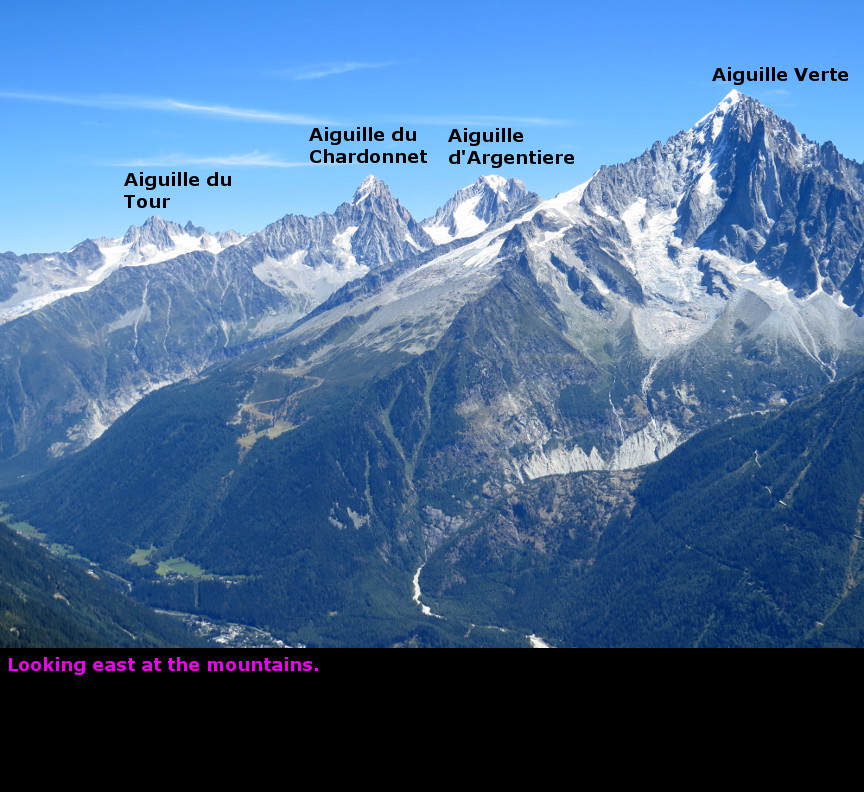
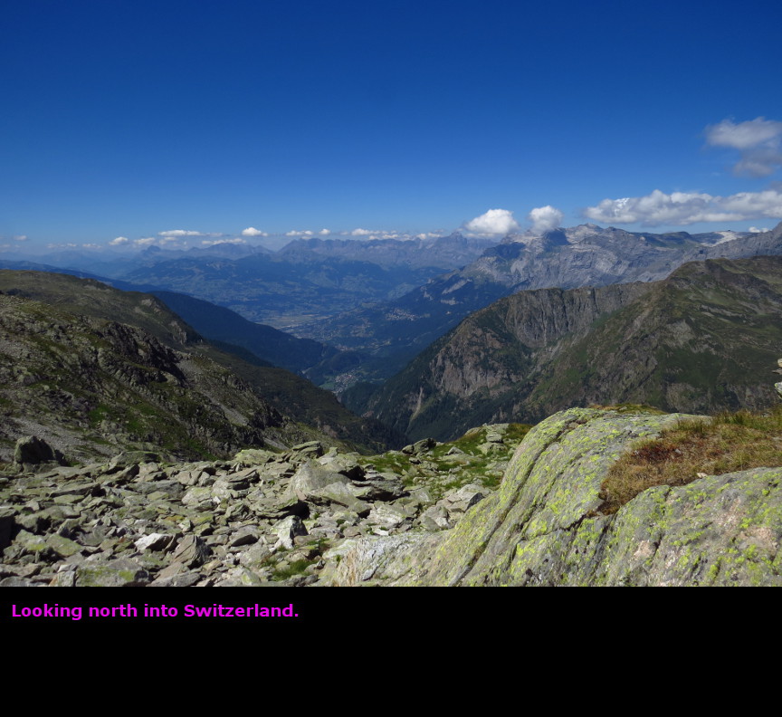
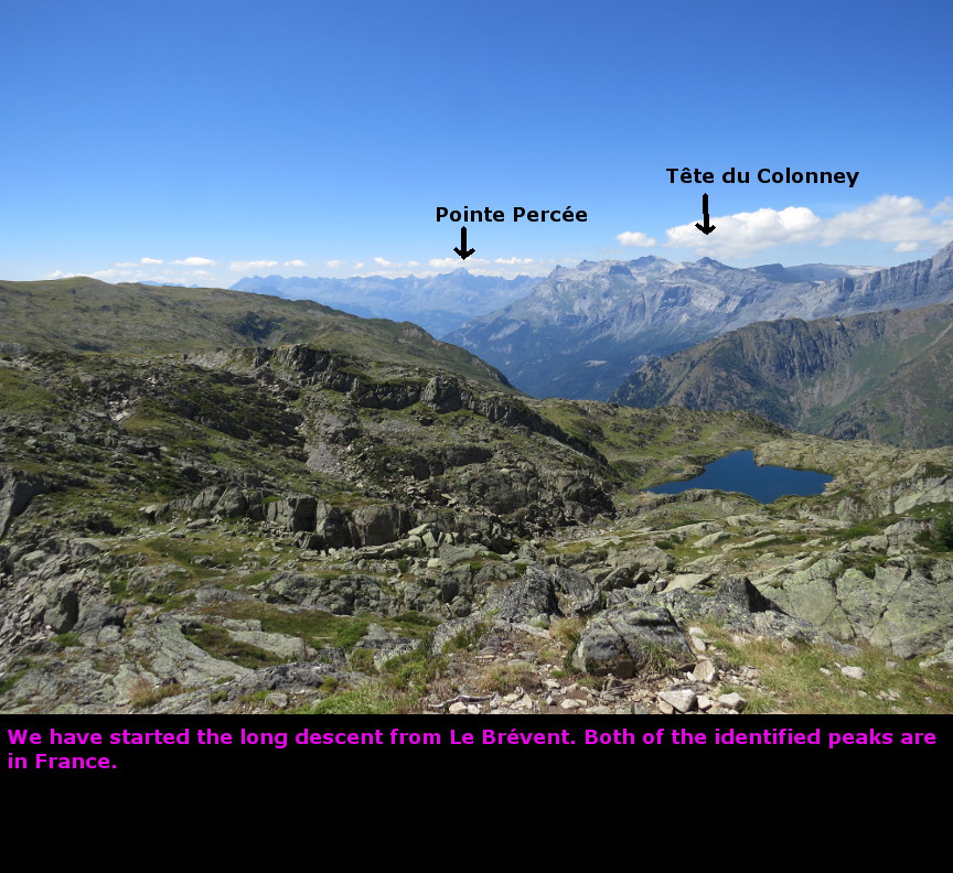
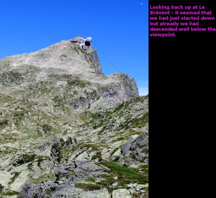
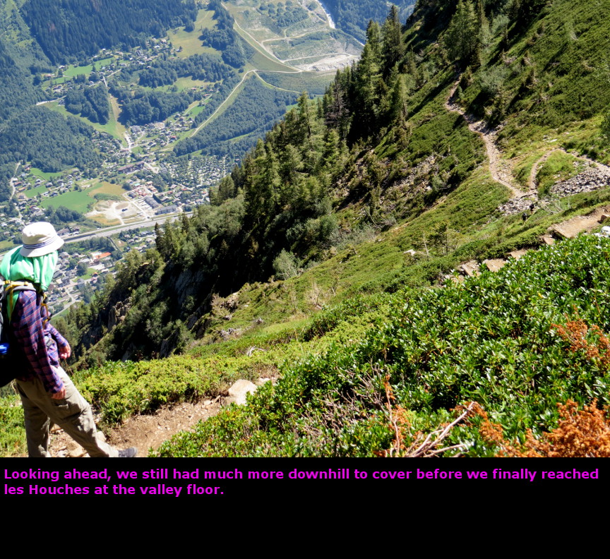
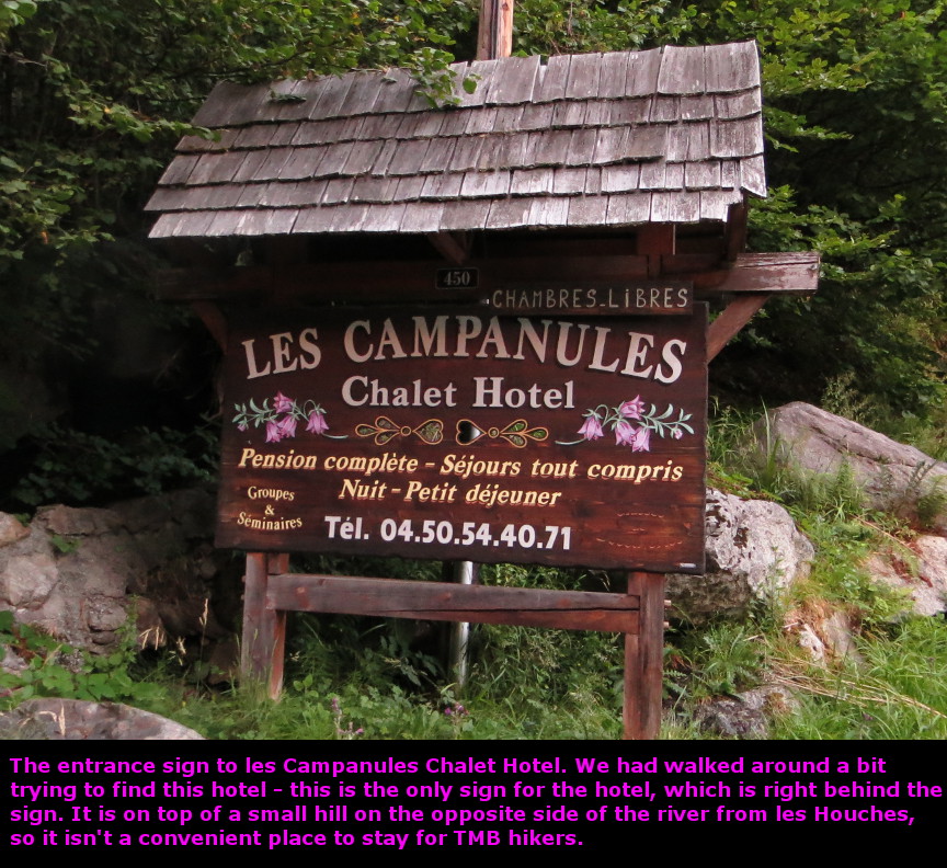
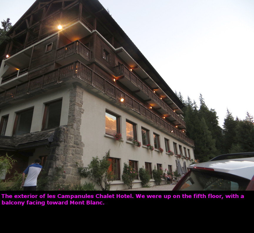
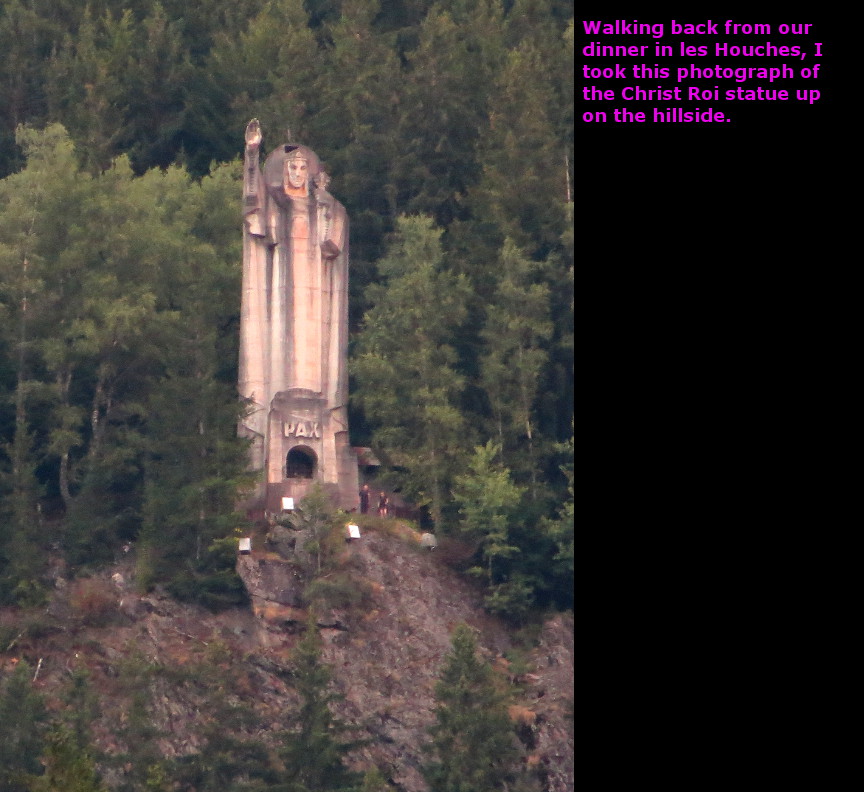
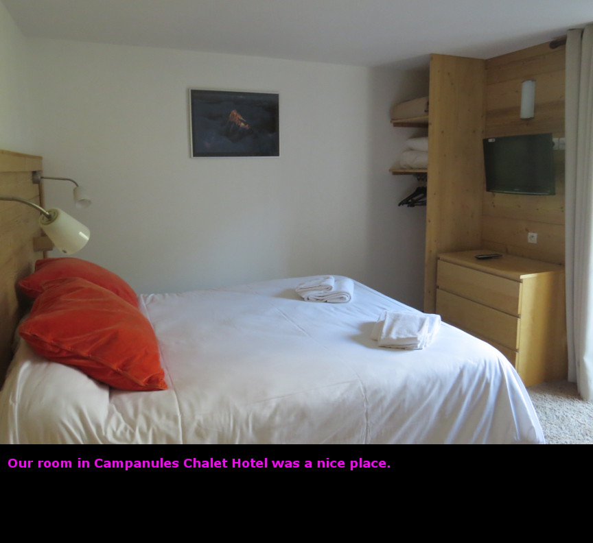
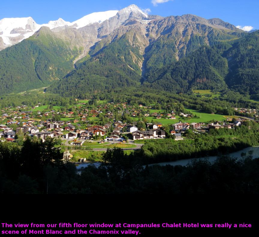
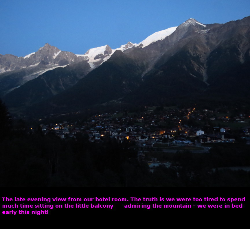
Today it began - our Tour of Mont Blanc. This was exciting, but there was also a tiny bit of trepidation on my part - what if the tour proved to be too hard? Could we hike all 105 miles and 29,000 feet of elevation gain? Well, we would never be far from civilization, we could always limp to safety. We started the day by eating a giant breakfast at the La Faucigny hotel buffet. I am a big believer in giant breakfast and a small, quick lunch on hiking days. Outside, the weather was clear and warm. It looked like it would be an ideal day, and indeed it turned out to be a day of perfect weather. I looked up at Le Brévent - it looked so high from the Chamonix valley floor, but by midday we would be standing up there. But first we had to ride the la Flégčre cable car up to the start of the trail. The base of the cable car station is about 3 kilometers from the La Faucigny hotel, so we walked along the road until we reached the cable car. A quick ride up, and then we were at the start. Naturally, we got several photos of us standing at the start of hike. I planned on taking another set of photos from the exact same point when we finished the hike twelve days hence. The first few kilometers of this trail are pretty easy. We walked along the Grand Sud Balcon (which is also part of the TMB) - we had excellent views across the valley to the Mont Blanc massif, and also views down into the valley of Chamonix. The Tour of Mont Blanc is all about mountain peaks, glaciers and climbing high passes, but it is also a tour of seven valleys that surround the massif. The Chamonix Valley (technically known as the River Arve valley) is the largest of the seven, and in fact we would end our day back down in the same valley, at the town of les Houches - which is to the west of Chamonix. I was carrying two guide books - the Cicerone guide, and the Trailblazer guide. Here is a couple of sentences from the Trailblazer description of this part of the hike: "After the path crosses a wide track, it ducks beneath a chairlift cable and negotiates a precipitous cliff. No climbing is involved but in places the trail is narrow and hugs the sheer rock, so watch your step." I warned Melanie that we might have to be careful on this section (though actually I am more afraid of heights than she is) - but after hiking for a while, I realized that we had already walked right passed the precipitous cliff. The trail is wide and safe, I can't imagine anyone being in any danger on that stretch, though maybe bad weather and heavy fog might make it a bit scary. Did I mention our weather was great? We met a couple from Philadelphia on the trail. They had started in Courmayeur, so this was their halfway point. They had hired a service to transport their luggage from inn to inn each night, so all they had to carry were their lunch, rain gear and a map. It sounds like a nice convenience, but if they told me the name of the company, I have forgotten it. When we got closer to Le Brévent, the trail started a steep climb. There were a series a switchbacks above a cable car station called Plan Praz. Lots of people were coming up that cable car and then jumping off the cliff with their paragliding chutes. It seemed like someone would run off of the cliff every few minutes, there were many of the colorful chutes soaring above the Chamonix valley. With no wind and warm sun, the paragliders climbed the thermals until they were higher than Le Brévent. Some of the gliders headed off toward the eastern end of the valley. At the top of the switchbacks, we reached a marker for Col de Brévent (I believe Col is the French word for mountain pass). This is the point where the GR5 hiking trails joins the TMB. The GR5 (La Grande Traversée des Alpes) is almost as famous as the Tour du Mont Blanc - it begins at Lake Geneva and finishes at Nice, on the shore of the Mediterranean. After Col de Brevent, the Cicerone guide says: "...you will enter an enclosed hollow where your field of vision is severely restricted. Bouquetin (ibex) are know to inhabit this upper region, so keep alert for a possible sighting". Melanie seems to have a knack for spotting animals hidden in the landscape - and indeed she pointed out a couple of animals moving in the rocks. I only could see one of the two, and I had to zoom in with my camera to get a good view. It is a young animal, so I am not sure if it was indeed an ibex - perhaps it was a chamois instead. However, we were at a high altitude, which is favored by the ibex, so perhaps that is what it was. To exit the rocky bowl area and reach Le Brévent...I will again turn to the Trailblazer guide to describe this section of the trail: "The path continues through a moonscape of rocky bowls and jagged ridges. Route finding can be tricky in the mist, so keep an eye out for the red and white paint splashes that mark the route. Just below the ridge there is a short section of ladders up the steep rock. These are unavoidable but they are not as frightening as the ones above Argentičre." We found the ladder with no trouble, and Melanie climbed them so easily that I barely had time to snap a picture. And just like that, we had reached Le Brévent. Way back in the Victorian era, it was recognized that Le Brévent was ideally situated for viewing Mont Blanc. It is a high point directly across from the Mont Blanc peak and its skirt of gleaming glaciers. We spent about an hour at Le Brévent, eating lunch and snapping many photographs. This was a terrific spot - there are views in all directions, though of course Mont Blanc is the most dramatic. It was about 2 P.M. when we began the long descent. The trail goes down in a hurry. We reached a refuge perched on the side of the mountain, Refuge de Bel Lachat. We stopped here for another fifteen minute break, drinking water and admiring the view. After the refuge, the hike turned VERY STEEP. We descended a series of tight switchbacks, dropping altitude in a hurry. I can't imagine hiking the TMB in the clockwise direction and hiking up that set of switchbacks. Between Le Brévent and les Houches, the trail drops an incredible 1500 meters. It is a long descent. Once we reached the trees, it seemed like we should be close to les Houches, but the trail kept going onward and down the flank of Aiguillette de Brévent. I got pretty tired. Finally we reached the big concrete statue of Christ the King, and I knew we were nearly finished. Unfortunately, at the very base of the trail, we made a wrong turn and walked an extra twenty minutes before we could ask someone where the trail to les Houches was. We found the hotel and checked in to Les Campanules Chalet Hotel. The hotel told us that they were completely booked for dinner, so we would have to walk into les Houches to get dinner. Unfortunately, the hotel is on the opposite side of the river from les Houches, so we had to walk about 2 km down a hill, over a bridge and then up to les Houches. Melanie didn't feel like making that walk, so I went with Stephen and James. In les Houches, we ate some good burgers at a place called le Delice. I was quite tired as we walked back to our hotel in the twilight, but it had been a successful first day. Panorama Photos


VideosIf you do not see the videos, but instead see a message that says: "Error: Video playback aborted" it is possible that the content is being blocked by your web browser. You may see a message at the top or bottom of your page that says "restricted webpage from running scripts or ActiveX controls". If you see that message, click on the ALLOW BLOCKED CONTENT box and that should allow these videos to run.
To display the photo images on this webpage, I am using a freely distributed java script called Lightbox v2.7.1 written by Lokesh Dhakar. You can download this program by clicking on this link. All the text and photographs on this webpage are my own creation, but the textured background is taken from a site, EOS development, that offers non-profit users free use of their graphics. Click the icon below to visit their site.
|
Click on any thumbnail to begin the slide show at that photograph TMB Stage 1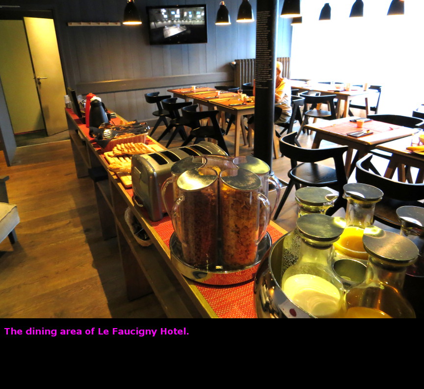


|