|
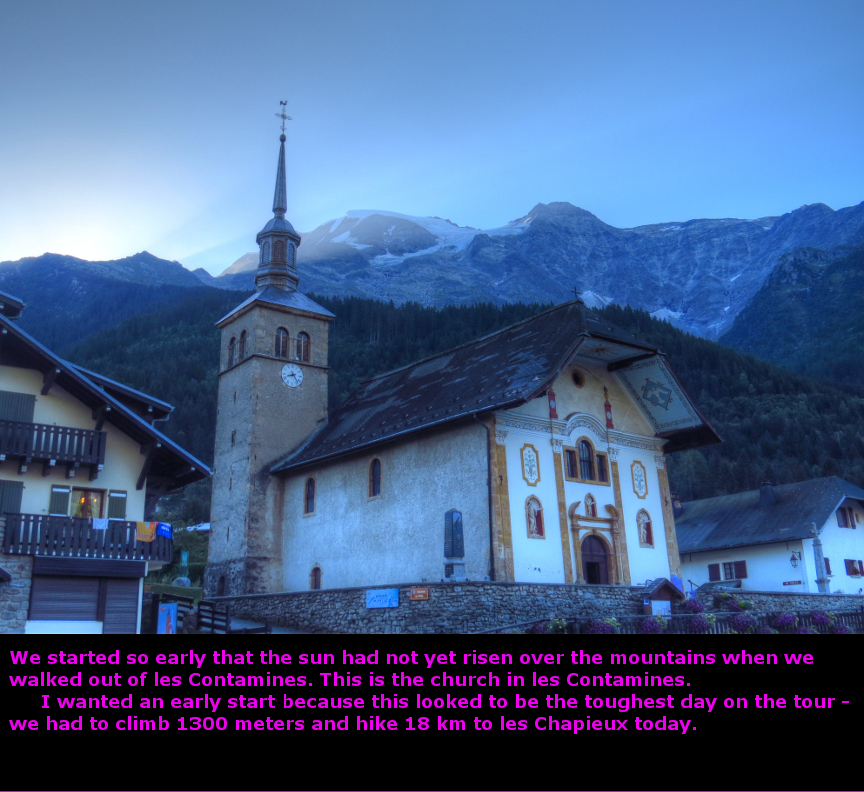
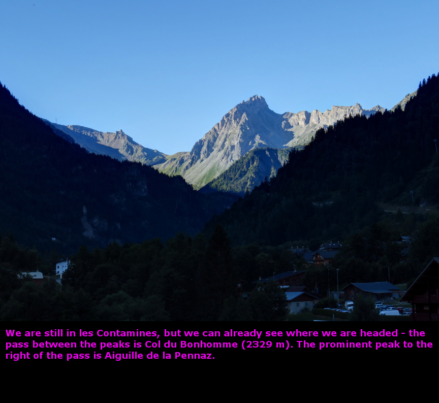
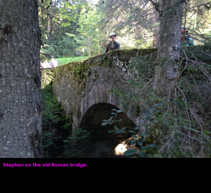
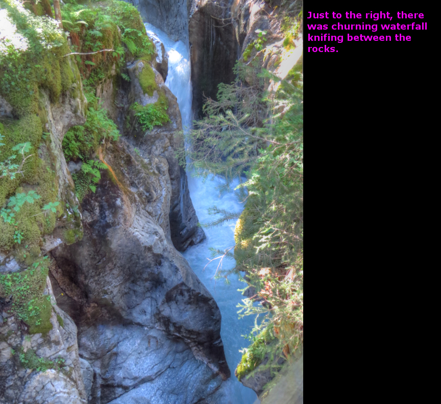
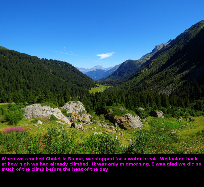
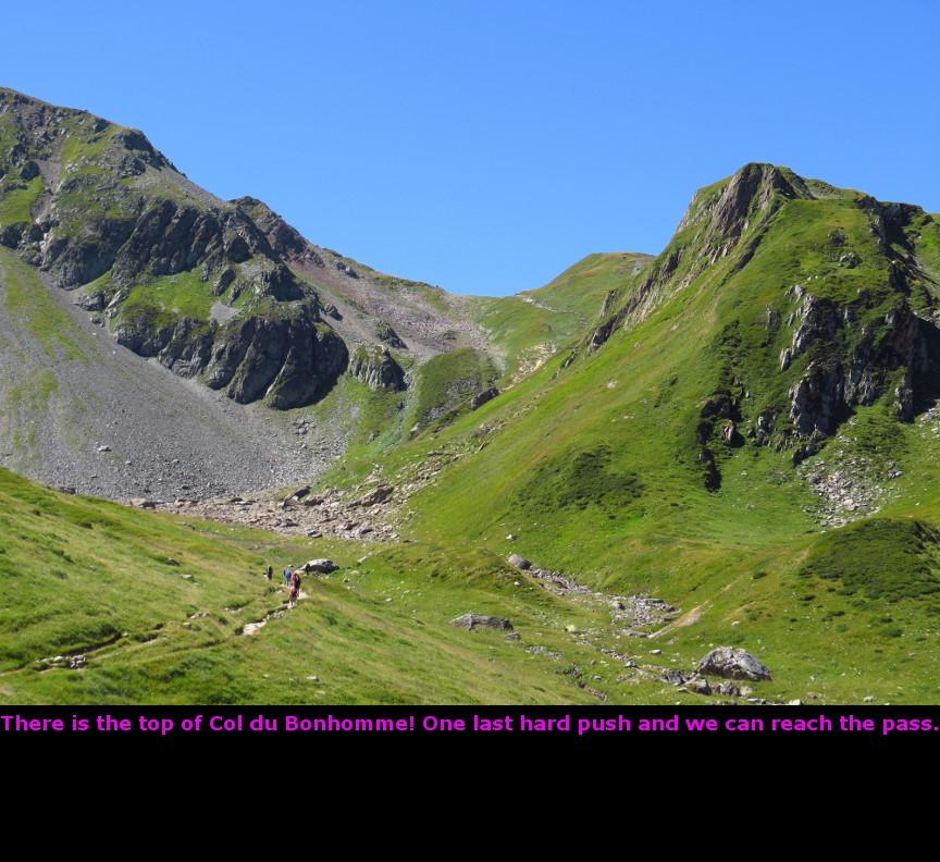
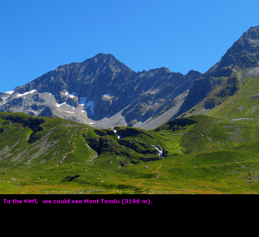
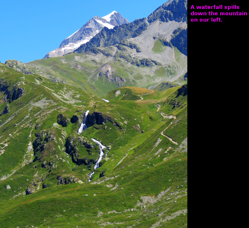
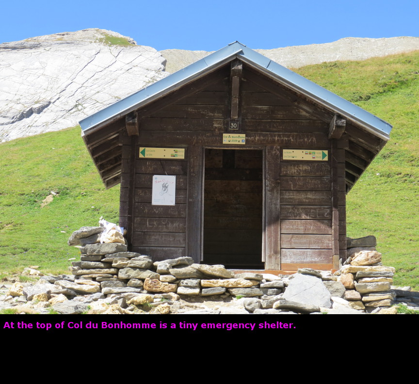
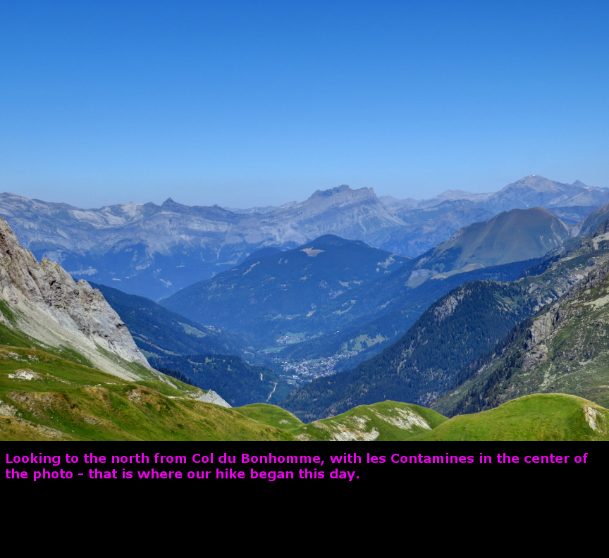
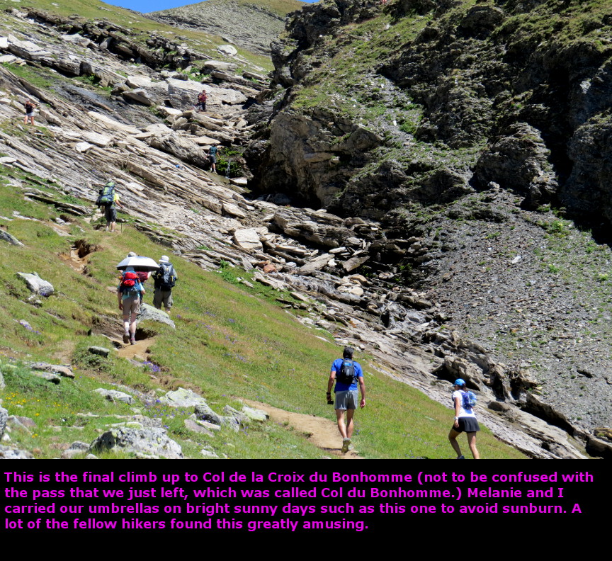
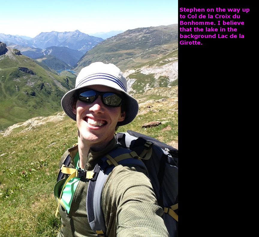
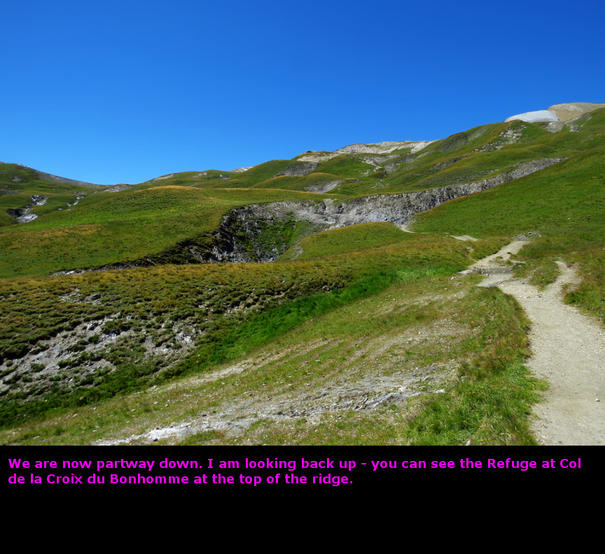
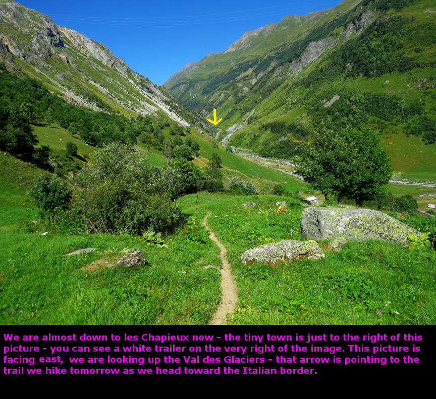
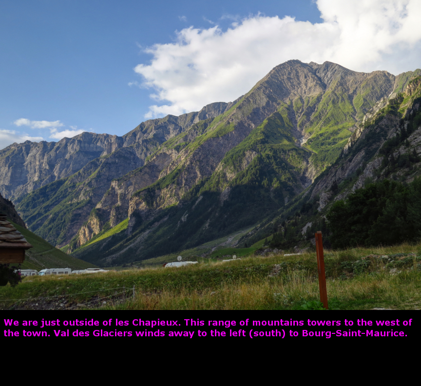
When I saw the original trip itinerary, I figured this stage would be our toughest day. It had a lot more elevation gain than any other stage, and it was one of the longest distances we were going to hike. I set a goal of reaching le Chapieux by 5 P.M. It turned out that we beat that goal easily. This was an excellent hiking day! The route for the day marched to the southern end of the Val Montjoie, and then up and over the pass of Col du Bonhomme. We climbed a bit higher to a second pass at Col de la Croix du Bonhomme, and then descended into the next valley, the aptly named Vallee des Glaciers, where we would spend the night in the tiny town of les Chapieux. Our course followed an ancient Roman road (Chemin Romain); this day's path of the TMB followed a route used by the legions as they marched north from Italy. I wonder if those legionaires admired the scenery as much as we did. The day began with breakfast served at the dining table by the owner of La Ferme de Bon-Papa. There was another pair of hikers at the breakfast with us, a mother and her daughter. They were hiking the GR5, which apparently they had already done once before. So their route would parallel ours up to the pass. Before we left les Contamines, we stopped at a bakery, where James and Stephen bought some pastries and bread for lunch. With an early start, we headed south. Already ahead of us, brightly lit in the morning sun, we could see Aiguille de la Pennaz. The pass was just to the left of that mountain. But the first kilometer or so was a completely flat walk. We passed a small shrine, and then reached Notre Dame de la Gorge. This is a pilgrimage church, where travellers pray for safe passage over the Col, or else they stop to give thanks to God for a successful journey. We wouldn't need any prayers, the weather was beautiful. Not humid or overcast like yesterday. At Notre Dame de la Gorge, we again met the couple we called Philadelphia (I think the wife's name was Susan, but I forget the husband's name). South of Notre Dame de la Gorge, the Roman road rises sharply. Even though it was still a cool morning, I was soon sweating profusely. The Roman road reaches a narrow, deep chasm, which it crosses with a bridge called Pont de la T�na. From the bridge itself, the gorge doesn't look impressive, but if you stand off to the side and look down, you can see the deep cut in the rock sliced out by the surging water. Beyond the Roman bridge, the trail resumes the steep ascent. We soon left the pine trees and began crossing alpine fields. We hiked past a couple of refugios on the way up, stopping at one for a water break. At Plan des Dames, we found a huge cairn. This cairn is said to mark the spot where a female Victorian hiker and her escort perished in bad weather while attempting to hike the TMB. I read that the Victorians were avid hikers, often completing the Tour du Mont Blanc in just 5 for 6 days. Those must have been some long days. We ate lunch before starting up the final climb to Col du Bonhomme. The Mont Blanc massif was on our left, we could see some peaks, a few lakes (the Lacs Jovet) and a waterfall. Trails led off across the landscape in various directions, but we stuck to the main route and soon attained the pass at 2329 meters. We had a nice long rest here, while I took pictures in all directions. After the pass, there was still more climbing to reach the second pass Col de la Croix du Bonhomme, but that was only about another half hour of hiking. Despite all the elevation gained, I was feeling pretty good. Just below Col de la Croix du Bonhomme is a refugio. We stopped there for another rest, filling our water bottles. It was all down hill to les Chapieux from there, across alpine meadows that were used as pastures for herds of sheep. James and Stephen seemed delighted to see the sheep on the mountainside. We descended quickly. Because it was so sunny, Melanie and I brought out our umbrellas and used them as sun shields as we hiked down to les Chapieux. We made it to les Chapieux before 4 P.M., much quicker than I had anticipated. This might have been our best day of hiking. There weren't a lot of dinner options in the tiny hamlet of les Chapieux. I think there are only eight buildings in the town. We ate spaghetti dinners at the Auberge de La Nova, which turned out to be an excellent dinner choice. In addition to the spaghetti, James and Stephen also got ordered an omelet and salad. Plus we had a couple of Heineken's. We stayed that night in a bed and breakfast called Les Chambres du Soleil. Panorama Photos


VideosIf you do not see the videos, but instead see a message that says: "Error: Video playback aborted" it is possible that the content is being blocked by your web browser. You may see a message at the top or bottom of your page that says "restricted webpage from running scripts or ActiveX controls". If you see that message, click on the ALLOW BLOCKED CONTENT box and that should allow these videos to run.
To display the photo images on this webpage, I am using a freely distributed java script called Lightbox v2.7.1 written by Lokesh Dhakar. You can download this program by clicking on this link. All the text and photographs on this webpage are my own creation, but the textured background is taken from a site, EOS development, that offers non-profit users free use of their graphics. Click the icon below to visit their site.
|
Click on any thumbnail to begin the slide show at that photograph TMB Stage 3


|