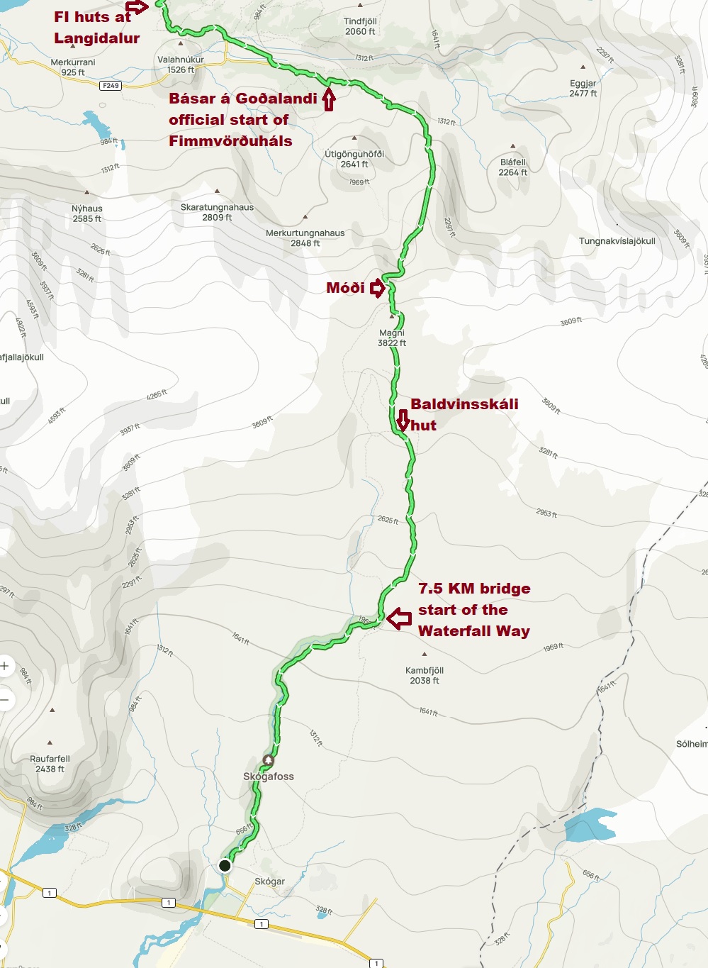
The weather forecast for this day was ideal, and that meant we would attempt to hike the entire length of the Fimmvörđuháls trail in one day. The traditional length for this hike is 25 Km, but that distance is from Básar to Skógar. Since we began at the Volcano huts, we had to hike an additional 5 Km just to reach the trailhead at Básar.
We woke up early, and ate our muffins for breakfast, trying to be quiet so as not to disturb Anthony and Anneka, who were sharing the sheepherder's hut with us - their plan was to spend two days on the Fimmvörđuháls, so they would be starting after a hearty breakfast at the Volcano huts.
My pack felt quite heavy, I was carrying 6 water bottles and two packed lunches; I didn't intend to run out on this trail, and I didn't think that there would be any way to get resupplied at the primitive Baldvinsskáli hut.
It is just 1.2 Km of easy hiking from Volcano huts to the FI hut at Langidalur. We stopped there to use the restrooms - but I forgot to pickup my pack afterwards! Perhaps I was subconsciously rebelling about carrying such a heavy load all day long. We were about to cross the bridge over the Krossá river when Melanie asked: "Where is your pack?" I had to run back and pick it up - that cost us about twenty minutes. Good thing we started early.
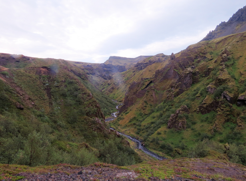
The Fimmvörđuháls starts climbing immediately after leaving Básar. We soon found ourselves in a wonderland of sculpted stones, steep ravines and even some arches. The rocks here must have been carved by the violent outflow of melted glaciers when volcanos erupt beneath the glacier ice. There is a short section famous for its scary appearance - the Kattarhryggir - which means the 'cat spine' - this stretch is only about 20 yards long, but there are steep drop offs on either side. I walked carefully through that part, always making sure one foot was firmly on the ground.
Higher up is the 'chains" section of the Fimmvörđuháls. I read several online descriptions of "the Fimm" before our trip, and when the chains were mentioned, the comments were always the same: the chains are so loosely anchored that they could not be relied upon to hold you up if you did fall. The descriptions were accurate. Fortunately, the chains aren't necessary - only at the last part, where the trail climbs steeply to a plateau, were the chains helpful to help pull myself up over the rocks.
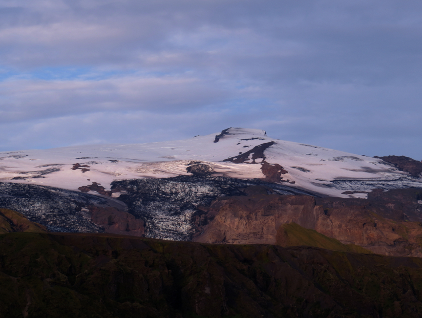
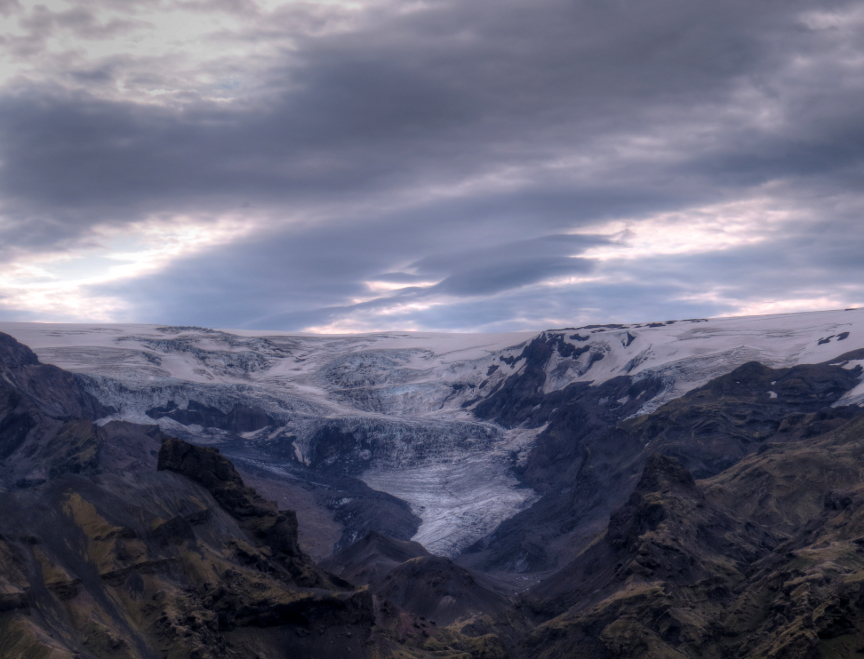
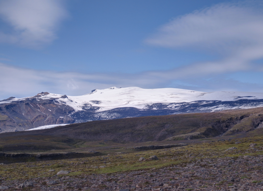
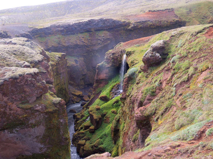
As predicted, the weather was ideal. We had views in all directions, able to see both glaciers, the Eyjafjallajökull on our right and the Mýrdalsjökull to the left. There was an impressive waterfall coming off of the Mýrdalsjökull and pouring into a deep gorge, visible from just off of the trail.
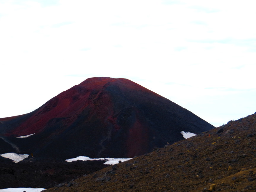
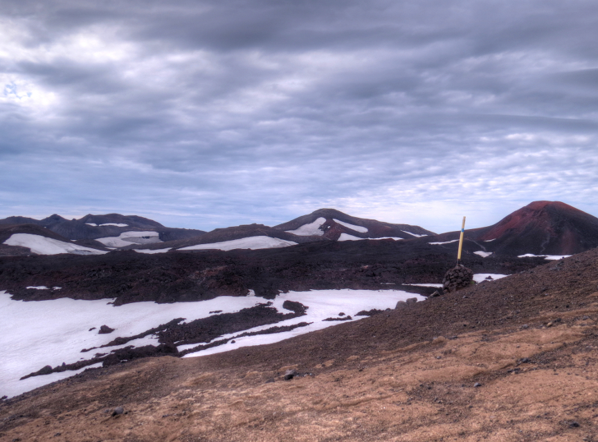
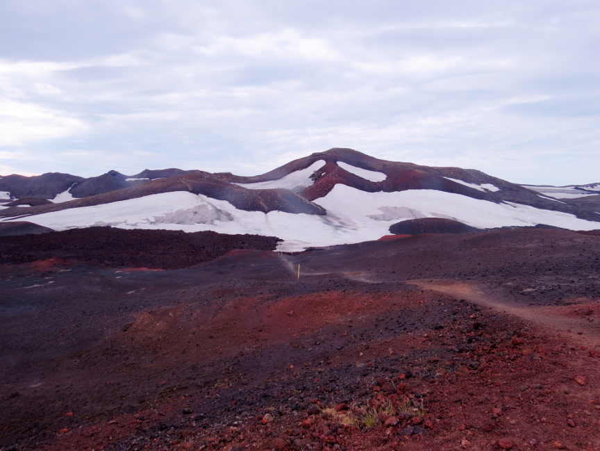
At the highest point of the Fimmvörđuháls are two recently-formed volcanic cones - the Móđi and Magni (named for the sons of Thor). The Móđi is a bright red color. These small cones
can be climbed, but we still had a long way to go and so we did not take any of the enticing side jaunts. It takes a surprisingly long time to cross over the summit of this trail. There are couple of ice fields to navigate, and some
lava fields to clamber over. All of the trail descriptions for the Fimmvörđuháls warn that the weather here can change suddenly, with fog and clouds and cold making it difficult to get through. Our biggest obstacle
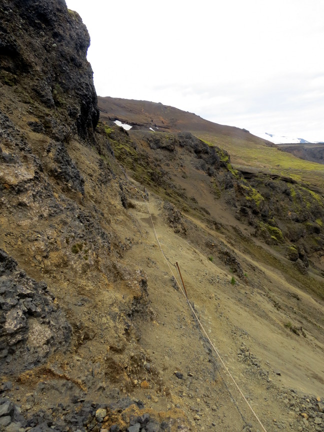
was when the trail seemingly disappeared down the side of a cliff. The only way down was a steep climb on a crumbling surface of ash and scree. We could see the trail markers at the bottom, so we knew this was the
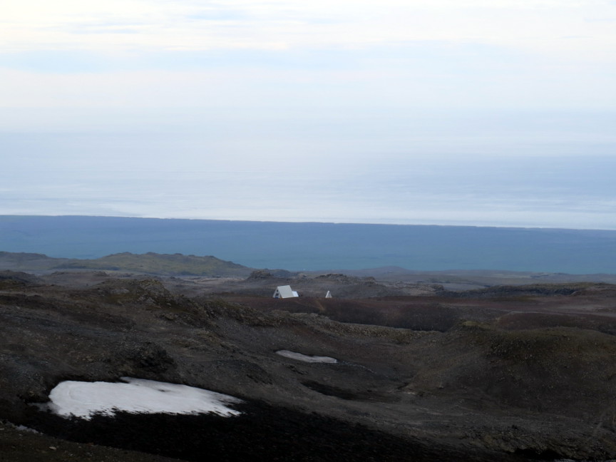
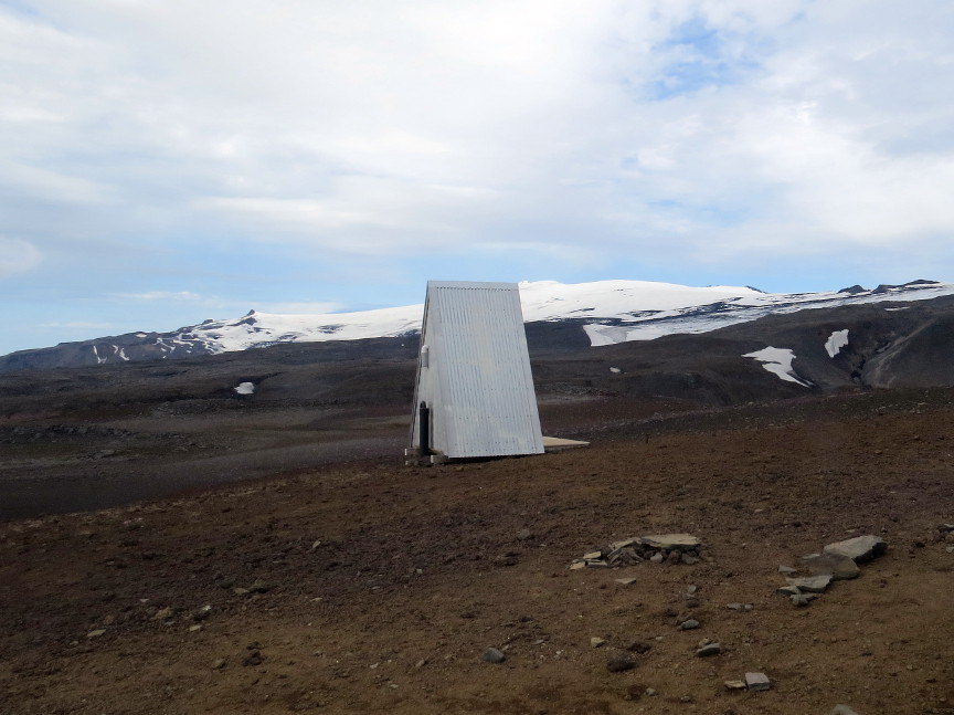
correct route, but it was quite a challenge to get down. Despite using my poles and trying to be cautious, I did fall once on this descent, though fortunately not too far. We stopped for lunch at the Baldvinsskáli hut, and told the hut warden about how difficult that portion of the trail was. She told us that the canyon that we had climbed down into
used to be filled with ice - the trail use to be an easy hike across an ice field. But now that the ice has all melted, the easy hike has become a difficult challenge. The warden also told us that in the 2022 season,
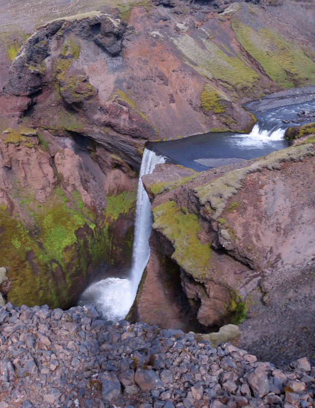
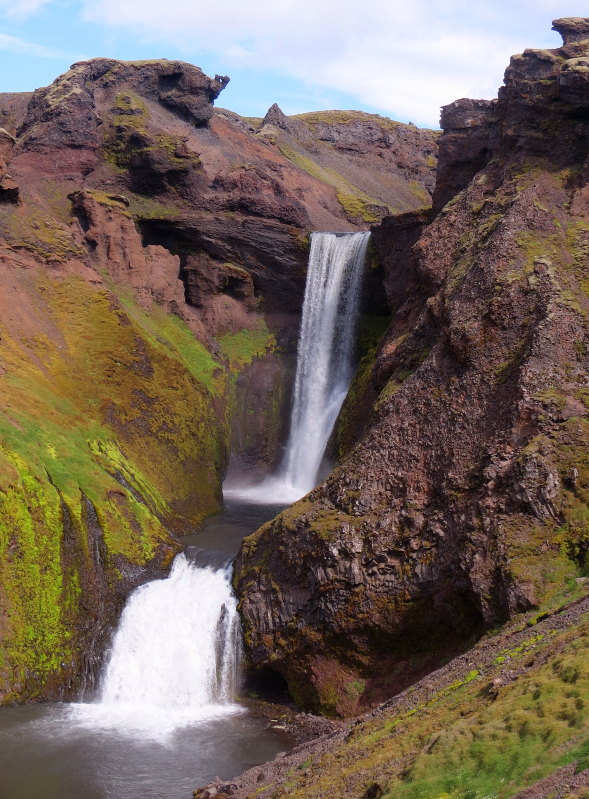
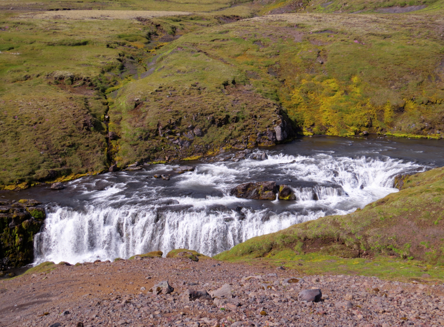
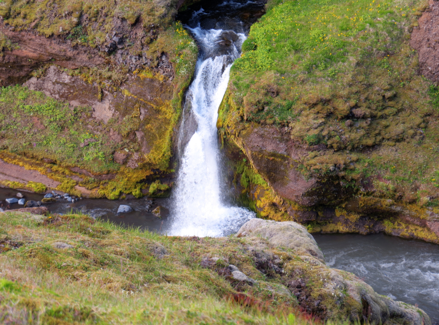
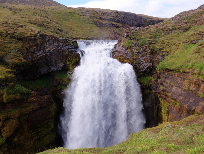
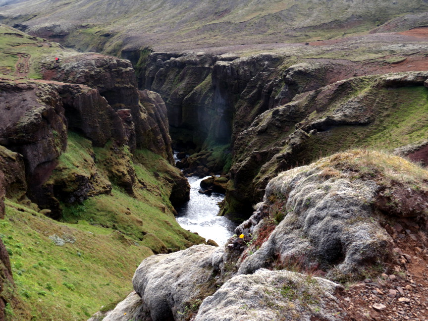
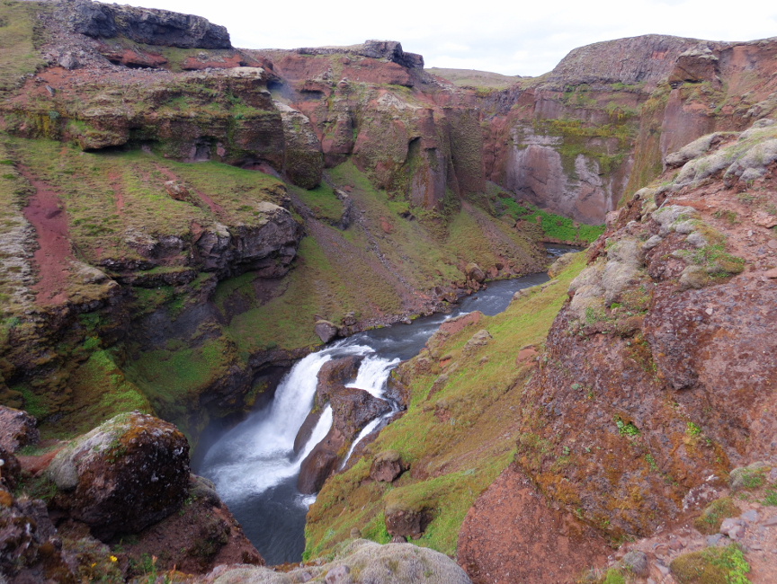
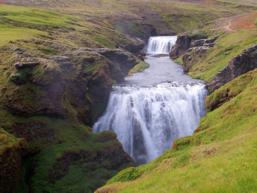
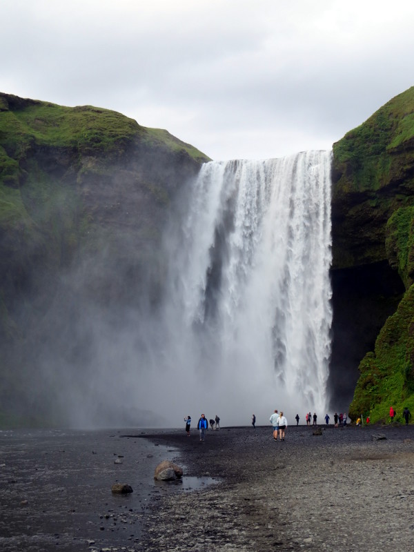
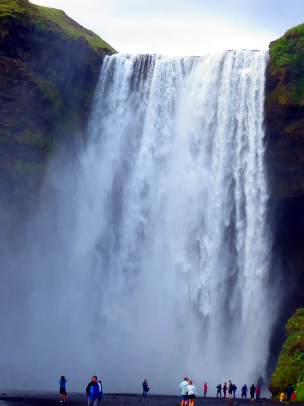
she had seen only three clear days her entire summer stay. But on the day of our visit, it was the tenth consecutive clear day she had seen in 2023, and it was only July. We were lucky indeed. It is nine miles from the Baldvinsskáli hut down to Skógar, downhill all the way. The last 7.5 Km are famously known as the "Waterfall Way'. Depending on which websource you consult,
there are 25, 26 or 27 waterfalls in that final 7.5 Km. The Fimmvörđuháls follows the flow of the Skóga river down to where it ends dramatically as the photogenic Skógafoss waterfall. I decided to take a picture of
each of the waterfalls, in order to have a visual record of all these waterfalls. We stopped partway down for a snack, resting on the grass and admiring one of the more impressive falls. Only the last eight waterfalls
are named, so the other falls can be assigned any fanciful name you can imagine. It was about 6 PM when we reach the Skogahotel. We checked, got a shower, and then a nice hot meal at the hotel restaurant. I slept really well this night!