|
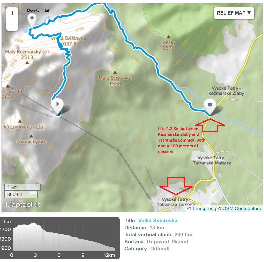
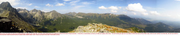
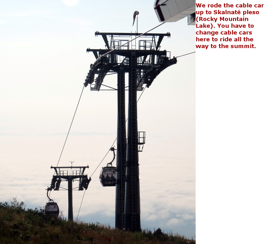
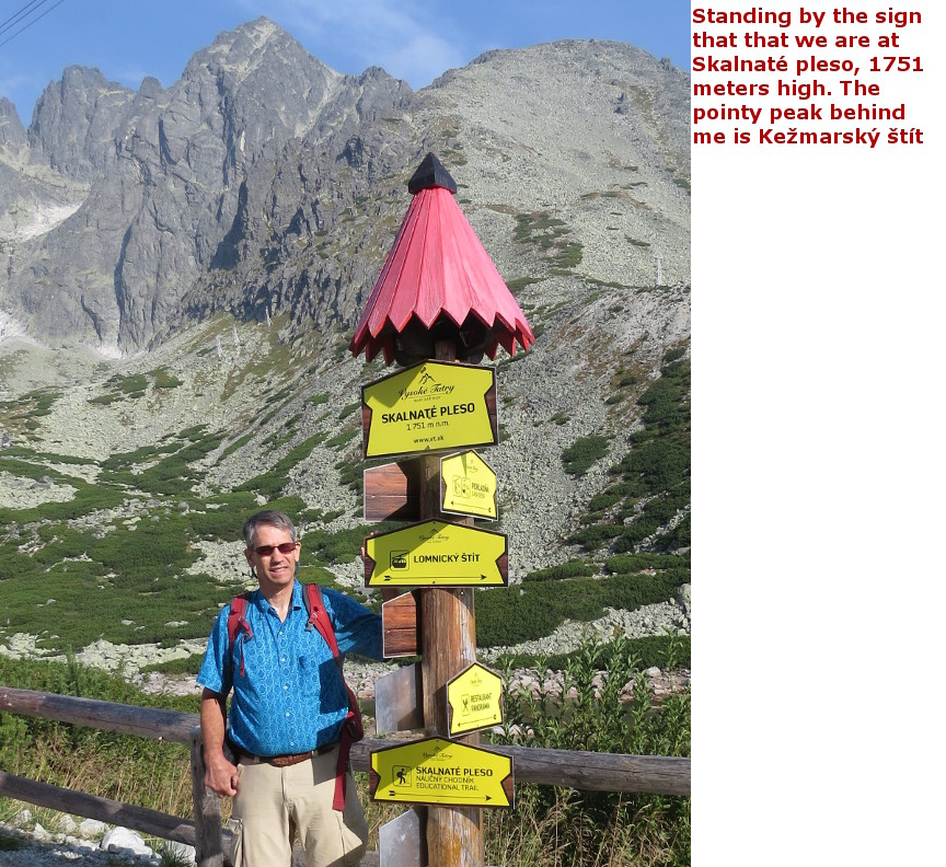
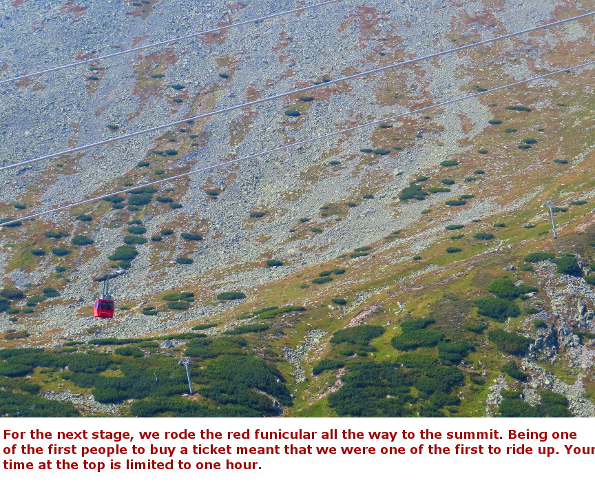
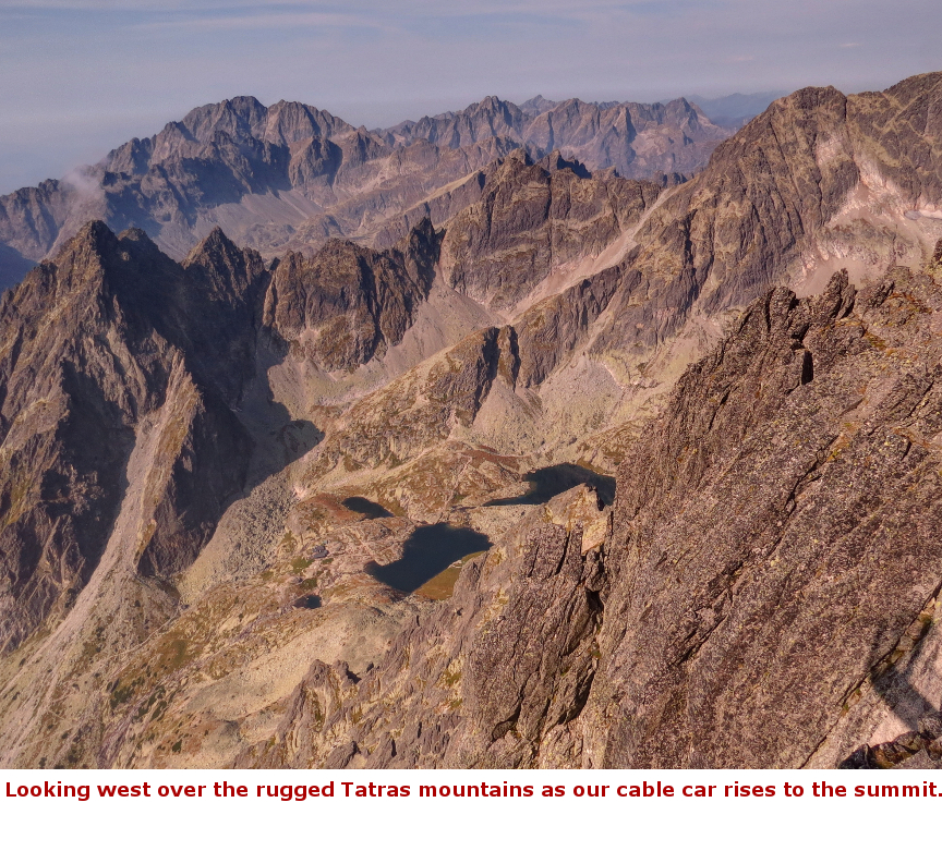
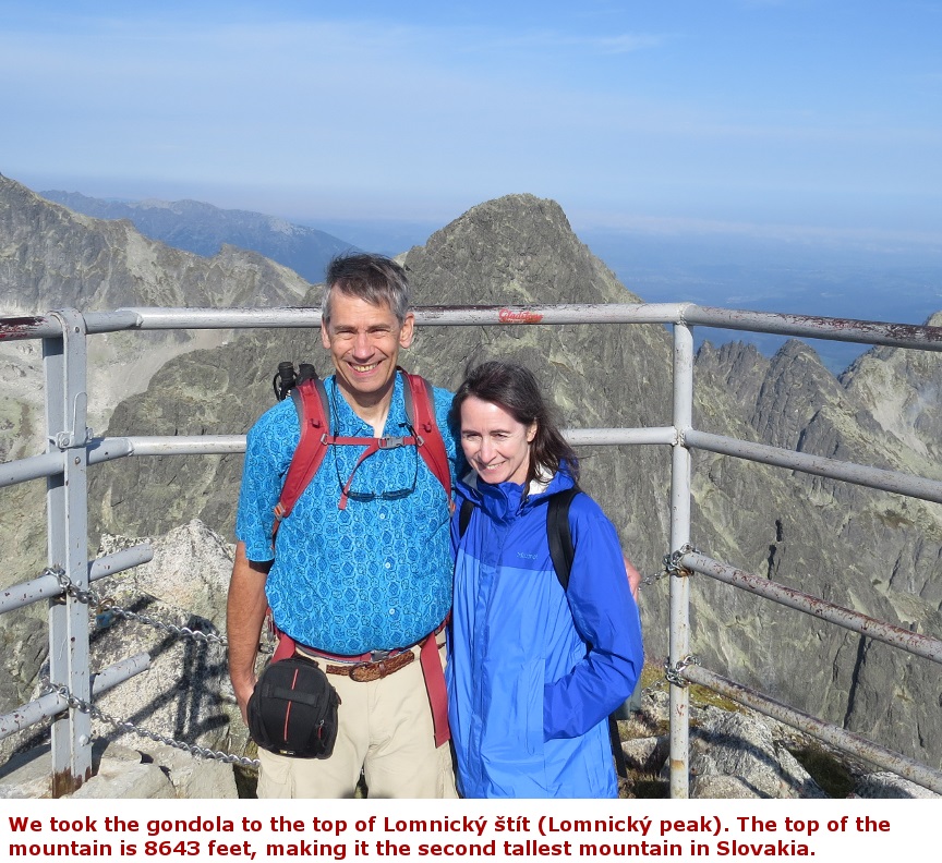
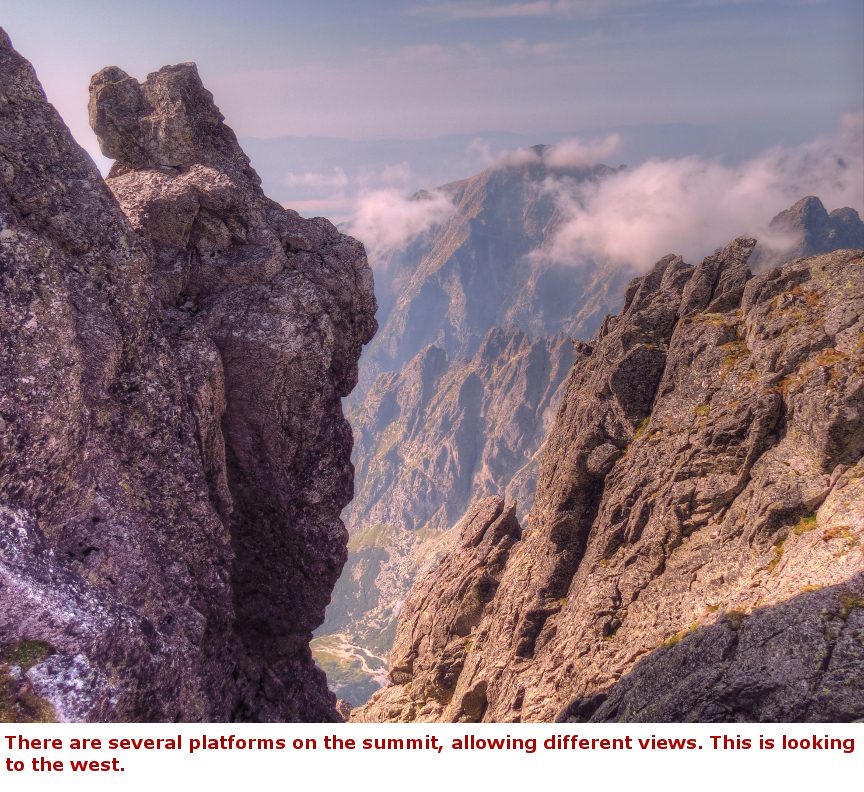
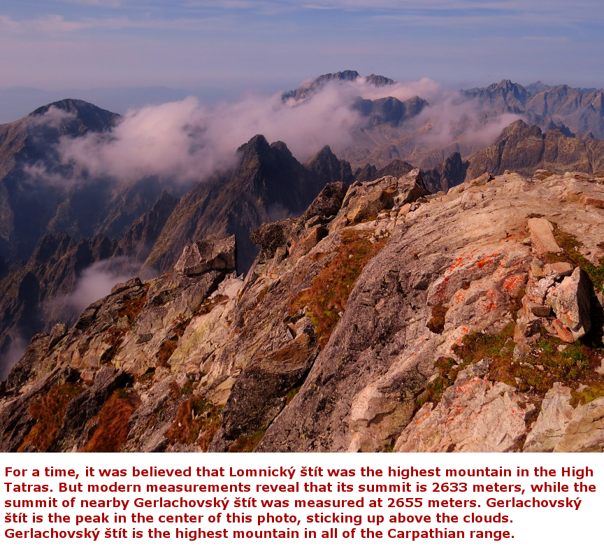
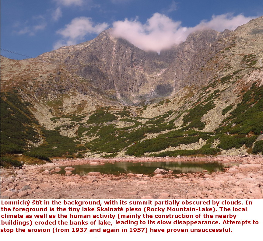
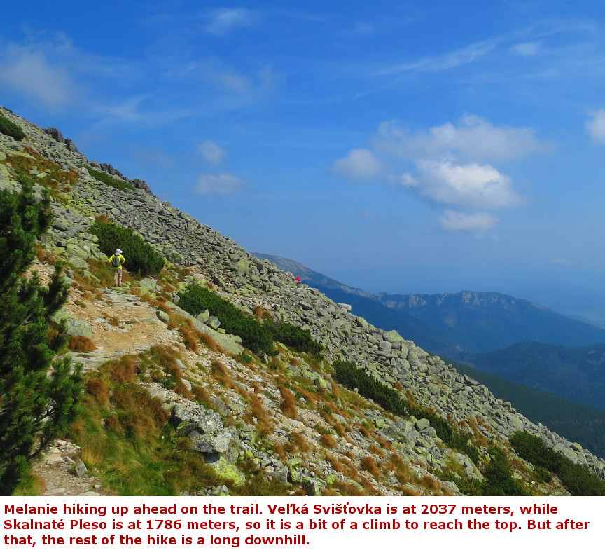
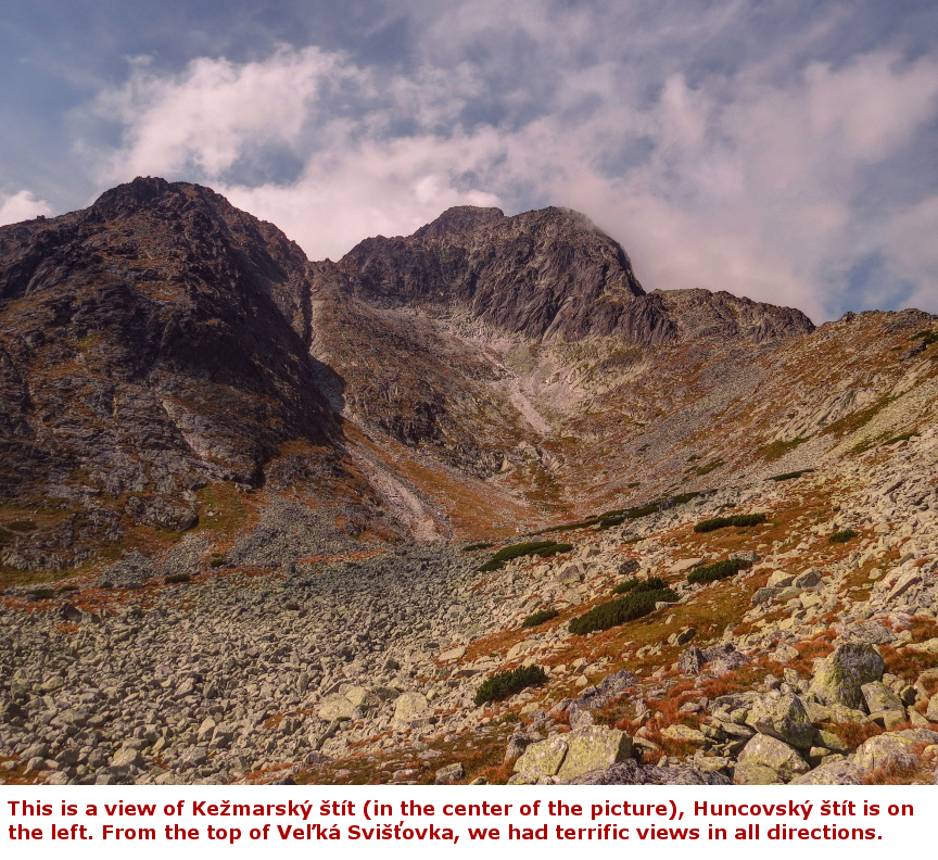
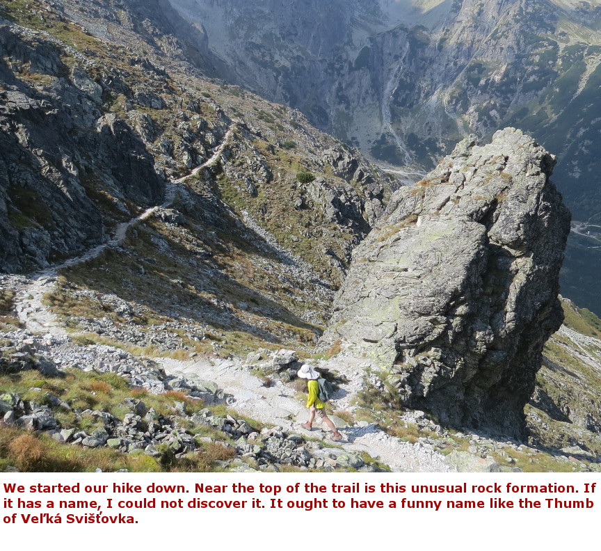
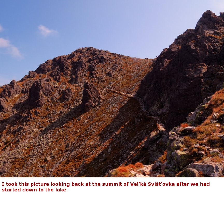
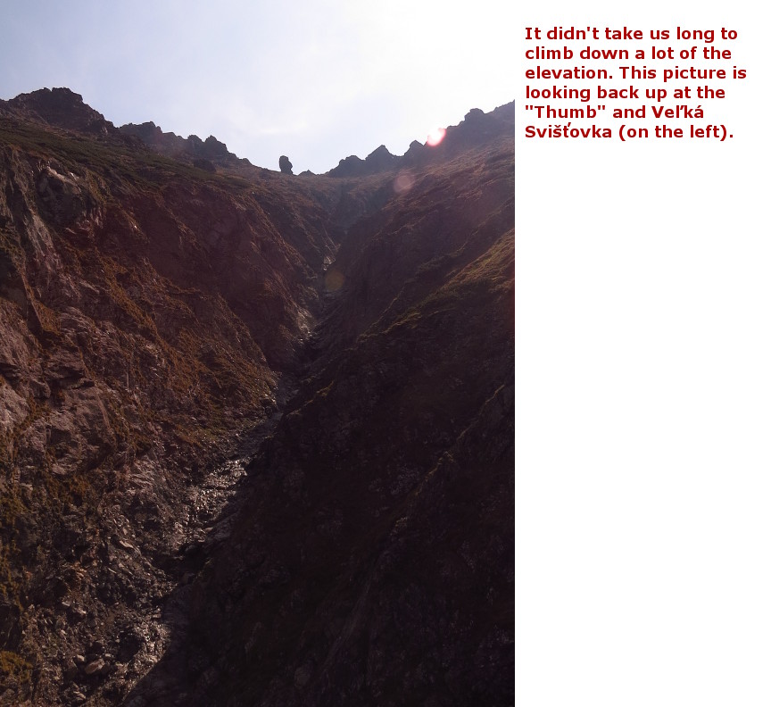
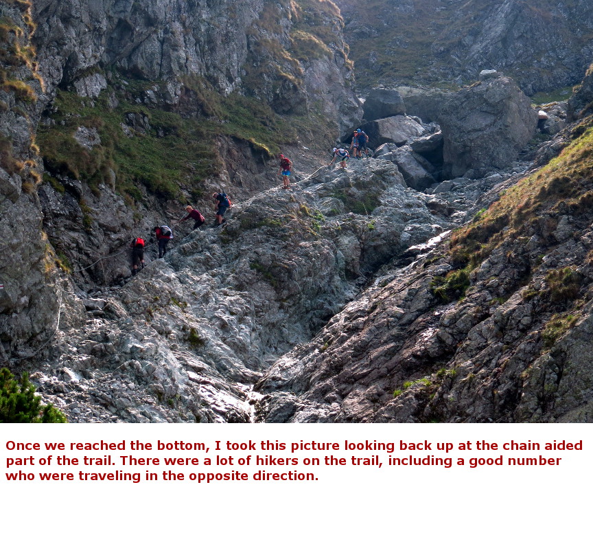
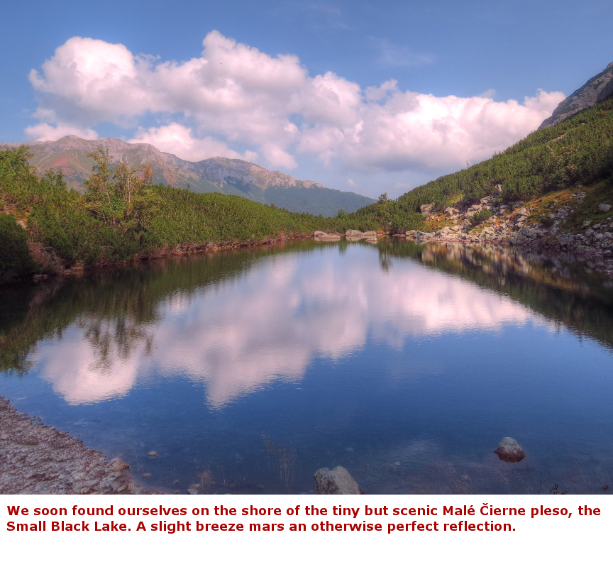
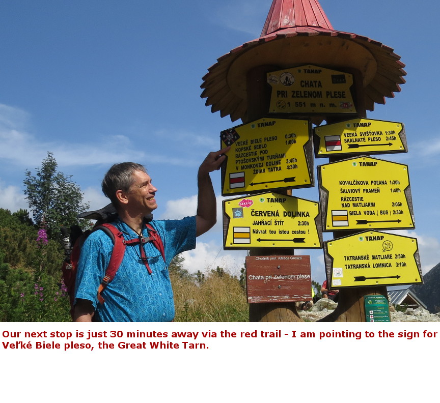
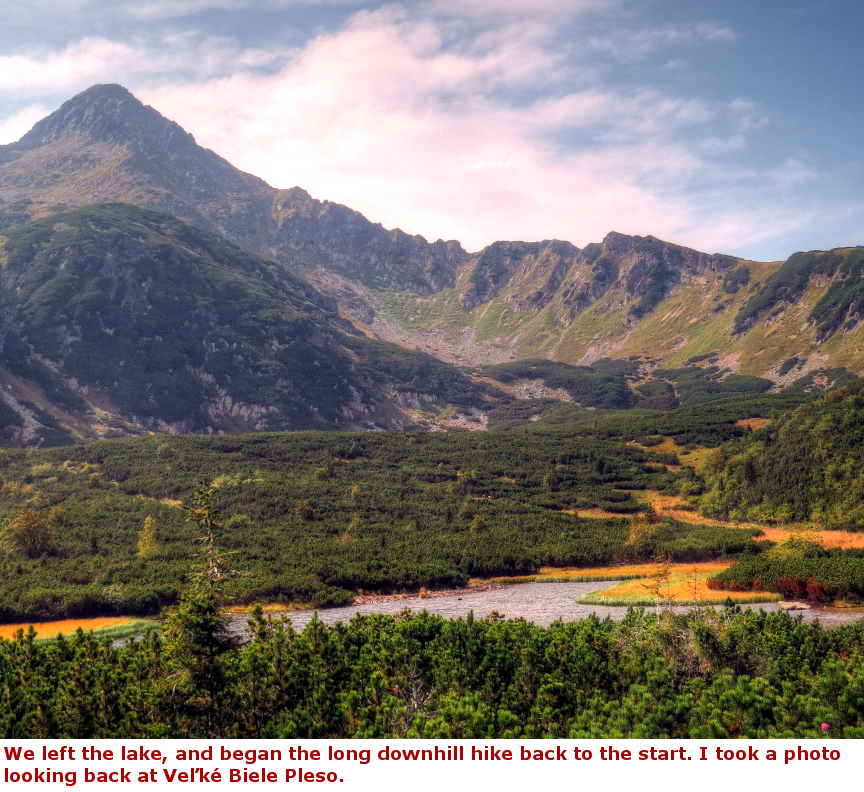
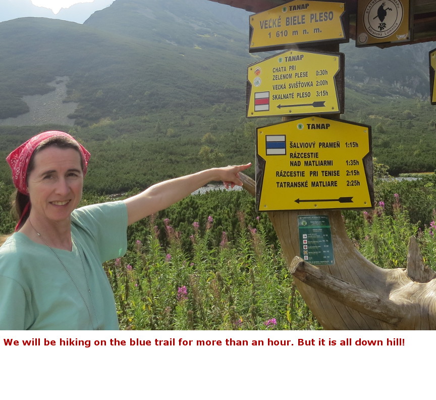
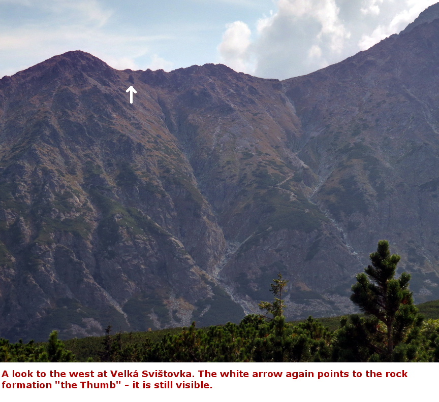
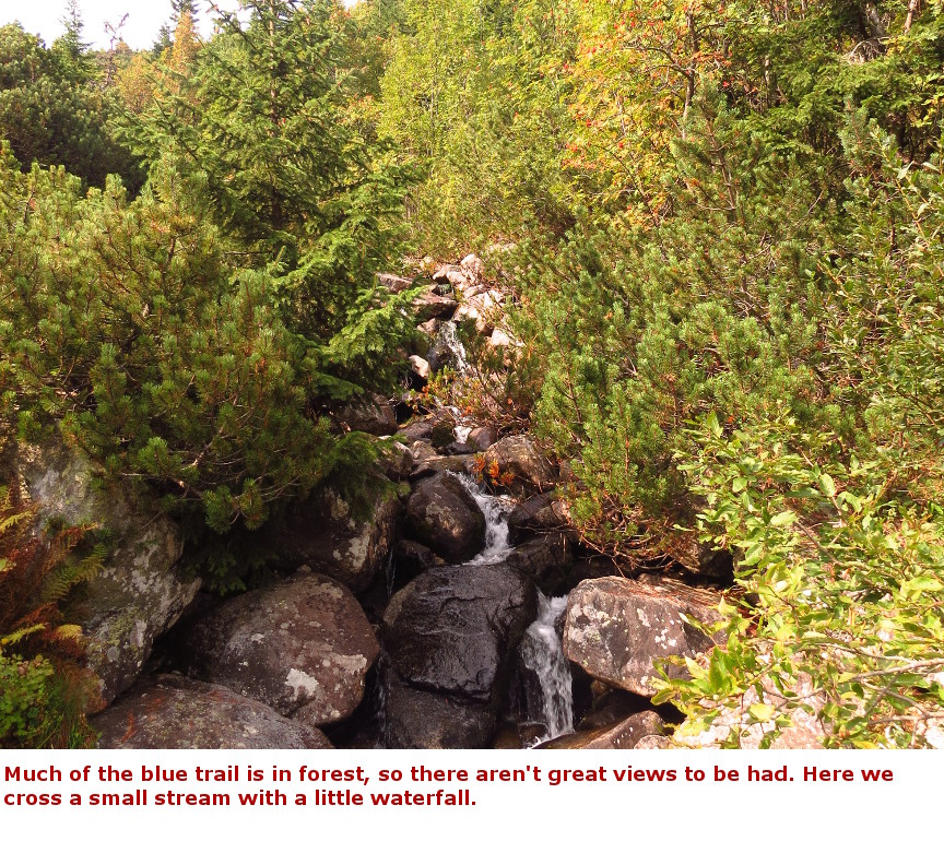
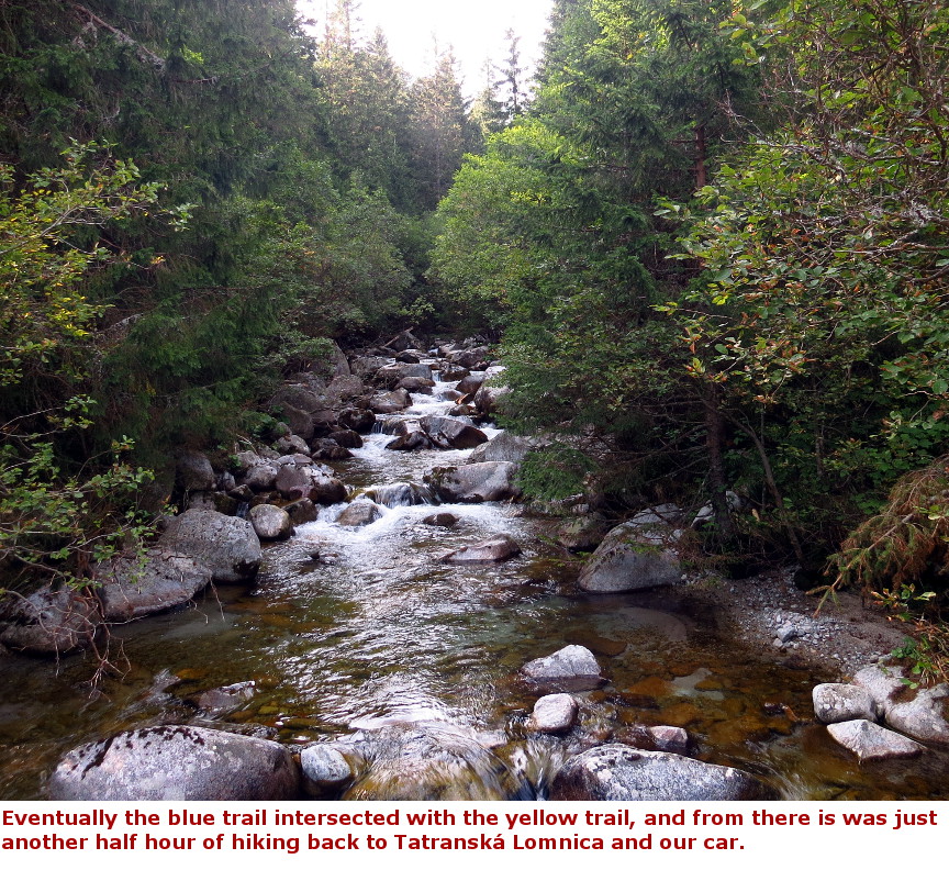
I picked out the Lomnický stit trail because it showed up on a number of lists when I was searching for "Best Hikes in Slovakia". The hike features plenty of High Tatras scenery, and, other than the climb to Velká Svištovka, it is almost all down hill. The reason that the trail is mostly down hill is that it begins by ascending from the village of Tatranská Lomnica up the mountain side to the summit of Lomnický štít on the Funicular. It cost 92 Euros (plus a 4 Euro deposit for our two tickets) - US$104 - to ride the funicular, but we were on vacation, so gladly paid the high price for the nice view. Lomnický stit was once thought to be tallest mountain in Slovakia, but modern measurements reveal that it is a few meters shorter than nearby Gerlachovský štít. Nevertheless, on a clear day, there are nice views from the top of Lomnický stit. We had clouds to the east of us, but great views south, west and north. After spending our allotted hour at the summit, we took the funicular partway down, getting off at the Skalnaté Pleso station - the hike begins from this lake. From Skalnaté Pleso, it is a climb of 251 meters to the top of Velká Svištovka, so it doesn't take long to get to the summit of this promontory. From there we enjoyed nice views in all directions. There were signs posted at the top identifying the visible mountains, so I took pictures of those signs and now I can name all the peaks in my photographs. Velká Svištovka looks directly down into Zelené Pleso (Green Lake), which is nestled in a cirque at the foot of the surrounding mountains. It is a long walk down to that lake; at one point there is a section where hikers are assisted with an anchored chain. We got passed by about 10 trail runners along this section of trail - they were wearing numbers, so presumably it was an organized event. Running is hard enough, I am always impressed by people tough enough to run up and down these mountain trails. There is a big chalet (Chata pri Zelenom plese - Cottage by the Green Lake) built on the shore of Zelené Pleso, with restrooms and selling refreshments. This is a nice spot to spend some time on a warm afternoon, but we didn't linger too long, because there are a lot of hiking miles to get back down to the village of Tatranská Lomnica. We studied the Tatras hiking map - it said that from Zelené Pleso we could hike for one hour and forty minutes along the yellow trail to reach the Šalviový prm intersection - or, we hike on the red trail for 30 minutes to reach Velké Biele pleso (Great White Lake), and then an additional one hour and 15 minutes of hiking on the blue trail would get us to Šalviový prm. In other words, taking the hike to Velké Biele pleso was only an additional 5 minutes of hiking time (the High Tatras hiking map doesn't give the trail mileage, instead it lists estimated times for each segment.) So of course we took the side hike to Velké Biele pleso, and were rewarded with more beautiful scenery of mountains surrounding a high altitude lake. The hike back to our starting point was now mostly through forests. The trail follows the course of the water that drains from Velké Biele pleso, so we walked down the valley with occasional views of a pretty mountain stream beside us. It seems like a long walk down, but it is easy miles, and we were back at the car by about 5 P.M. My knee, which had been bothering me since the long descent from Mt. Kriván, no longer troubled me and I was fine. Panorama Photos:


Maps:
This hike map shows an additional side hike up to something called Belianska kopa, at 5900 feet. Looks like it adds 1.2 KM each way, with about 700 feet of elevation gain. 


|
Single Click on any thumbnail to begin the slide show at that photograph Lomnický stit Photos 


|