

|
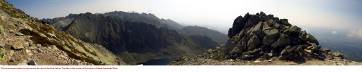
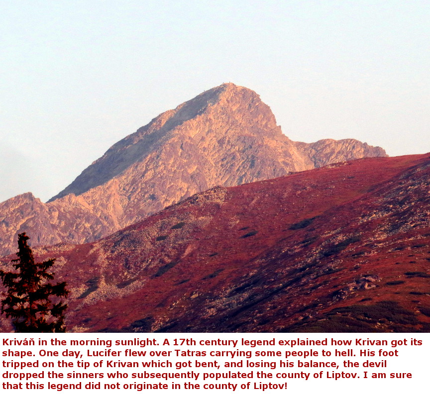
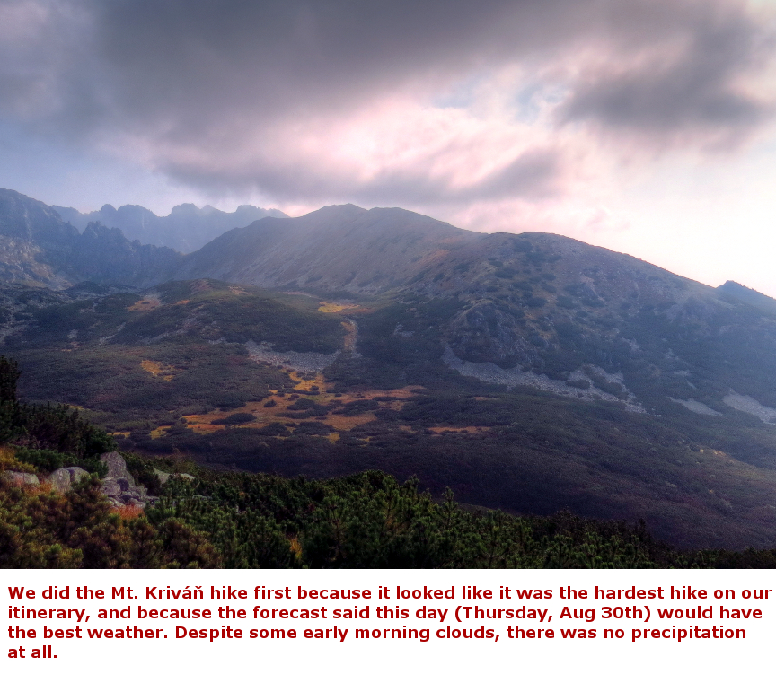
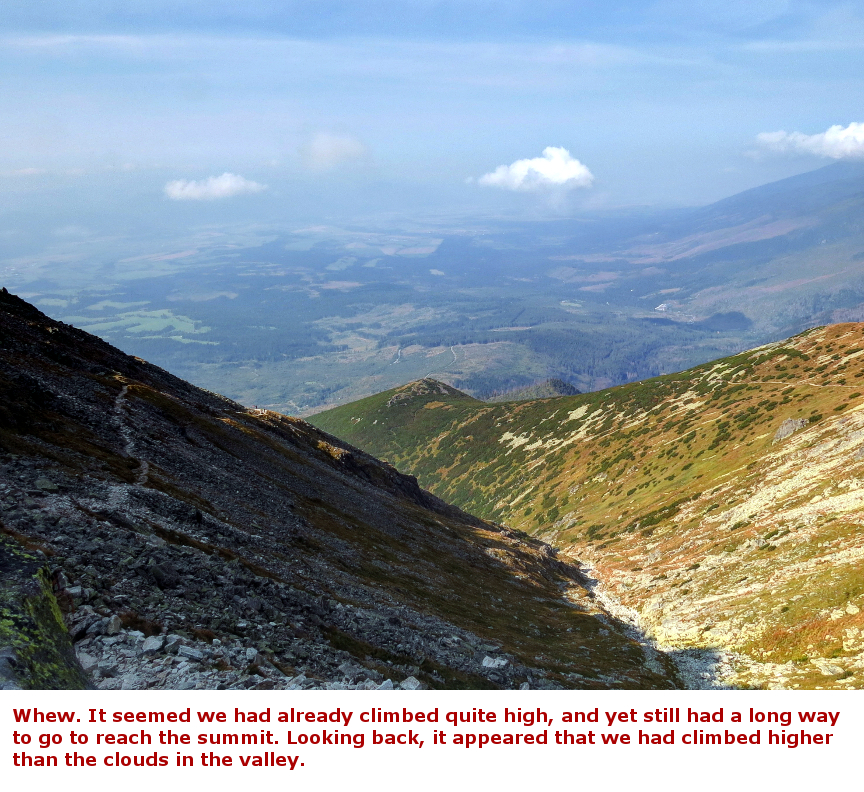
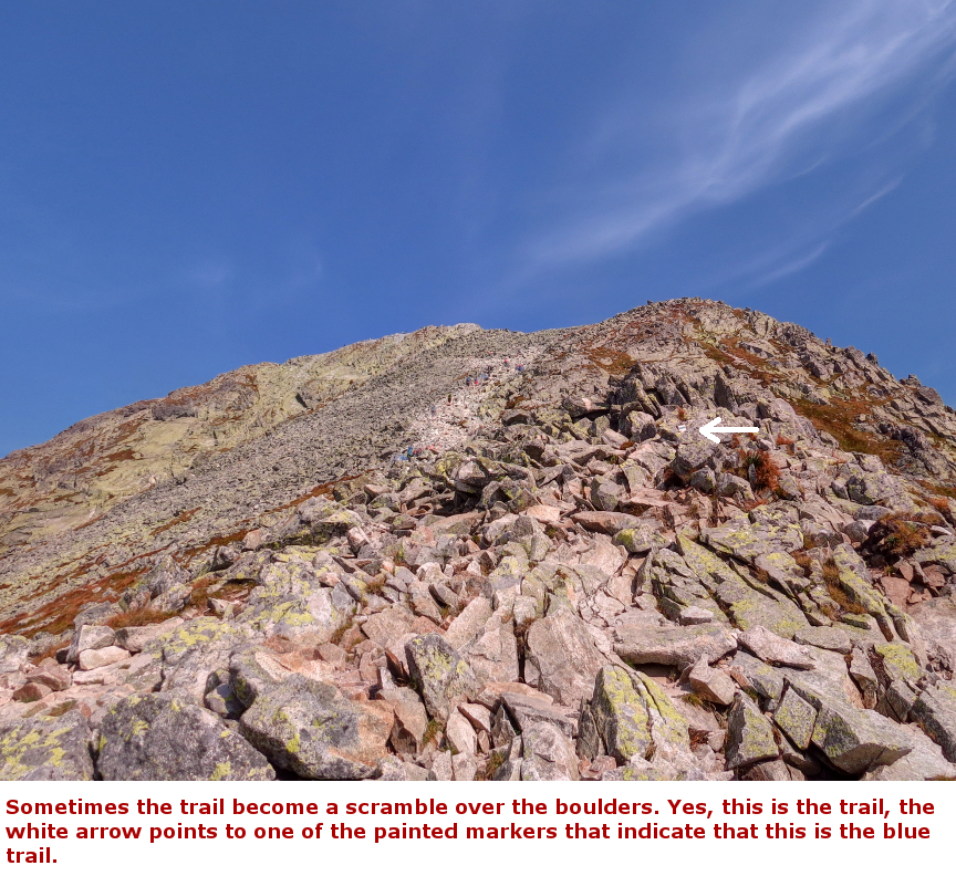
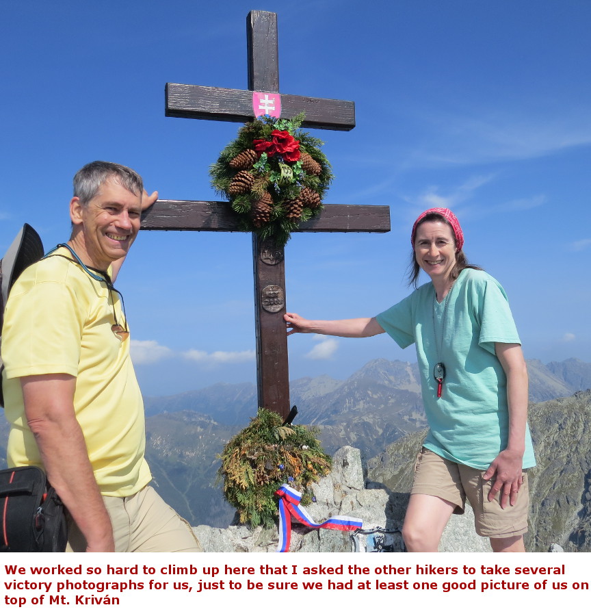
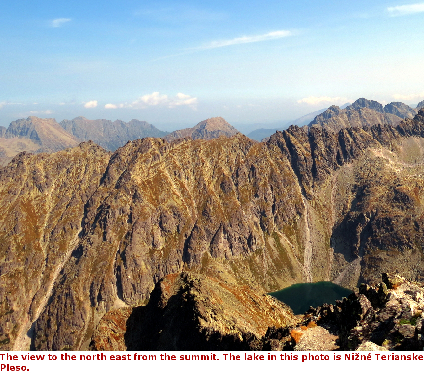
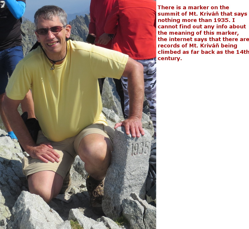
We devoted the last week of our Slovakia vacation to hiking. There are hundreds of hikes to choose from, I selected the hikes we did by searching the internet for the "Best Day Hikes in Slovakia", and then picking the hikes that showed up on multiple listings. Mount Kriván is one of the most popular hikes in Slovakia. It is 8.5 miles roundtrip, but with 4500 feet of elevation gain - this was a tough hike! Yet, even though we were hiking on a weekday, there was a large number of other hikers on the trail with us. I was glad we started early, when we were slowly ascending through the boulder scramble at the summit, there weren't too many other hikers around. On our way down, we encountered many more hikers coming up. I found the long descent actually more difficult than the steep uphill, my right knee ached for a couple of days after we completed this hike. We checked the weather report at the beginning of our week of hiking, and it looked ominous - thunderstorms or showers every day except for the first day. The hike up Mount Kriván is completely exposed, most of the hike is above the timberline, and up near the summit hikers have no shelter at all. Doing the Mt. Kriván first, on the one dry day, seemed like a good plan. There is some bouldering required near the top of this hike, so it is not a hike to try on a wet day. Also, the Mt. Kriván hike was the toughest hike on our selected list of hikes, so it was a good plan to do it first, while we were fresh and full of energy. There are two starting points for the Mount Kriván hike. We began at Štrbské Pleso, which has plenty of parking, but you have to pay when parking here. The start of the trail to Mount Kriván is not too hard to find - just follow the red trail to the west, and when you reach the junction with the blue trail, where you will begin the long climb. I was glad the clouds stayed away. Once we reached the summit, we were able to look for miles in all directions. Poland is visible to the northwest; the High Tatras mountain range is the border between the two countries. For a long time, Mount Kriván was thought to be the tallest mountain in Slovakia, but modern techniques for measurement reveal that its summit is only 8186 feet, while the peak Gerlachovský štít stands 8709' tall. Panorama Photos:


Maps:A close up of the contour map for the hike up Kriván. I put some black arrows to highlight the trails we took. The elevation gain is all on the blue, the red trail is more or less flat. 
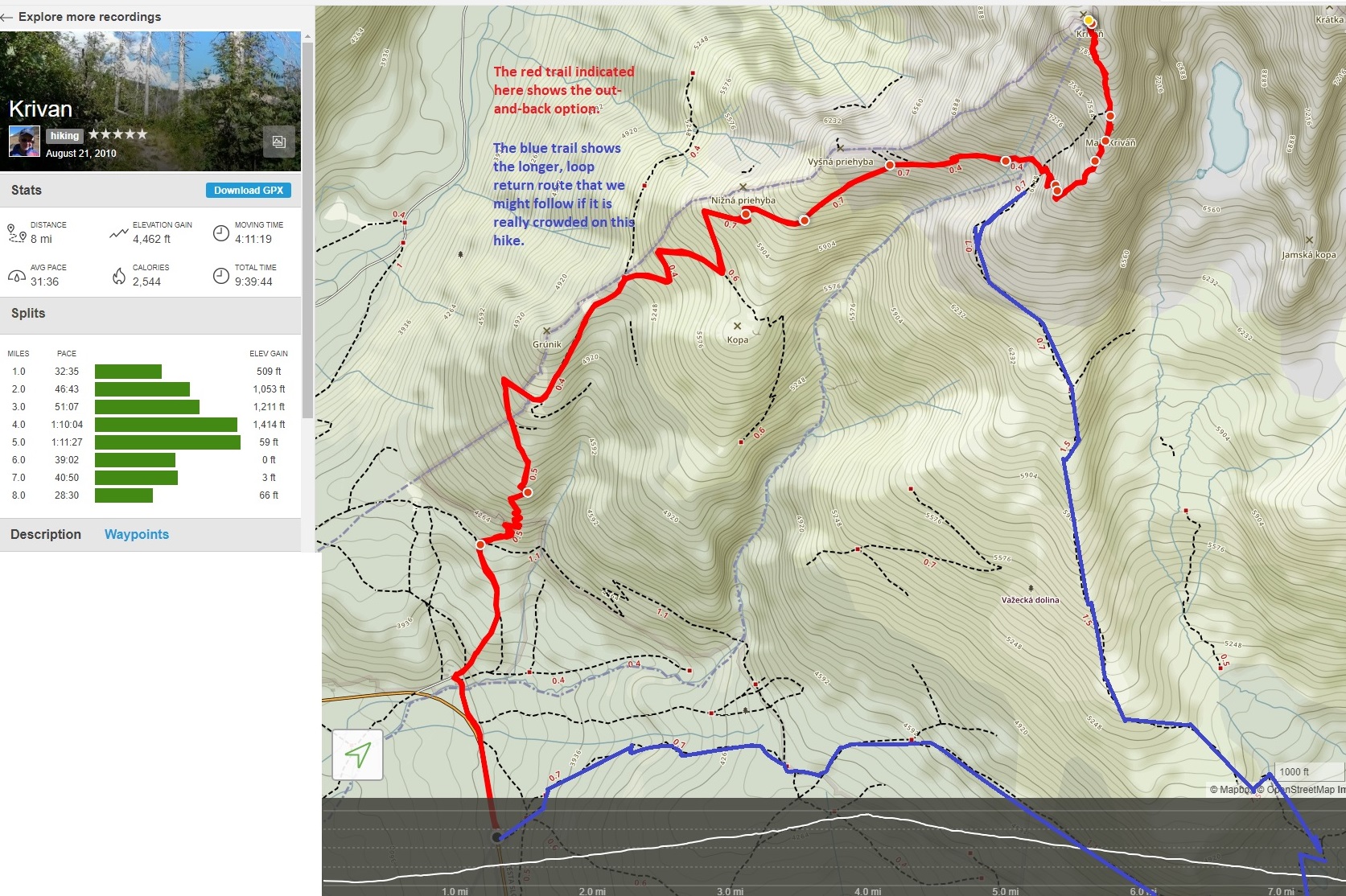
I am including some links to maps and trip descriptions from other people who have hiked Mt. Hike description if starting at Štrbské Pleso. 20 Km, 8 Hrs This trail description of Kivran has some good photos and shows the crowds on trail. This Kriván trail map shows (in red) that the hike is 8 miles (12 Km) if you do it as an out and back. If you do the full loop hike, up on the red trail, and returning on the blue trail, then the hike is 15 KM long. There is also an option to start hiking at Štrbské Pleso, which is an 18 KM roundtrip. On line trail map showing route from Štrbské Pleso 


|
Single Click on any thumbnail to begin the slide show at that photograph Mt. Kriván Photos 


|