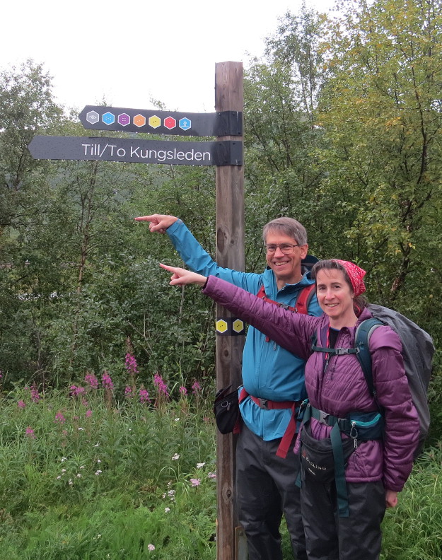
Kungsleden: Abisko to Nikkaluokta
August 22 to September 2 2017
|
This is the story of our trek along the Kungsleden (the King's Road) in the summer of 2017. I went with Melanie and Anthony and his wife Anneka. The entire
length of the Kungsleden is 440 KM; we only hiked the northernmost portion of the trail, which is supposed to be the most scenic stretch.
Getting to Sweden turned out to be difficult. We flew from Seattle to Cologne, and then from Cologne to Stockholm. However, our Eurowings flight from Seattle took
off two hours late, and we only had an hour and fifty minute layover in Cologne. We ended up running to the plane in Cologne and making it to Stockholm, but Eurowings left our bags in Cologne. I was disappointed with
the Eurowings company the entire way, their help at the airport was non-existent. We had to go to SAS at the Stockholm airport to try to find our bags.
We considered waiting an extra day in Stockholm for our bags to arrive, because most of our hiking gear was packed there. Perhaps we could start on day late on the trail and try to make up time on the Kungsleden?
We made the decision to stick to our original schedule and flew out to Kiruna the next morning. At the Abisko Mountain Station we spent over 10,000 Swedish Krona buying new gear for our hike. It was super expensive, but at least the new
gear was good quality. Unfortunately, Melanie had packed her hiking boots and wore tennis shoes on the plane. She didn't want to try wearing new boots on the Kungsleden, so she did the entire hike in her sneakers. That's probably a
first for Kungsleden hikers.
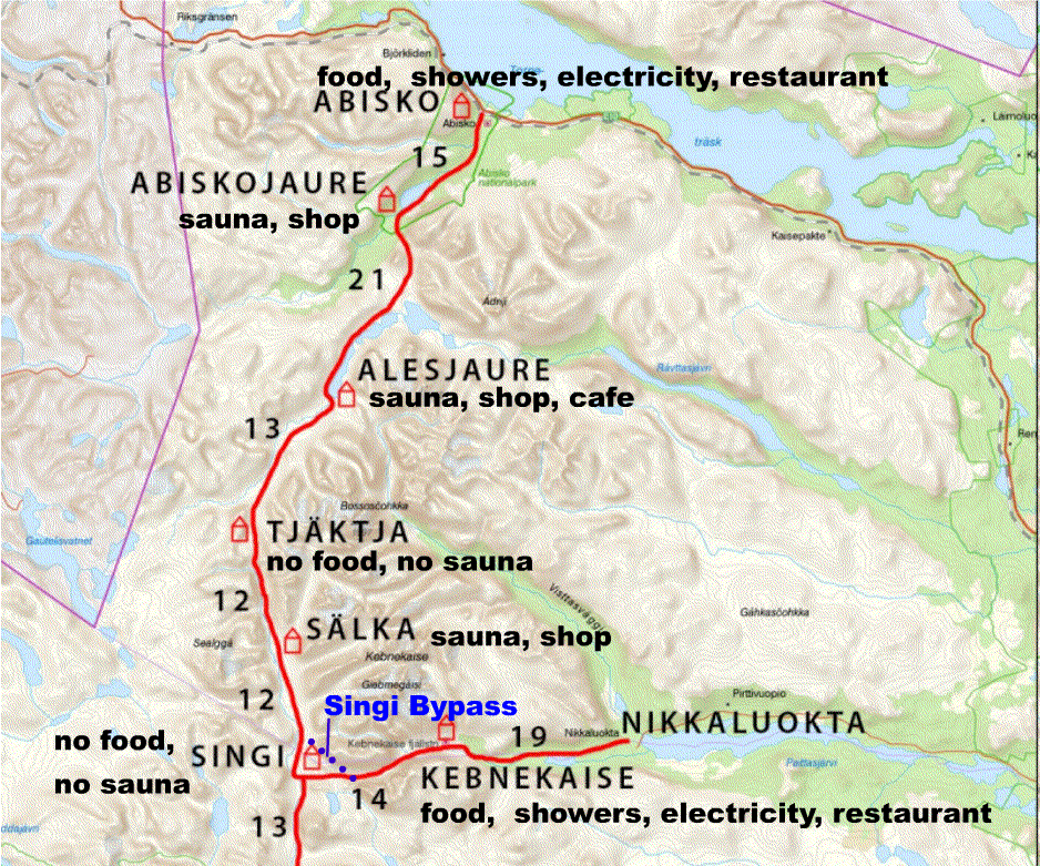
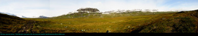
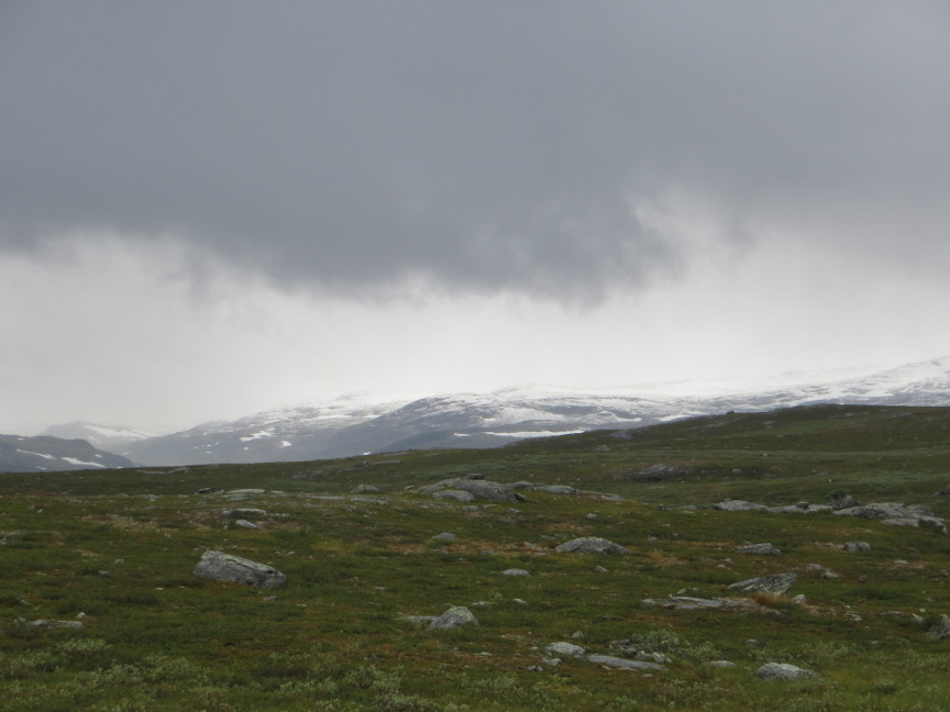
Here is a map of our Kungsleden route. We hiked from north to south, skipping the hut at Singi, and spent two nights at Kebnekaise. Kungsleden Day 1 After a hearty breakfast buffet at Abisko Mountain Station, we started our Kungsleden hike before 9 AM. We had 15 KM to go on the first day, to the hut called Abiskojaure. The forecast
called for rain on this day, but it didn't start to fall until about half way through our hike. When it did fall, it was more of a drizzle than rain. Misty and wet and cool today.
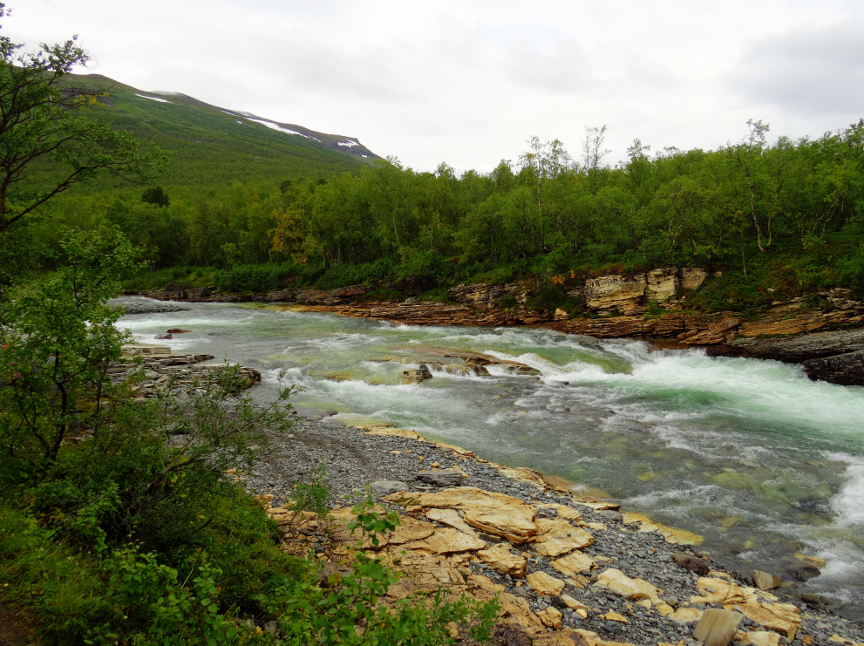
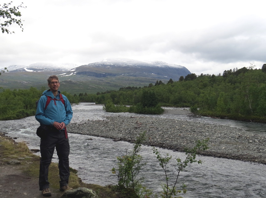
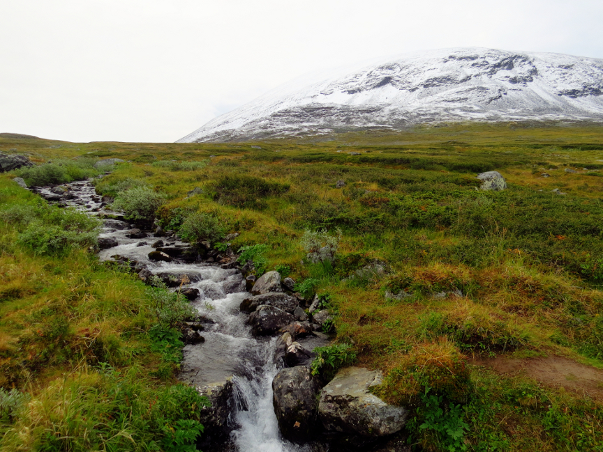
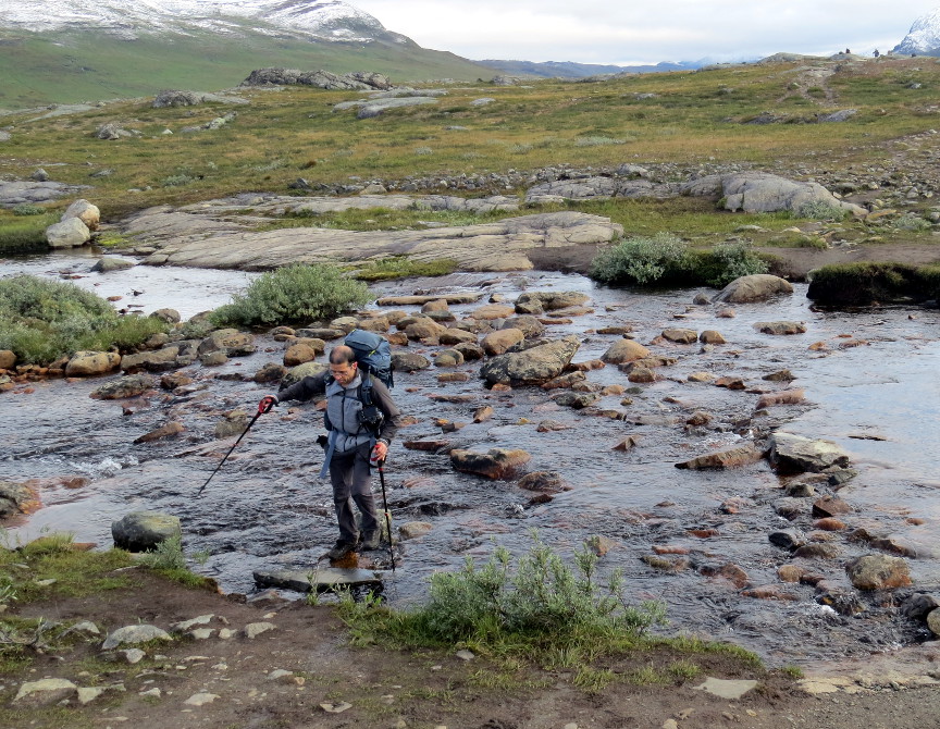
The first few kilometers were along the eastern bank of the Abisko River. Since our hike was in August, the water level at an end of summer low. We followed the course of this river all
day. At the start of our hike, we walked amongst beech trees in a forest. We were headed gradually uphill all day, and by the end of the day the trees had mostly disappeared. We didn't see trees again until we reached Kebnekaise. We
were hiking on the tundra!
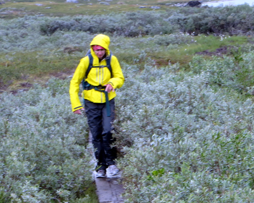
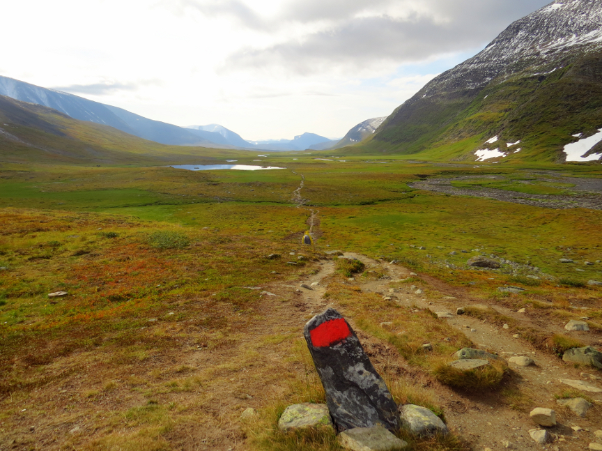
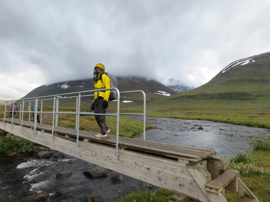
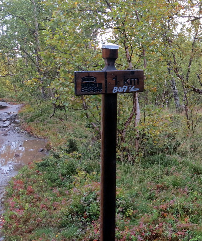
The tundra is a wet place in the summer, with streams, shallow pools, marsh land and mud. The trip would be an unpleasant slog, except the Swedes have placed kilometers of boardwalk over the
wettest stretches. Instead of wading in the mire, we easily walked over the landscape. True, in some places the wooden boardwalks had rotted and needed to be repaired, and other muddy stretches could have used boardwalks, but overall the
amount of infrastructure that maintains the Kungsleden is nicely done. Bridges took us over every river, we didn't have to wade.
Around us, the mountains had a dusting of snow, even though it was late August.
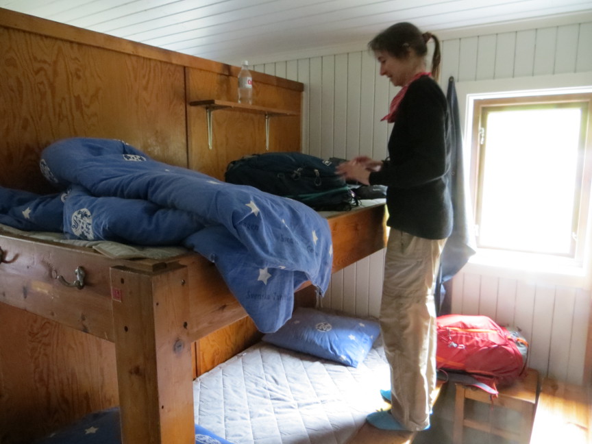
At Abiskojaure, we bought some food at their store, and cooked it using the gas stoves in the kitchen. The bunks at Abiskojaure are in two large rooms, with about 20 bunks per room. We went to
bed early, but in the evening a large group of Germans arrived late. They spent noisy hours loudly cooking a big meal and drinking during their dinner. Then there was more racket as they shoved aside all the tables and put down mattresses to
sleep on (all of the bunks were occupied, but the Kungsleden huts store extra mattresses for the overflow of patrons.) I slept poorly that night, and I was disheartened to think that this boisterous crowd would be following us every step of the
way down the trail. But fortunately we never saw them again! Kungsleden Day 2 Today was one of the longer stages - we had to hike 21 km to the Alesjaure hut. We started exactly at 8 AM. It was already drizzling at the start, not pleasant hike weather. It was also quite cold, during the
day the light rain sometimes turned into snow flurries. The clouds hung low, so we couldn't see too much of the landscape, but I could just tell that if the mist would disperse, then the scenery would be spectacular. The rain made the rocks slippery and we all
slipped a couple of times. The cold froze the water on the boardwalks, so there were patches of ice on the wood. I was grumpy from the lack of sleep the night before, and I admit thinking as we hiked this first portion of this stage that coming up to the Swedish
tundra might have been a big mistake.
We walked without stopping, it was too cold to stop moving. I kept my hood up and my hands inside my pockets, occasionally bringing them out to try for a photograph. After lunchtime, the rain stopped and the clouds
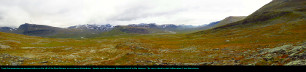
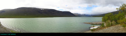
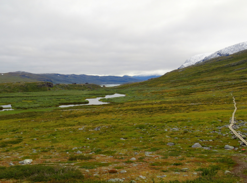
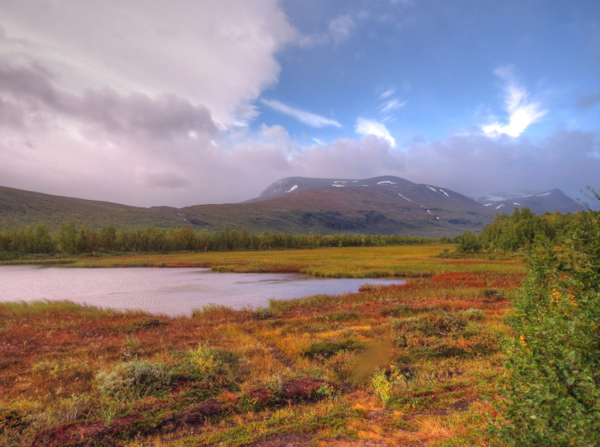
began to lift. The last stretch to Alesjaure is along the shore of a lake, and we started to see more of the famous scenery. Although it did not seem that we had been climbing, the day's hike sloped uphill. We were above the tree line, the open landscape stretched for
miles in all directions to the mountains. The low mountains appeared to be smoothed, as if massive glaciers had once crunched through these valleys, polishing the sharp rocks and abrading away any jagged outcrops.
By the time we reached Alesjaure, there was some sunshine. We saw a rainbow, and we could see just how nice the Swedish landscape could look. My mood lifted greatly, and I enjoyed the rest of the trip.
Alesjaure was a nice hut. We were given a room with just 4 bunk beds, so it was quiet. The store was amply stocked, so we bought a big bag of pasta and cooked up some spaghetti for dinner. In the late afternoon, we
went down to the sauna and were able to wash up. It felt good to be clean, and I wished I had used the sauna back at Abiskojaure the night before.
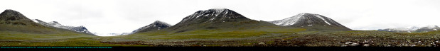
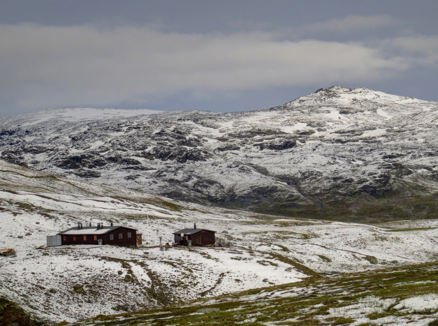
Kungsleden Day 3 Today was a good day. We started early, because we knew Tjäktja Mountain Hut had only 20 bunks, and so it would fill up fast. We were on the trail by 7:15 AM, and ended up passing a number of the other hikers. We arrived at
Tjäktja before noon, and we were the first ones there. We had our pick of which of the five rooms (four bunks each) would be ours. We arrived so early that we cooked some pasta for lunch, and then we had the second half of the pasta for dinner.
The weather was ideal today. We had clear skies and some sunshine, so at last we could enjoy the expansive views of the Kungsleden. Tjäktja Mountain Hut is located just below the pass, so it is the highest place we stayed. As we walked
up the gradual slope toward the hut, we could see more and more snow on the ground. Despite the sun, the snow didn't melt. But it didn't seem cold to me.
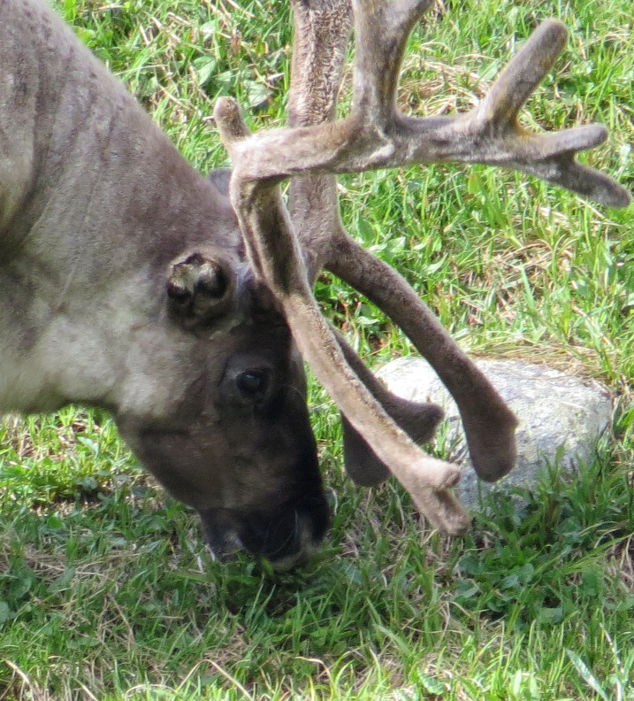
Today we saw our first reindeer. The reindeer were up ahead on the hills. Briefly, they stopped on the ridge and were easily visible against the sky, but then they ran over the hill and disappeared.
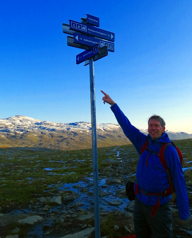
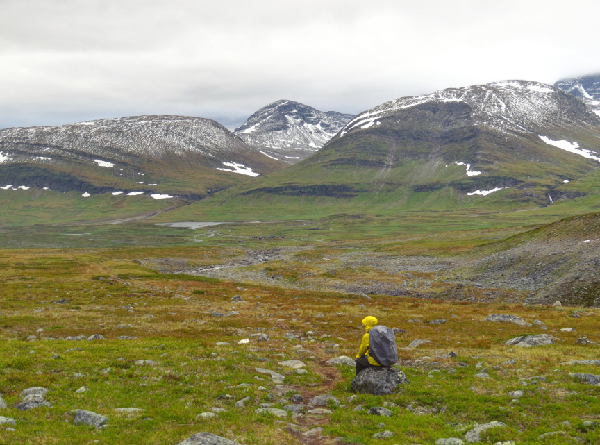
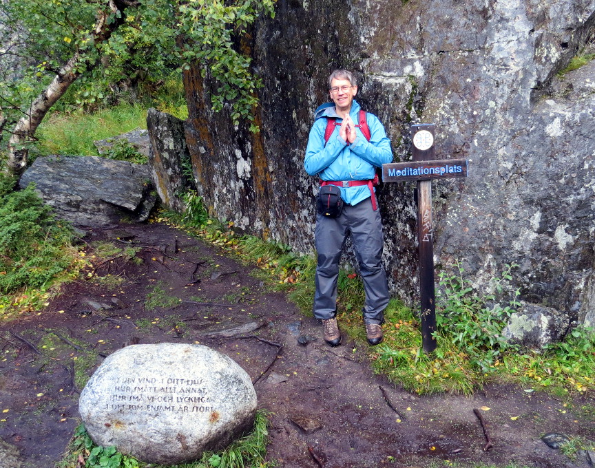
Just to the west of Tjäktja is a low mountain, called Muorahiscohkka. The Tjäktja hut warden told me that a day earlier many of the hikers had climbed to the top of Tjäktja for fantastic views, including being able to see into Norway.
(The border between Norway and Sweden is only a few kilometers to the west of the Kungsleden at this point). But with all the snow covering the slopes, it didn't look safe to climb Muorahiscohkka. However, Melanie, Anthony and I did climb as high as we could, stopping below the steepest
part of the ascent. From that height, we got a fantastic view of the area, especially looking all the way back to the north, toward Alesjaure. We watched as people slowly walked up the Kungsleden - some of the hikers turned in to stop at the hut, but some kept going, heading over the pass
and onward to Salka.
We talked to a hiker at Tjäktja, it turned out he was from Seattle. In fact, he lived only about a mile away from us, and shopped at the same grocery store! Small world. We also talked to 3 guys from Carnegie Mellon - we ended up seeing them
at each hut for the rest of our hike.
Anneka said she saw a ptarmagin when exploring near the base of the waterfall, so I went out to look after dinner. I didn't spot the ptarmagin, but on the distant mountainside I saw a large herd of reindeer. There were still hikers walking on the
Kungsleden at that hour, but I guess there were still 4 to 5 hours of daylight left at that latitude. Kungsleden Day 4 In the morning, the guys from Carnegie Mellon showed us time lapse photography that they had taken during the night - while they slept, Nikhil had set up his camera to take long exposure photographs of the night sky until the battery on his camera died. The result were impressive pictures showing
bright green activity of the Northern Lights. Amazing display of the aurora, and I slept right through it! I even got up during the night around 2 AM and went out to use the outhouse, but I did not see the shimmering green curtains. I couldn't believe we had been so close to such a memorable sight and missed it.
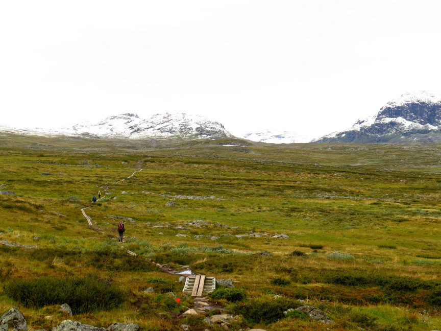
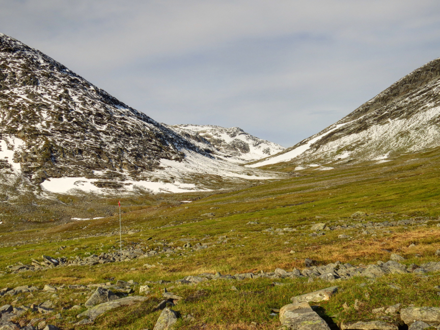
Another fantastic day again, with stupendous scenery and excellent weather. Our destination was the Salka Mountain Hut, just 12 kilometers away. It was clear and cold, but there was no wind. I spent most of the day hiking in just my long sleeve shirt, without a jacket.
The Tjäktja pass is only a few kilometers from the Mountain Hut. It isn't much of climb to reach the pass, in fact, no where on the Kungsleden did we have any difficult climbs. The only real challenge on this trek is the weather. It was icy on the ground on the walk up to the pass, but we soon
reached the summit. There were two couples there ahead of us already, so they took our victory picture at the top of the pass. We would see one of these couples again (the Australians), but sadly, not the other two.
After walking down from the pass, we soon were below the snow line, and found ourselves taking a glorious sunny walk across the tundra. We spotted a large herd of reindeer on the distant mountainside - the day was so warm, the reindeer had congregated on low patch of snow to cool off!
We reached Salka by noon, and had lunch there. We were assigned a room with 6 bunks, so another couple would be joining us - it turned out to be the same Australian couple (Susan & Peter) we had met on top of Tjäktja Pass. They told us a sad story - remember how I mentioned that there were two couples we met on the
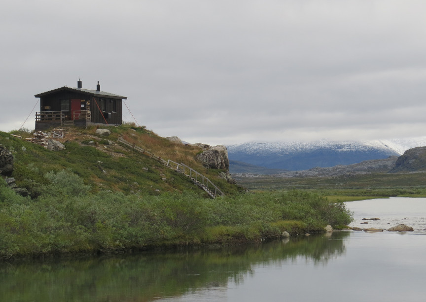
top of the pass? The second couple suffered a mishap and couldn't finish the trek. The Kungsleden has an impressive amount of infrastructure, including bridges over all the rivers. One of the bridges was missing the bottom rung of the low ladder that climbed up to the bridge span. The woman took a big step up to the second step, over the missing rung, but she over
balanced, and the weight of her pack pulled her back, and she fell and broke her arm. It was too painful for her to walk. Fortunately, Susan and Peter carry an emergency beacon that can be activated any where in the world. Since they happened to be hiking right behind the couple when she fell, they saw the accident happen and were right there to try and help.
When it became apparent that the injured woman would be unable to walk, they activated the beacon and in a few hours a helicopter appeared and transported the hurt woman back to civilization. Bad luck on the fall, but awesome luck that someone happened to have an emergency beacon right at the scene.
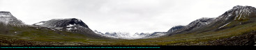
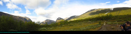
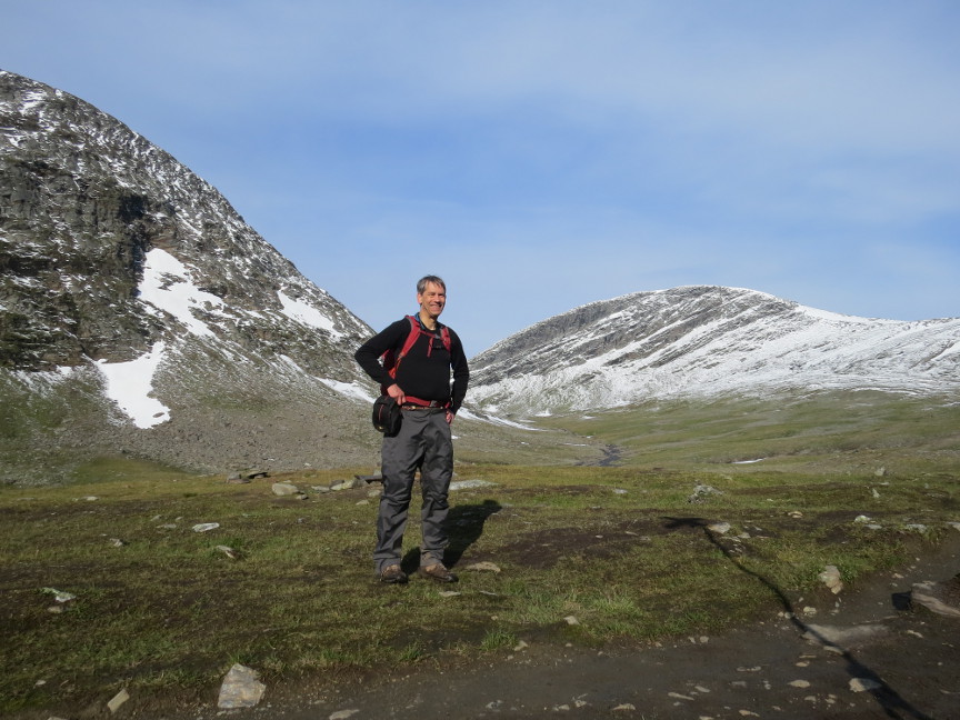
After lunch, we decide to do a day hike up the Reaiddavaggi Valley. One website calls this one of the most scenic valleys in Sweden. We hiked up a hill and over a long stretch of boulders, and found ourselves in a valley with snowy mountains on both sides. There is actually a Mountain Hut located in this valley,
the Nallo hut, but it was 10 KM one way to reach from Salka. We only hiked about 5 KM from Salka, far enough so that we could see the Reaiddjavir Lake, and then turned around and hiked back. We cooked dinner and cleaned up at the sauna. It was a great day for us. Kungsleden Day 5 We got a very early start this morning, we were hiking before 7 AM. Today was our longest day, 23 KM, so we wanted a good start. The weather was perfect that early in the morning,
it was warm, the clouds were high in the sky, and sunlight illuminated the nearby mountains. I took a lot of photographs. It was a great day.
In fact, it was so warm that as we walked south mosquitos made an appearance. I had assumed that the snowfall that we witnessed a couple of days earlier would have killed off all the
mosquitos, but perhaps it wasn't as cold at this elevation. The bugs were only bad if we stopped walking, so we kept moving.
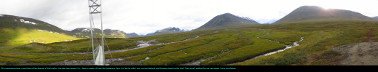
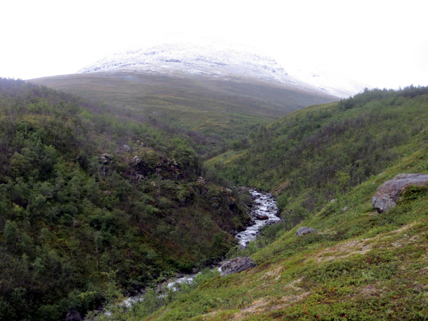
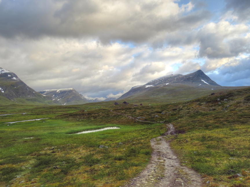
After 9 KM, we came to the fork in the trail. The official Kungsleden route continued south to Singi, but the "Singi Bypass" led up and over a hill to Kebnekaise. The hill was only a few
hundred meters high, so walking up it was not a challenge. The rain began to fall as we reached the top of the hill, and it continued as we descended down into the valley that led to Kebnekaise. Everyone slipped several
times on the rock and mud. But there would be hot showers tonight!
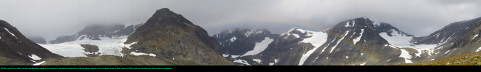
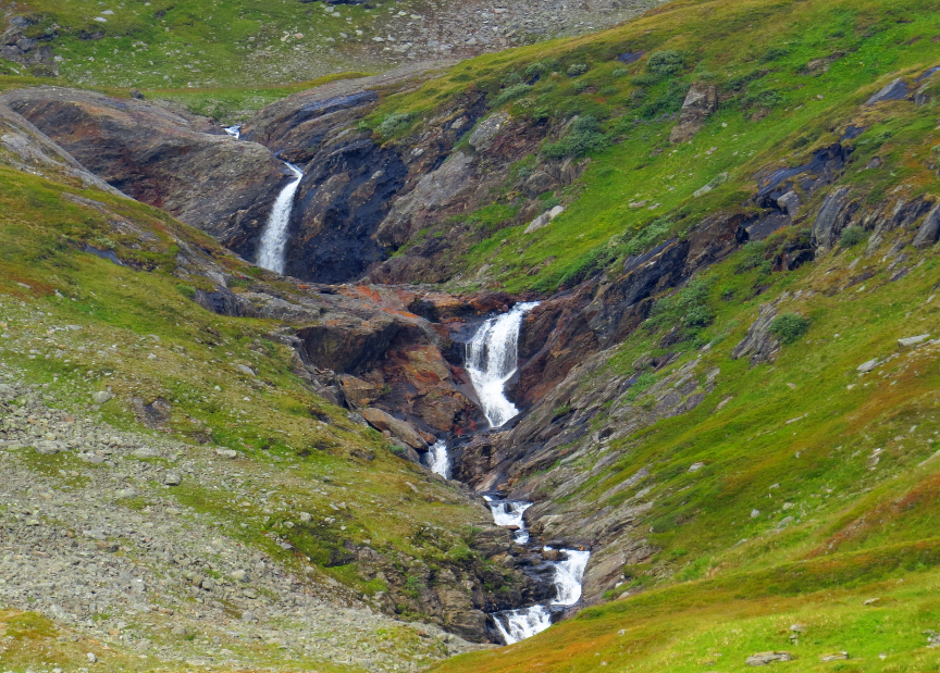
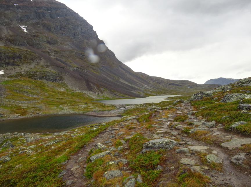
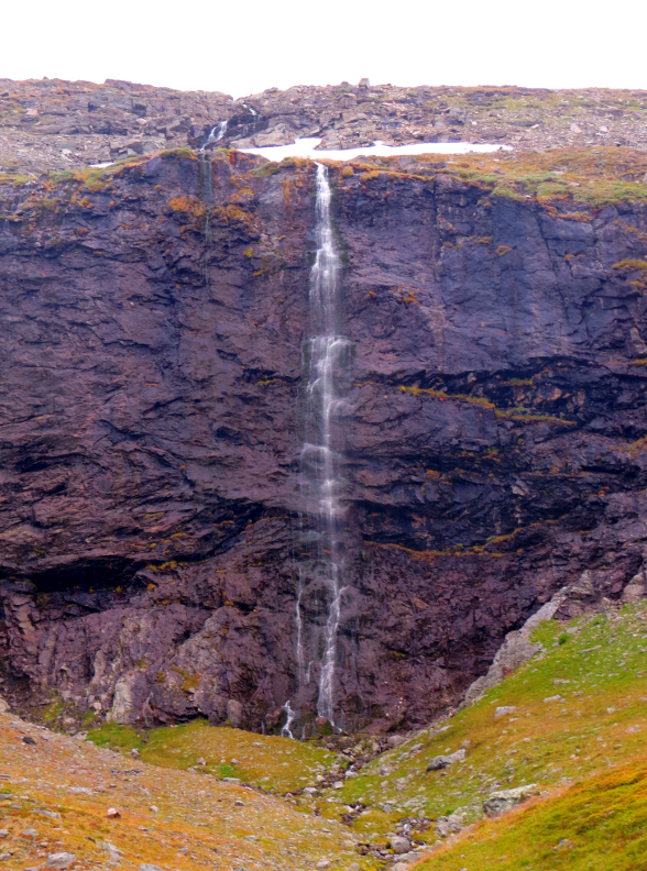
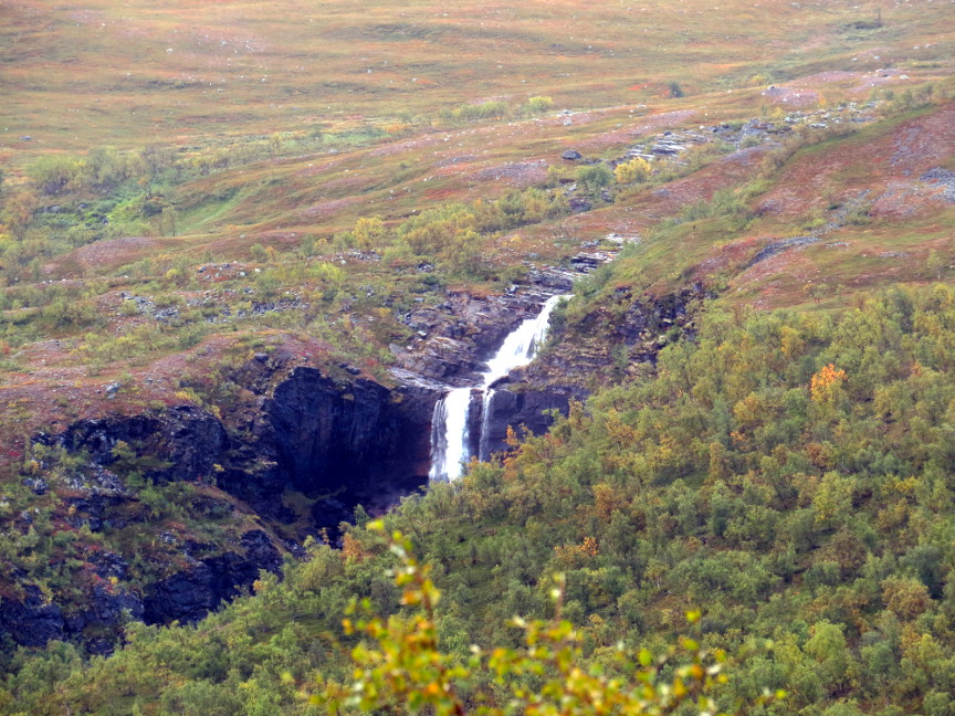
It's unfortunate that the clouds obscured the scenery on this part of our hike, because there were tall mountains on both sides of us, it could be some nice scenery. We could see waterfalls
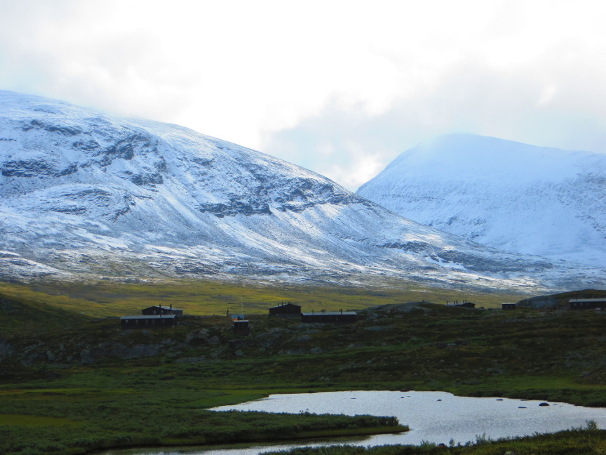
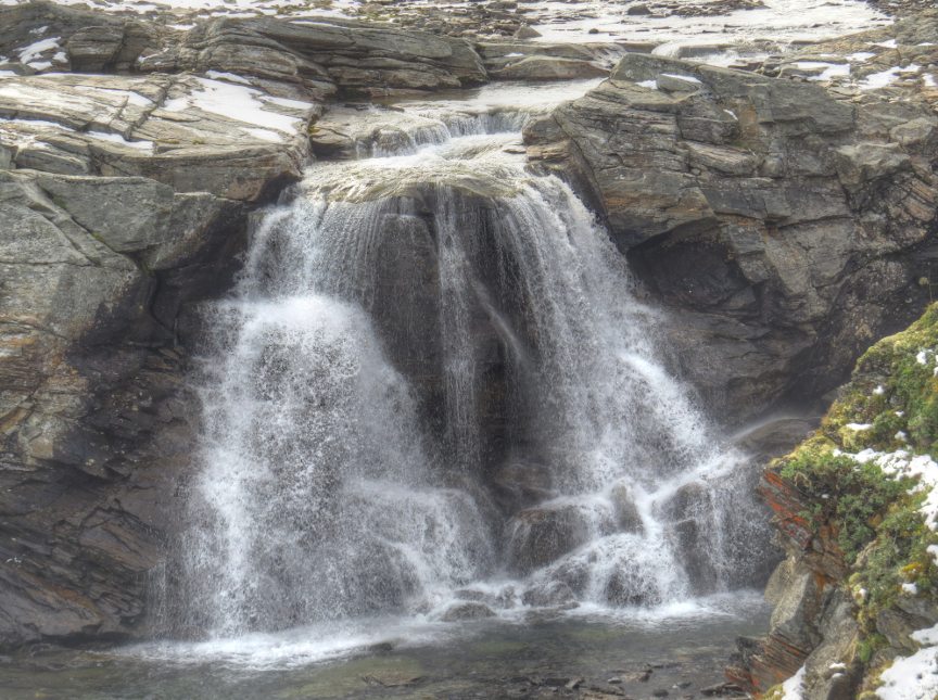
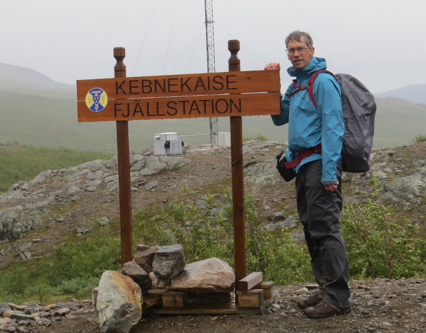
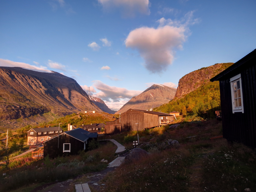
bouncing down the mountainsides from great heights, but we couldn't see the tops of the mountains. The valley widened into a basin. We crossed over a bridge next to a beautiful waterfall. After a bit of uphill hiking, we reached Kebnekaise.
At Kebnekaise we had reserved a 4 person room. There were two showers in our building, which had about 20 rooms - so by the time we tried to get our showers, there was no hot water left. We
decided to take our showers after dinner.
Dinner was at the Kebnekaise restaurant. It was an arrangement that I still don't understand - patrons were seated at long tables, we seemed to have been seated with other English speaking guests.
The Kebnekaise waiters then gave a LONG speech in Swedish - it must have lasted 15 minutes. Then each table was permitted to fill a plate with appetizers from the buffet. Apparently, they forgot about our table, because after a long wait after all
the other tables had visited the buffet, we ended up just getting up and walking to the buffet on our own. When they served the main course of the dinner, it was pretty good.
We set an alarm for midnight, and went out in the cold to look for the northern lights. It was hard to see anything, so we ended up splitting up, each of us seeking the darkest spot away from the
lights of Kebnekaise. I did see some lights moving across the sky, but they were very faint, without color. So technically, I did see the Aurora Borealis, but again it wasn't anything like the big sheets of green that you see in the professional photographs. Kungsleden Day 6 The next morning, we met Nikhil and the other Carnegie Mellon students at breakfast. They told us that they had seen a fantastic display of the northern lights at 11 PM, and showed us photographs of green curtains of light.
Aarggh! When we went out at midnight, we could barely see anything in the sky. We missed an awesome display by just an hour. Such rotten luck. Nikhil and his friends were headed off to climb Kebnekaise, the tallest mountain in Sweden. Our plan was to take a day hike up to
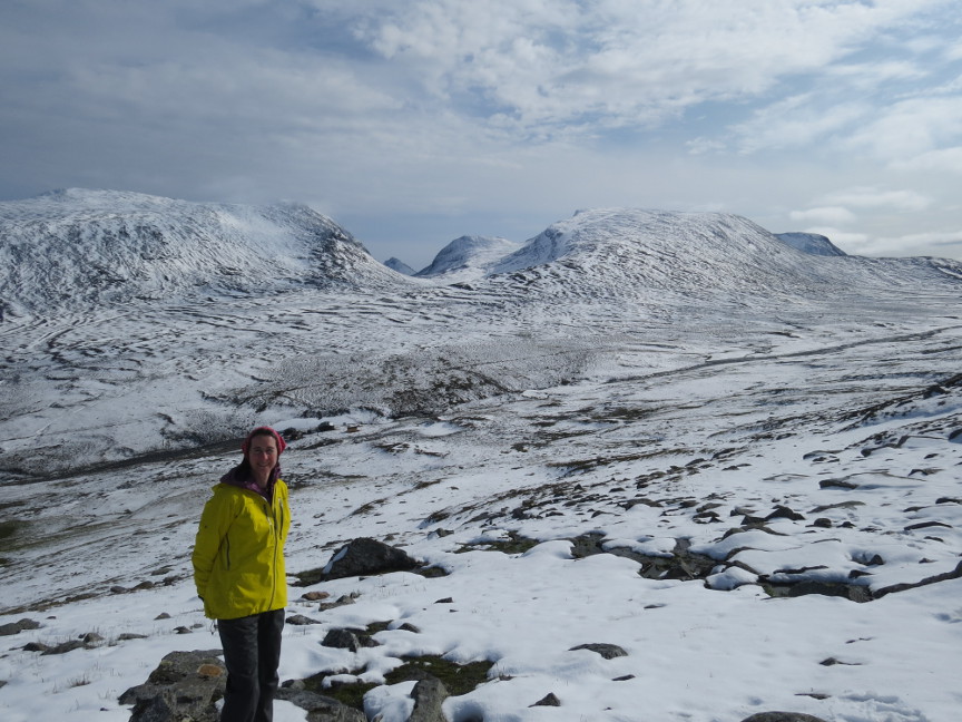
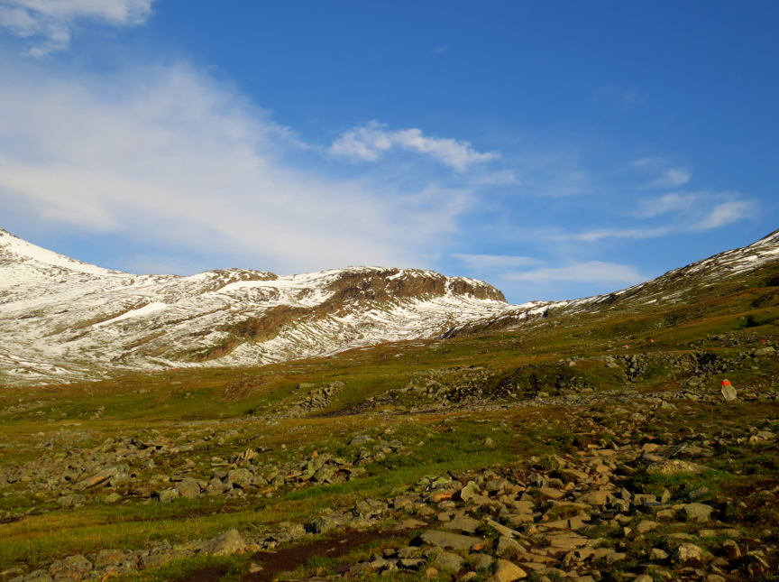
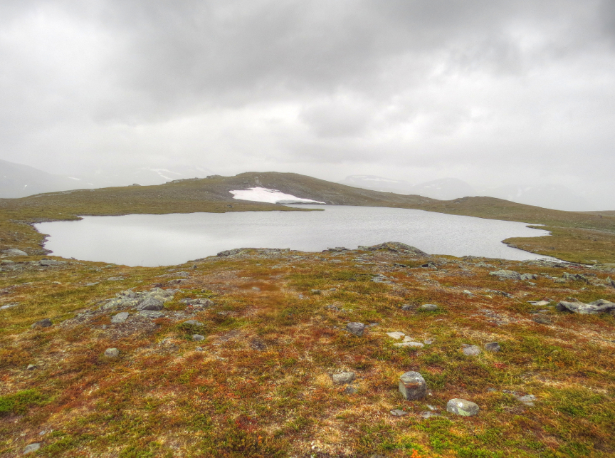
Darfaljavri Lake, a hike of about 9 KM in each direction. We started hiking before 8 AM, so again we saw interesting morning sunlight on the surrounding mountains. There were some clouds on this day, but we didn't experience any rain.
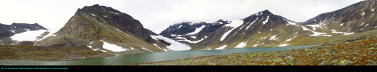
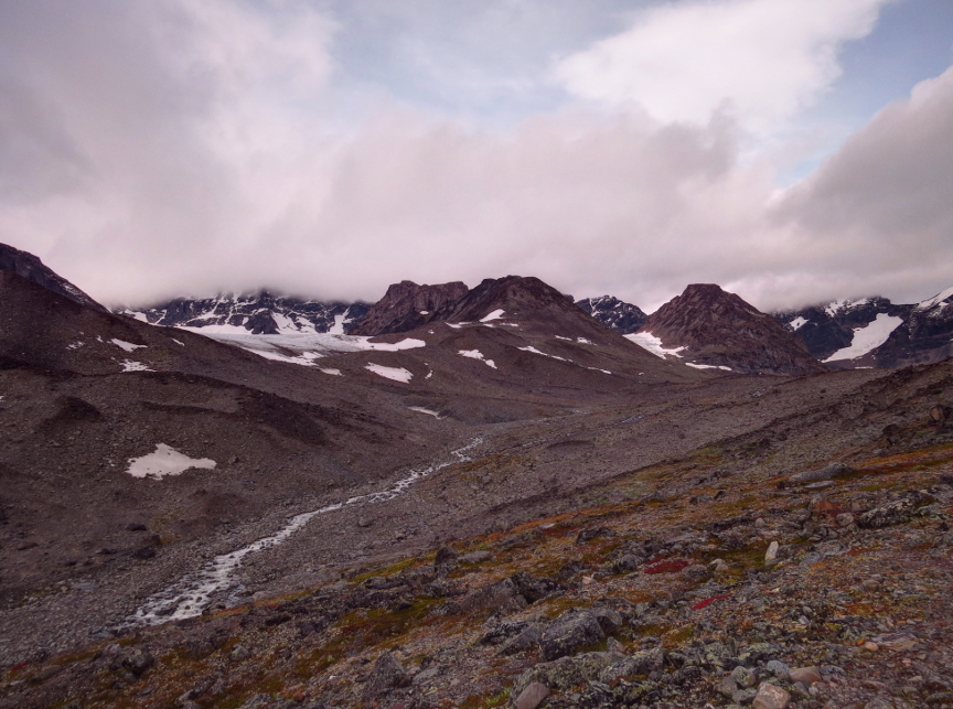
The hike to the Darfaljavri is uphill, following the stream that drains the lake. We soon climbed above the tree line and found ourselves in a narrow valley. At the end of the hike, after crossing a big field of boulders, we
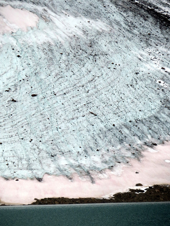
reached the lake shore. The Darfaljavri isn't that big, but it is surrounded by jagged mountains, and a couple of glaciers flow down the mountain. Plus, we briefly saw a rainbow when we arrived at the lake, so that was a nice bonus. It turned out to be windy near the lake, and
it was a cold wind, so we took our photographs and didn't linger too longer before heading back to Kebnekaise.
On our way back to the Mountain Station, we saw a solitary male reindeer browsing in a meadow. He didn't seem too concerned by the presence of humans, so we were able to get some up close photographs.
We repeated our routine for dinner at the Kebnekaise restaurant. The best part about these meals is talking to other hikers and learning about all their adventures. There are a lot of people out there who
spend a whole lot of time traveling.
That night it was too overcast and cloudy (and windy!) to go out and check for the northern lights. However, there was a solar activity website (you can get wifi in the main building) that predicted a big solar storm on the next night. Kungsleden Day 7 This was our last day on the Kungsleden hike. 19 KM to Nikkaluokta, but it was a flat, easy hike. We left at 7:30 AM and finished by 1 PM.
It was misty and drizzling when we started, but not enough to get anything really wet. The preciptation tapered off, and for the rest of the day the hike was dry.
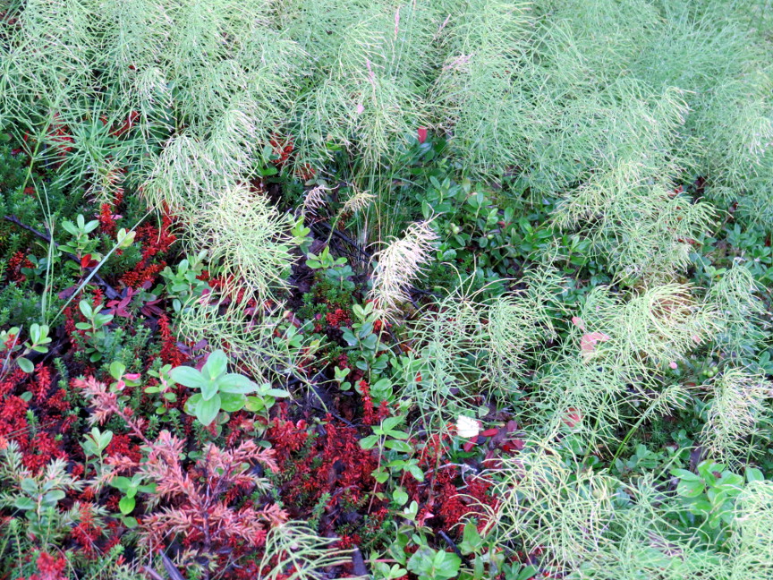
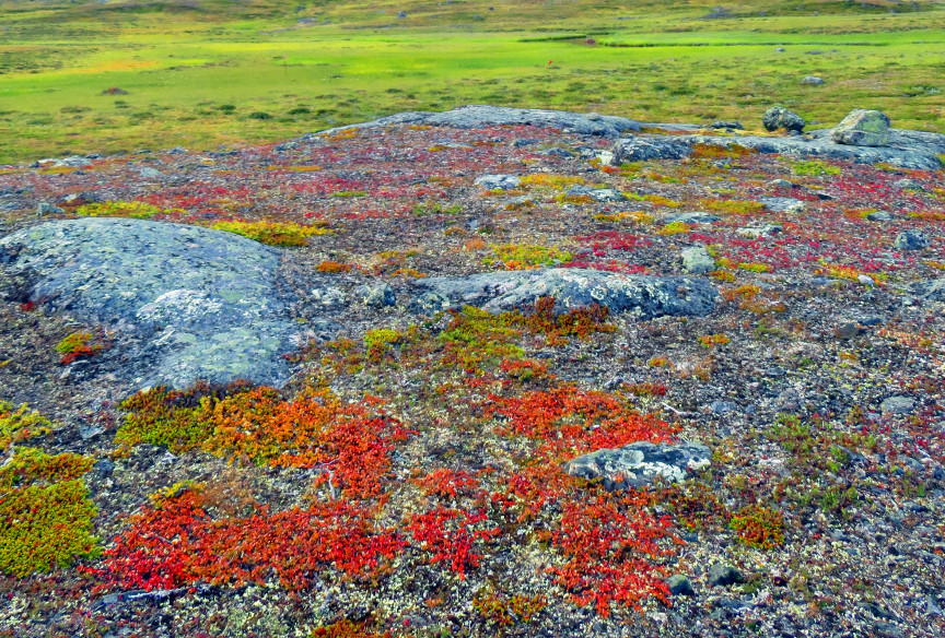
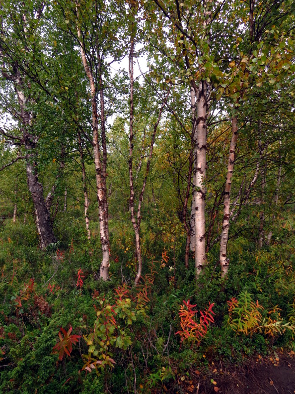
The flora had changed back to beech forest, we were no longer hiking on the tundra. We passed flowers and berries on the undergrowth, including blueberries. We walked beside streams
and lakes all day, it seemed like ideal moose country to me, but we saw no moose.
At the end of the lake is a Kungsleden institution called Lapp Donalds, which sells reindeer burgers. Anthony had been looking forward to a burger for lunch, but when we arrived, the
place looked abandoned. Later, we learned that the proprietor of Lapp Donalds was also the ferry boat driver; when he returned from his boat shuttle across Laddjujavri, Lapp Donalds reopened. If only we had arrived at a different time!
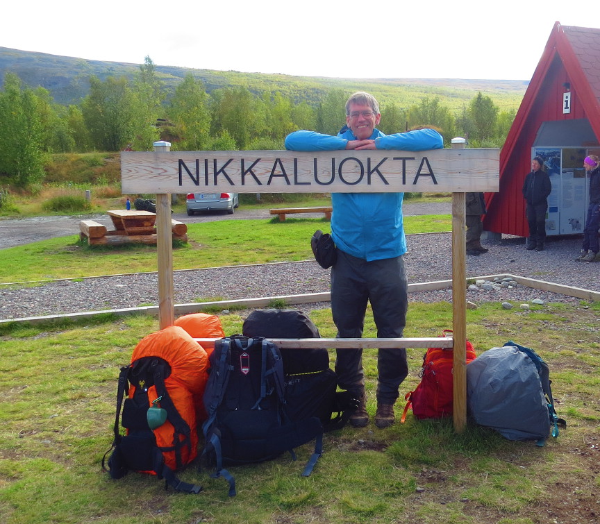
We walked into Nikkaluokta and killed a few hours waiting for the bus to take us back to Kiruna. As far as I can tell, there is no place to stay overnight in Nikkaluokta. There are plenty of
eating and sleeping options back at Kiruna. After a pizza dinner, we went out at midnight again, hoping for one last chance at the northern lights. It turned out to be difficult to find a spot in Kiruna that isn't lit up by bright artifical lights.
I guess Kiruna is in the land of midnight sun, and so artifical light is the only light they have during the winter months. We ended up in a churchyard as the darkest point we could find in Kiruna. I could see light faint bands moving across
the night sky, but there was no green coloring. Stockholm Early in the morning, we caught a flight back to Stockholm. I was overjoyed to find that our long lost luggage was waiting for us at the Arlanda airport. At least we recovered all our hiking gear, although
we now have two sets of good trekking clothes. I guess that means we will have to do twice as much hiking in the future.
We hired a taxi to drive us from the airport to the Vasa Ship Museum in Stockholm. The Vasa is a famous battleship built in the early 17th century. It was a huge ship, meant to intimidate Swedish opponents. Unfortunately,
the Vasa was poorly designed, and it capsized and sank just 1.5 KM into its maiden voyage. The Vasa rested on the bottom of the sea until 1961, when it was raised and restored in a museum. Now the Vasa is the primary tourist attraction in Stockholm.
I was impressed by the Vasa. It appeared gigantic, much bigger than other contemporary ships (for example, when I saw a replica of the Mayflower, I was impressed that the Pilgrims would cross the Atlantic in such a small ship.) When
look at the towering sides of the ship, it is no surprise that it toppled over. Because it sank so close to shore, most of the crew and passengers were rescued, only about 25 people perished on board. The museum has on display some their skeletons, along with notes about their age, health and likely occupation (based upon
the artifacts found with the bones).
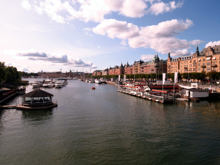
We spent the rest of our day walking around Stockholm, checking out the old town shops. It was a nice day, and a fine way to end our vacation. We flew back to the States on United, which was a much smoother flight than dealing with Eurowings. To display the photo images on this webpage, I am using a freely distributed java script called Lightbox v2.7.1 written by Lokesh Dhakar.
You can download this program by clicking on this link.
All the text and photographs on this webpage are my own creation, but the textured background is taken from a site, Din Pattern, that offers
users free use of their graphics. Click the icon below to visit their site. |
Click on the Best Photos icon to see my favorite pictures, otherwise, click on any of the other thumbnails below for the complete set of pictures (including my favorites) 
Click on any thumbnail to begin the slide show at that photograph Kungsleden Day 1 photographs 


Kungsleden Day 2 photographs 


Kungsleden Day 3 photographs 


Kungsleden Day 4 photographs 


Kungsleden Day 5 photographs 


Kungsleden Day 6 photographs 


Kungsleden Day 7 photographs 


Stockholm photographs 


|