|
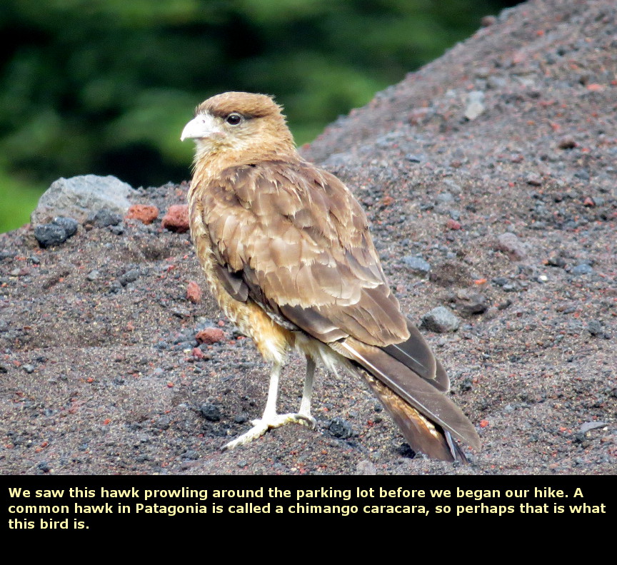
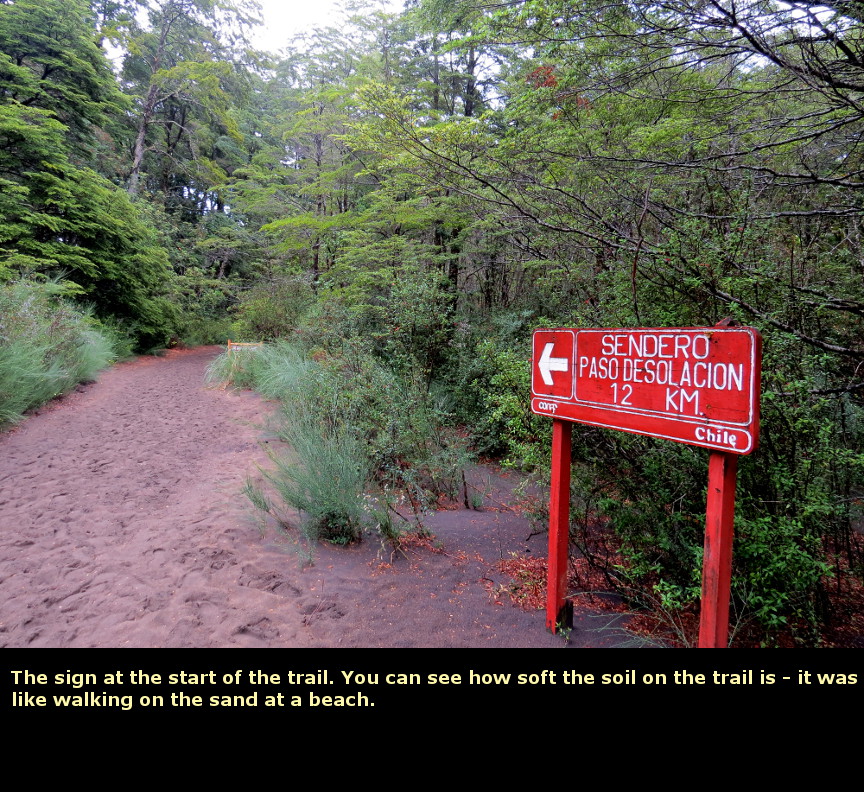
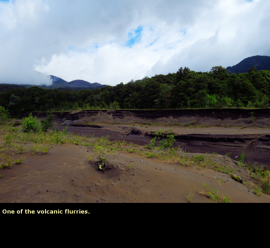
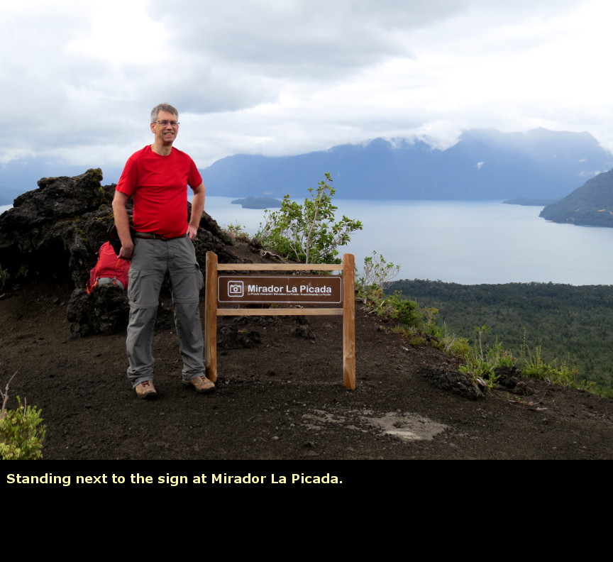
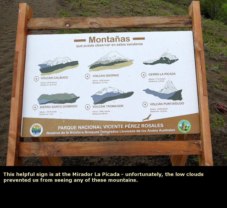
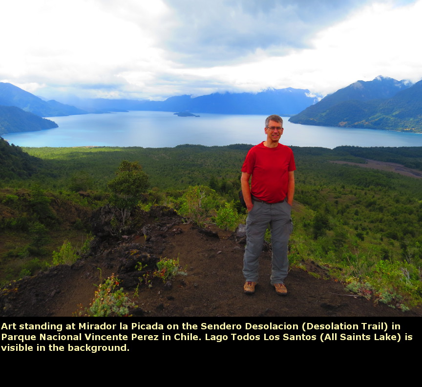
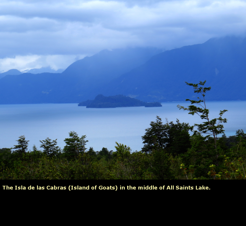
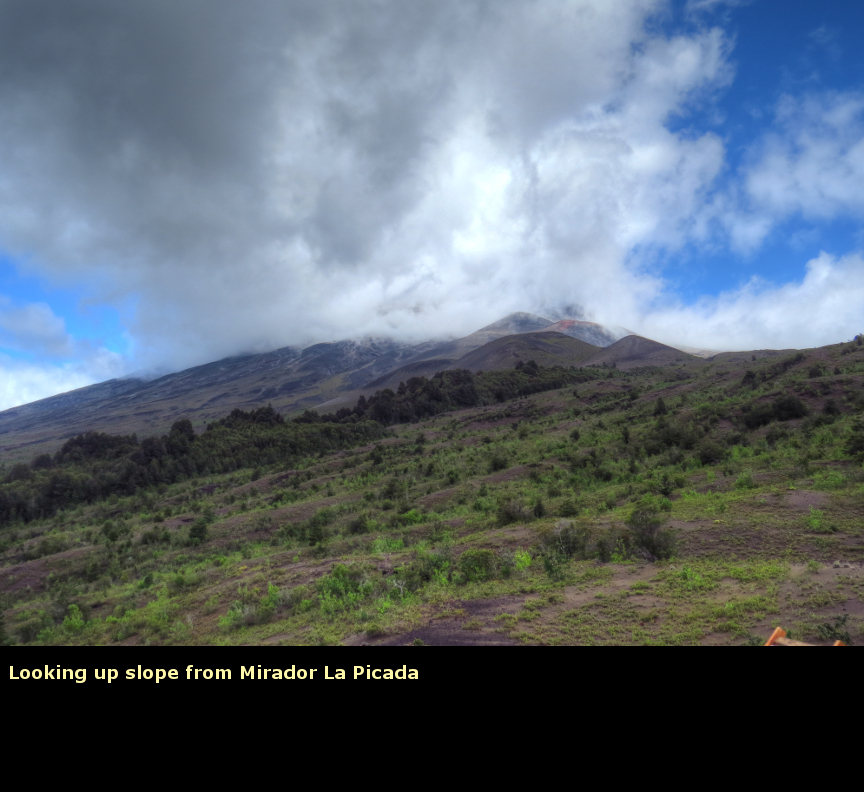
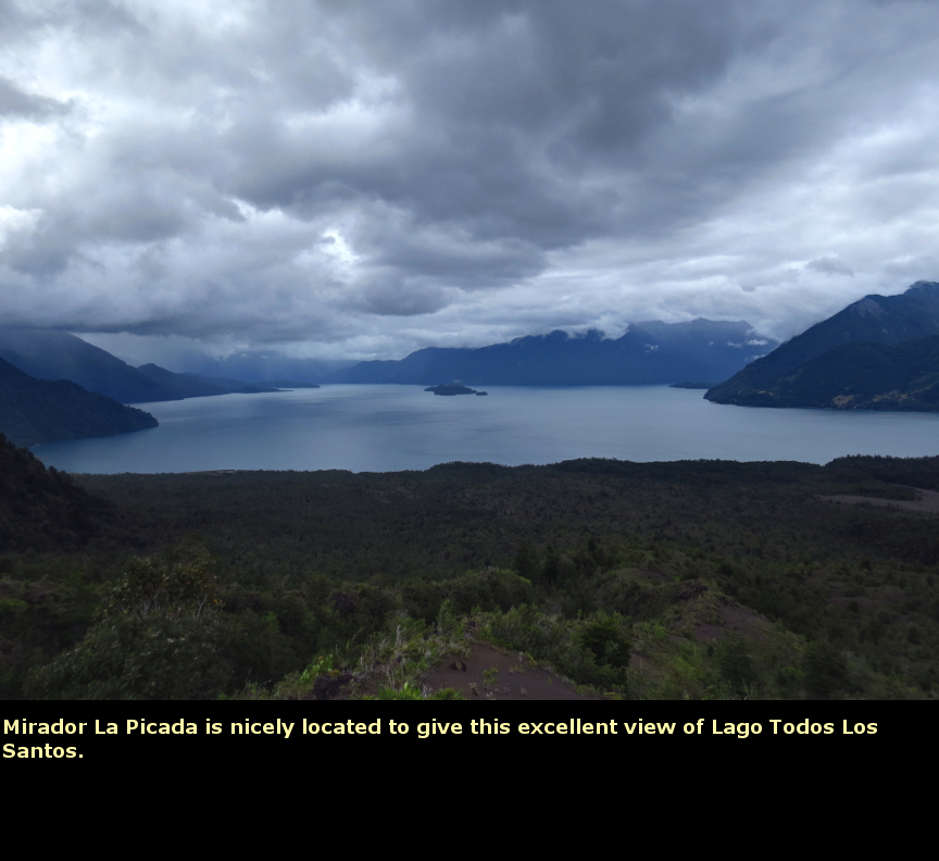
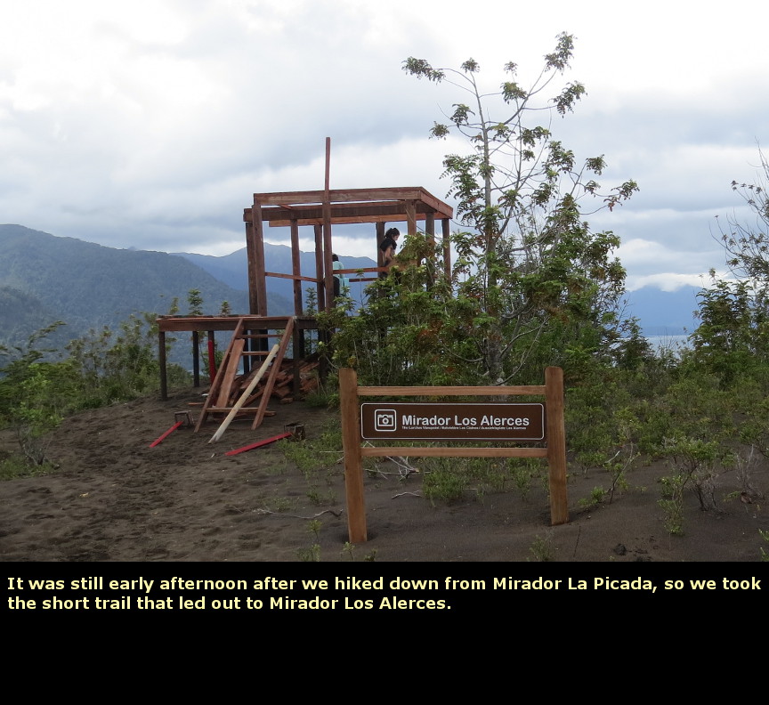
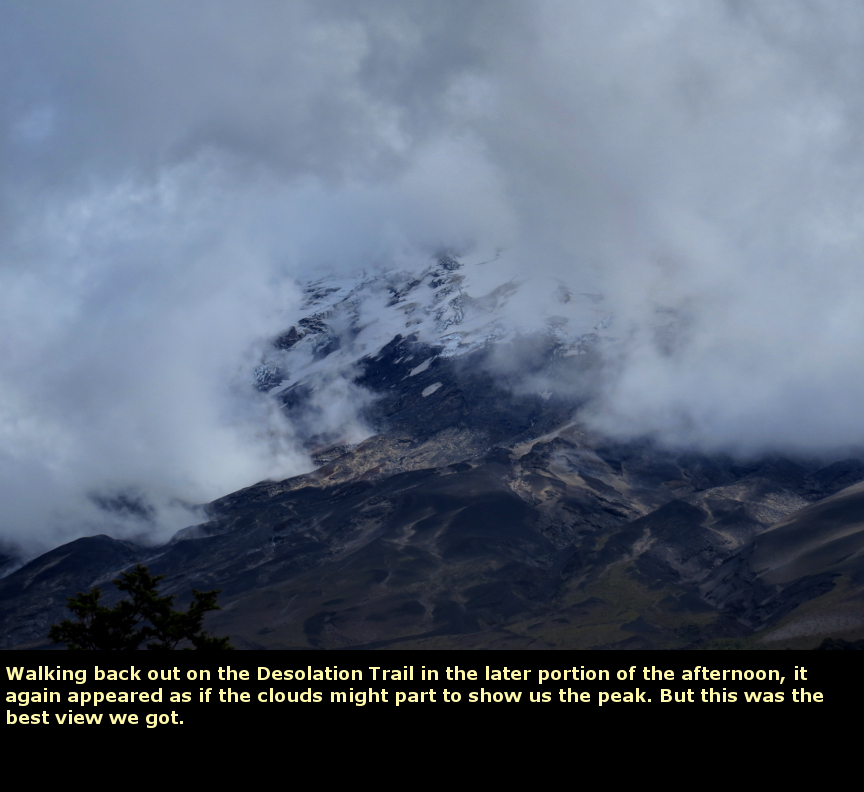
The previous evening, we checked the weather forecast for our remaining three days in Chile. Monday was predicted to be beautiful, which was great, because that was the day we were scheduled to go sea kayaking. Saturday had a 50% chance of rain and showers, while Sunday looked to be wetter. I wanted to do the Desolation Trail, since it seemed to be the most famous trail in Parque Nacional Vicente Pérez Rosales. Since Saturday looked drier than Sunday, we decided to hike the trail on this day. After another excellent breakfast at the Hotel Solace buffet, we drove the 50 km from Puerto Varas to the start of the trail. The weather got worse as we headed east, it was raining as we drove past the Saltos del Petrohue. But by the time we parked the car at the end of the road, the rain had stopped and it didn't rain the rest of the day. Unfortunately, the rain clouds didn't depart, so we did not see the top of Osorno on this day. The Sendero Paso Desolación (Desolation Trail) is 12 km one way if you hike the entire length; which isn't too much to do in one day. However, most of the trail is over the loose ash, so it is like walking on the sand of a beach. This sort of slows the pace, especially since we were going uphill. We decided to go only as far as the Mirador La Picada (12.4 km roundtrip). If the weather had been nicer, we might have hiked higher. The Desolation trail crosses over three deep gullies, or "volcanic flurries" ("Aluvión Volcánico"). Each of these channels had a sign, the channels were named, apparently after characters from a ancient local legend. Quitralpique was a young lover who was forced to sacrifice his perfect soulmate to appease the angry volcano god - at least that is the story on the webpage. One of these flurries had a small stream of water in it, but the other two were dry. They have carved immense channels in the volcanic soil - you can see the levels of ash. I assume that during the spring melt that these flurries are full of rushing water. As we hiked along, a stray dog came out of the brush and walked along with us. Despite the fact that we offered no food or encouragement to this animal, the dog followed us all the way up to the viewpoint, and back down again. The dog only left us at Mirador Los Alerces, when it wandered off after two women hikers. I wondered why the dog didn't just stay down by the parking lot, where there are lots of humans and picnics and presumably many more opportunities for food. It was a bit of a slog to get up to Mirador La Picada (a total of 8 km from the trailhead), but once we were there, it was easy to see why it would be an ideal viewpoint on a cloudless, sunny day. To the east, we had a view across Lago Todos Los Santos and the mountains that surround it (though we could not see the mountain peaks.) Behind us was the towering presence of Osorno. When we hiked down from Mirador La Picada, it was only early afternoon, so we took a short side trail to another viewpoint, the Mirador los Alerces. This gave us another look across Lago Todos Los Santos, but since it was lower elevation, it was note quite as fine a view. We walked back across the flurries and returned to our car. The parking lot was full of cars, and more vehicles were streaming in. I am not sure what the attraction was, other than the fact that it was a Saturday evening and perhaps the people were coming out for a picnic. It started raining lightly on our drive back to Puerto Varas. We had pizza again for dinner. Panorama Photos


MapsThis is a map of the Desolation Trail, it is a photo taken of a sign near the trailhead. It shows that it is 6.2 km walk to Mirador La Picada, with 612 meters of elevation gain.
VideosIf you do not see the videos, but instead see a message that says: "Error: Video playback aborted" it is possible that the content is being blocked by your web browser. You may see a message at the top or bottom of your page that says "restricted webpage from running scripts or ActiveX controls". If you see that message, click on the ALLOW BLOCKED CONTENT box and that should allow these videos to run.
To display the photo images on this webpage, I am using a freely distributed java script called Lightbox v2.7.1 written by Lokesh Dhakar. You can download this program by clicking on this link. All the text and photographs on this webpage are my own creation, but the textured background is taken from a site, EOS development, that offers non-profit users free use of their graphics. Click the icon below to visit their site.
|
Click on any thumbnail to begin the slide show at that photograph Sendero Paso Desolación Photos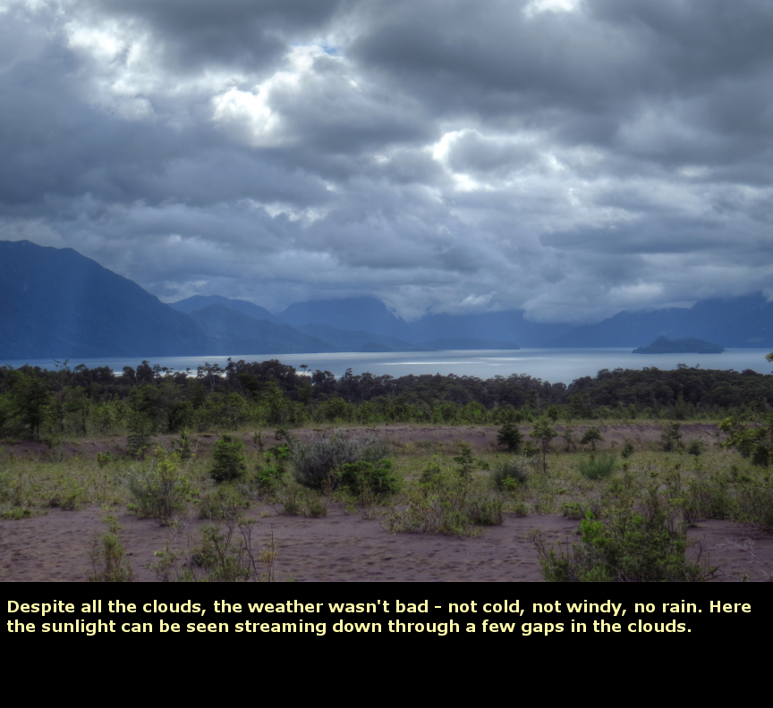


|