


Kauai vacation
April 23rd - Kalalau Trail
Click on any photo to see a larger image
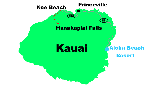
We headed to the north shore for our first day on the island. We drove to the very end of the road, which dead ends at Kee Beach. This is a popular spot, because the beach is so nice and the water is protected by a sandbar, making it nice for swimming. Our goal was to hike along the famous Kalalau Trail - not the entire 11 mile length (you need a permit for that) - up to the first waterfall.

This is a picture looking up at a rock cliff from the Kee Beach parking lot. The Na Pali coast is so famous because of the dramatic black volcanic cliffs that knife down to the ocean. The Kalalau trail hugs these cliffs. Apparently, beyond the point where permits are required, the trail becomes dramatically narrow with steep plunges off to the side. If you do hike the 11 miles, you will end up in the beautiful Kalalau Valley - we got a view looking down into that valley on our hike the 2nd day in Kokee State Park.

Here is Melanie at the starting sign.

This is one of my better pictures (so click on it to see it full size!). The trail started climbing immediately and it was not long before we were high enough to look back at Kee Beach. You can see the sandbar and the calm warm water. The beach was still mostly empty at about 9 in the morning, it was more crowded when we returned from the hike, all parking spaces were occuppied.

You don't have to hike too far to see some views of the famous Na Pali cliffs. Here are a couple photos of the cliffs looking ahead on the trail. Impressive! When we took the catamaran trip later in the week, we sailed in those waters looking up at the formations.


These rocks near the trail head have any easy-to-identify shape. We saw these same rocks from the catamaran and the helicopter ride. I guess they mark the offical start of the Na Pali cliffs. You can see the red mud trail in the bottom corner of the photo. It was a dry day, but it was still slick in a couple places - at least that is my excuse for slipping and falling into the mud at one point!

Two miles of up and down hiking take you to Hanakapiai Beach. This is much more treacherous water than Kee Beach, I don't think swimming is recommended here. The beach is rocky, not sandy. But it is beautiful. Blue ocean waves crashing against black rocks, and throwing up white sea foam.

This picture shows the rock face just to the west of Hanakapiai Beach. You need the permit to proceed beyond this point. I think the trail ascends up and behind (to the left) of that rock. You don't need a permit to take the 2 mile trail branch up to the waterfall, and that is what we did.

The trails winds inland, climbing gradually as it follows the stream bed. This is a popular hike. For some reason, this 2 mile portion to the falls seemed to take much longer than the first 2 miles between Kee and Hanakapai beaches.

Sure enough, there is a waterfall at the end of the trail! The hiking book says it is named Hanakapiai Falls.

We had lunch at the side of the pool at the base of the falls. Some people went into the water and swam around, but we did not. It looked warm though. They could go right out to the base of the falls. The falls are several hundred feet tall, so they are impressive, though there was not a lot of water pouring over them on the day we were there.


We relaxed at the side of the pool for a bit, and then we hiked back. It is an 8 mile round trip. Back at the Kee Beach parking lot, we checked out two caves - the Wet Cave and the Dry Cave. You can not enter the Wet Cave (unless you want to wade) but we walked back into the dry cave - you can go in a hundred or so feet. I think these are old lava tubes that used to empty into the ocean.

Back near our hotel, (and after a post-hike visit to Cold Stone ice cream parlor) we drove up to the lookout for Opaekaa Falls. There is a pulloff from the roadway for the viewpoint.

Crossing the road from the Opaekaa Falls viewpoint is another overlook, where you can see the Wailua River. If you look just beyond the bend in the river, you can see the tributary entering on the right. That is the channel to the Secret Falls, which we canoed up the next day. (you may have to click on the photo to see it full size to spot that inlet for Secret Falls). There is a tower of rock standing at the base of the mountain - it looked a whole lot bigger the next day when we got a view of it from our canoe.


